Safety Score: 3,0 of 5.0 based on data from 9 authorites. Meaning we advice caution when travelling to United Kingdom.
Travel warnings are updated daily. Source: Travel Warning United Kingdom. Last Update: 2024-08-13 08:21:03
Delve into Elton
Elton in Derbyshire (England) is a city located in United Kingdom about 131 mi (or 210 km) north-west of London, the country's capital town.
Current time in Elton is now 06:40 PM (Thursday). The local timezone is named Europe / London with an UTC offset of zero hours. We know of 8 airports closer to Elton, of which 5 are larger airports. The closest airport in United Kingdom is Manchester Woodford Airport in a distance of 24 mi (or 38 km), North-West. Besides the airports, there are other travel options available (check left side).
There are several Unesco world heritage sites nearby. The closest heritage site in United Kingdom is Liverpool – Maritime Mercantile City in a distance of 33 mi (or 53 km), North-East. Also, if you like playing golf, there are some options within driving distance. We saw 1 points of interest near this location. In need of a room? We compiled a list of available hotels close to the map centre further down the page.
Since you are here already, you might want to pay a visit to some of the following locations: Matlock, Bradley, Yeldersley, Shirley and Rodsley. To further explore this place, just scroll down and browse the available info.
Local weather forecast
Todays Local Weather Conditions & Forecast: 2°C / 35 °F
| Morning Temperature | -0°C / 31 °F |
| Evening Temperature | 2°C / 35 °F |
| Night Temperature | 3°C / 37 °F |
| Chance of rainfall | 0% |
| Air Humidity | 80% |
| Air Pressure | 1000 hPa |
| Wind Speed | Moderate breeze with 13 km/h (8 mph) from East |
| Cloud Conditions | Broken clouds, covering 76% of sky |
| General Conditions | Light snow |
Friday, 22nd of November 2024
4°C (38 °F)
1°C (34 °F)
Rain and snow, fresh breeze, scattered clouds.
Saturday, 23rd of November 2024
4°C (40 °F)
13°C (55 °F)
Rain and snow, strong breeze, overcast clouds.
Sunday, 24th of November 2024
14°C (57 °F)
9°C (48 °F)
Moderate rain, high wind, near gale, overcast clouds.
Hotels and Places to Stay
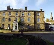
The Rutland Arms Hotel
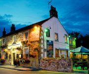
The Peacock
Videos from this area
These are videos related to the place based on their proximity to this place.
Stanton-In-Peak & Beeley Moor in the snow in a Landcruiser HDJ80
Heading over to a service call at Stanton-In-Peak. First time with the truck in any appreciable amount of snow and it did really well, passing a Derbyshire County Council Defender 90 on the...
Peak District Ancient Graffiti Amazing View
Quite simply... an amazing view After the bilizzard of February 2010 filmed from the top of the Andle Stone looking towards Youlgreave on the edge of Stanton Moor not far from Matlock & Darley...
Peak District - Bradford Dale & Nine Ladies Stone Circle
A year ago I found a map, not a treasure map but a regular White Peak Ordnance Survey map. It had a route plotted on it that i'd not walked before so today we headed off to check it out. We'd...
Rowtor Rocks
Me and Dave doing a few problems round Rowtor Rocks. Gotta love guide book grading for this area, so grades are all a bit of a guess.
Robin Hood's Stride & Cratcliffe Tor
Robin Hood's Stride (also known as Mock Beggar's Hall), Cratcliffe Tor and the Hermit's Cave below the Tor are near Birchover in Derbyshire.
Darley Dale Clay Pigeon Shooting Club
Darley Dale Clay Pigeon Shooting Ground Nov 2014 why dont you come and visit our shooting ground. Find out more at www.ddcpsc.org.uk.
BestVine - When your bitch is trying to start a fight and your not having it
"10 Min Best Vines Compilation 2013!" "Top 100 Vines Of All Time!" "BEST VINES Compilation JUNE 2013" "The Best VINES of 2013 Compilation! (77 VINES!)" "Top Vines's Video" "The Best VINES ...
Americans are not stupid.2010BranDNew
stupid Americans call 911about burgers and random checks by the public!! lol Very funny.Enjoy.
GTA IV 1995 Ferrari F50 [ENB Series + Visual IV + Realizm IV + SimpleNative Trainer] HD
I hope you enjoy the show!! Don't forget to subscribe! Download Link: http://www.gta4-mods.com/vehicles/1995-ferrari-f50-f7089.
Self catering holiday cabins at Hoe Grange
Luxury self catering log cabins set on a working farm in the spectacular Peak District, Derbyshire. Dramatic views of the white peak limestone scenery from the decking area. Rainster can be...
Videos provided by Youtube are under the copyright of their owners.
Attractions and noteworthy things
Distances are based on the centre of the city/town and sightseeing location. This list contains brief abstracts about monuments, holiday activities, national parcs, museums, organisations and more from the area as well as interesting facts about the region itself. Where available, you'll find the corresponding homepage. Otherwise the related wikipedia article.
A5012 road
The A5012 road is a main road in the south of the English county of Derbyshire. Around 9 miles in length it connects two primary north-south routes, the A6 at Cromford and the A515 between Buxton and Ashbourne. It passes through Pikehall and Grangemill and alongside Ible. The eastern part (Grangemill to Cromford, set in a deep valley) is known as the Via Gellia - named after its builders, the Gell family, who held lead-mining interests in and around Wirksworth.
Limestone Way
The Limestone Way is a long-distance bridleway in Derbyshire, England. It runs through the White Peak of the Peak District National Park, from Castleton south east to Rocester over the county boundary in Staffordshire. It originally ran to Matlock, but was diverted to its current, longer route to join up with the Staffordshire Way. The trail is named for the limestone scenery along its route. It was created by the West Derbyshire District Council.
Derbyshire Dales (UK Parliament constituency)
Derbyshire Dales /ˈdɑrbɪʃə deɪlz/ or /ˈdɑrbiʃɪər deɪlz/ is a constituency represented in the House of Commons of the UK Parliament since it was created for the 2010 general election by Patrick McLoughlin of the Conservative Party.
Winster Market House
Winster Market House is a building dating from the end of the 17th or beginning of the 18th centuries, and is situated in Winster, near Matlock, Derbyshire, England. The house has been in the ownership of the National Trust since 1906. It was the Trust's first acquisition in the Peak District. Winster Market House dates back to the time when cheese and cattle fairs featured prominently in the daily life of the area.
Robin Hood's Stride
Robin Hood's Stride (also known as Mock Beggar's Mansion) is a rock formation on the Limestone Way in Derbyshire close to Bakewell, between Harthill Moor and the Alport–Winster road. It consists of gritstone boulders deeply seamed by water flows. Limited short climbing is possible; nearby Cratcliffe Tor provides more serious routes. The two "pinnacles" are Weasel pinnacle and Inaccessible pinnacle (west; V Diff).
Doll Tor
Doll Tor, occasionally known as the Six Stones, is a small stone circle near Birchover, west of Stanton Moor in the Derbyshire Peak District. Dating from the Bronze Age, the circle consists of six standing stones. The site was excavated in 1852 by Thomas Bateman, and again from 1931 to 1933 by J. P. Heathcote. During this second excavation, three stones were smashed and later repaired with cement.
River Bradford
The River Bradford is a river in Peak District National Park in England. Its source is near Middleton-by-Youlgrave and after passing below Youlgreave it joins the River Lathkill at Alport. Less than 2 miles in length, its waters are very clear due to the limestone rock over which it flows, and its width has been enhanced by a number of weirs which also encourage white-throated dippers to breed in the pounds created. The valley is known as Bradford Dale, and the Limestone Way passes through it.
Stanton in Peak
Stanton-in-Peak is a village in the Peak District, Derbyshire, It is about seven miles north-west of Matlock, on the north side of Stanton Moor, from Birchover. There is a fine 19th century Parish Church, and many fine stone houses, with mullion windows. There is also a stately home, Stanton Park, a combination of the English Classical style, and later Palladian alterations, which is a private house.


!['GTA IV 1995 Ferrari F50 [ENB Series + Visual IV + Realizm IV + SimpleNative Trainer] HD' preview picture of video 'GTA IV 1995 Ferrari F50 [ENB Series + Visual IV + Realizm IV + SimpleNative Trainer] HD'](https://img.youtube.com/vi/5rvglMw1h_4/mqdefault.jpg)
