Safety Score: 3,0 of 5.0 based on data from 9 authorites. Meaning we advice caution when travelling to United Kingdom.
Travel warnings are updated daily. Source: Travel Warning United Kingdom. Last Update: 2024-08-13 08:21:03
Delve into Breadsall
Breadsall in Derbyshire (England) is located in United Kingdom about 115 mi (or 184 km) north-west of London, the country's capital town.
Current time in Breadsall is now 01:08 AM (Sunday). The local timezone is named Europe / London with an UTC offset of one hour. We know of 9 airports close to Breadsall, of which 5 are larger airports. The closest airport in United Kingdom is East Midlands Airport in a distance of 10 mi (or 16 km), South-East. Besides the airports, there are other travel options available (check left side).
There are several Unesco world heritage sites nearby. The closest heritage site in United Kingdom is Liverpool – Maritime Mercantile City in a distance of 36 mi (or 58 km), North-East. Also, if you like playing golf, there are some options within driving distance. If you need a hotel, we compiled a list of available hotels close to the map centre further down the page.
While being here, you might want to pay a visit to some of the following locations: Derby, Matlock, Yeldersley, Shirley and Bradley. To further explore this place, just scroll down and browse the available info.
Local weather forecast
Todays Local Weather Conditions & Forecast: 20°C / 68 °F
| Morning Temperature | 16°C / 60 °F |
| Evening Temperature | 18°C / 64 °F |
| Night Temperature | 14°C / 57 °F |
| Chance of rainfall | 1% |
| Air Humidity | 62% |
| Air Pressure | 1003 hPa |
| Wind Speed | Moderate breeze with 12 km/h (7 mph) from South-West |
| Cloud Conditions | Broken clouds, covering 67% of sky |
| General Conditions | Light rain |
Monday, 9th of September 2024
16°C (61 °F)
9°C (49 °F)
Light rain, fresh breeze, overcast clouds.
Tuesday, 10th of September 2024
14°C (57 °F)
9°C (48 °F)
Light rain, fresh breeze, overcast clouds.
Wednesday, 11th of September 2024
13°C (55 °F)
7°C (45 °F)
Light rain, fresh breeze, scattered clouds.
Hotels and Places to Stay
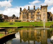
Breadsall Priory Marriott Hotel & Country Club
pentahotel Derby
Lumb Farm Country Club
Morley Hayes
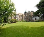
Makeney Hall Belper
Luxe Serviced Apartments
Best Western The Stuart Hotel-Derby
Holiday Inn Express DERBY - PRIDE PARK
Aston Court Hotel
Hallmark Inn Derby
Videos from this area
These are videos related to the place based on their proximity to this place.
OTV Valentino i Derby Dernek Predstavljaju: Pozdrav Iz Dijaspore - Derby Engleska
Snimanje emisije televizije OTV Valentino "Pozdrav Iz Dijaspore" uzivo u Aprilu/Travnju 2014 u Derby-u, Engleska. Gosti veceri: Eso Balic, Rade Lackovic i Zlata Avdic. Voditelj emisije: DJ Deny.
Double Glazing Derby | 01332 746153 | Loco Windows & Fascias
http://www.locowindowsfascias.co.uk - upto 35% Off Nearest Competitors - Certass Accredited and Insurance Backed Guarantee For a quick no hassle quote call 01332 746153 - We are suppliers...
Get On My Bike - Spondon to Breadsall (Great Northern Greenway)
So, this route starts, as usual, in Spondon. Heading out on Locko Road towards Oakwood then on to Breadsall. Then, I got onto the Great Northern Greenway, National Cycle route 672, which will...
Trip Down Memory Lane
Short series of clips taken in Chaddesden near Derby, specifically in Field Lane where I was born and grew up. Sad to see things so neglected but time moves on and all things change.
Derby's Street Lighting PFI - The Pentagon Roundabout, City Centre
Travelling from the City Centre side of the roundabout, the outgoing columns are seen in their final few weeks of operation. See also: http://www.streetlightonline.co.uk/DerbyPFI/PentagonRABCC.htm .
Derby's Street Lighting PFI - Sir Frank Whittle Road, City Centre (Northbound)
Travelling from the Pentagon Island to Alfreton Road, we see that the existing lighting did not have long left at the time of filming, as the replacement lighting is installed, but is still...
DancingGeek podcast - Episode 10
Episode 10 - It's all about community Recorded on Wed 5 November 2014 Find me online: Ravelry - http://www.ravelry.com/people/DancingGeek Instagram - http://www.instagram.com/DancingGeek...
Derbyshire UK Floods
27th June '07, Derbyshire and the rest of the UK suffered extreme floods from heavy rain fall. This is the Amber valley and my cycle ride home. Big thanks to www.youandyesterday.co.uk for their time.
Derby's Street Lighting PFI - Derwent Avenue, Allestree
Travelling up a snowy Derwent Avenue towards Duffield Road, we see that, although the new street lighting is installed, it is also joined by the outgoing lig...
Derby's Street Lighting PFI - Burley Hill, Allestree
Commencing at Evans Avenue, this short video features the relighting of the A6 Burley Hill up to the City boundary, opposite the entrance to Allestree Park. ...
Videos provided by Youtube are under the copyright of their owners.
Attractions and noteworthy things
Distances are based on the centre of the city/town and sightseeing location. This list contains brief abstracts about monuments, holiday activities, national parcs, museums, organisations and more from the area as well as interesting facts about the region itself. Where available, you'll find the corresponding homepage. Otherwise the related wikipedia article.
County Cricket Ground, Derby
The County Cricket Ground, usually shortened to County Ground and also known as the Racecourse Ground, is a cricket ground in Derby and has been the home of Derbyshire County Cricket Club since at least 1871. As the name implies it originally hosted horse racing. It also held the games of Derby County Football Club until their move to the Baseball Ground in 1895. The first FA Cup final outside London was held at the ground in 1886 when Blackburn Rovers beat West Bromwich Albion 2-0 in a replay.
Derby Nottingham Road railway station
Derby Nottingham Road railway station was a railway station about half a mile north of Derby station on the Midland Railway line from Derby to Leeds in England. One effect of the railways was that racing became a national sport with owners being able to transport their horses over much larger distances. Most racecourses had a nearby railway station with suitable facilities. Derby Racecourse opened in 1848 right next to the Midland line beside the Nottingham Road.
Little Chester
Little Chester, or Chester Green as it is often referred to by locals, is a suburb of the city of Derby, in Derbyshire, England, located directly north of the city centre. It is also bounded by the River Derwent, the main railway line to Sheffield and Darley Park.
Breadsall Priory
Breadsall Priory is a former priory in Derbyshire situated some two kilometres north of Breadsall. It was a house of the Friars Eremites, founded, it is said, by the Dethick family, about the middle of the 13th Century, and subsequently converted into an Augustinian priory. Following the Dissolution of the Monasteries in 1536 the site was granted by the Crown to the Duke of Suffolk.
Darley Abbey
Darley Abbey is a village on the outskirts of Derby, England. The village is located on the River Derwent and is associated with the world heritage site of Derwent Valley Mills.
St Mary's Church, Chaddesden
St Mary's Church is a Church of England parish church in Chaddesden, a suburb of Derby, England. One of the oldest churches in the city, it is a Grade I listed building dating back to the mid-14th century.
Breadsall railway station
Breadsall railway station was a former railway station in Breadsall, Derbyshire. It was opened by the Great Northern Railway (Great Britain) on its Derbyshire Extension in 1878.
High View School and Technology Centre, Derby
High View School and Technology Centre was a secondary school located in Derby, Derbyshire, England. This school originally opened in 1988 as High View Community Education Centre, Derby. It also became known as High View School and Technology Centre and High View Technology Centre. The school no longer exists; it was closed and was replaced by da Vinci Community College in September 2004 and moved into new buildings in 2006.


