Safety Score: 3,0 of 5.0 based on data from 9 authorites. Meaning we advice caution when travelling to United Kingdom.
Travel warnings are updated daily. Source: Travel Warning United Kingdom. Last Update: 2024-08-13 08:21:03
Discover Brassington
Brassington in Derbyshire (England) with it's 573 citizens is a city in United Kingdom about 127 mi (or 204 km) north-west of London, the country's capital city.
Local time in Brassington is now 05:38 PM (Friday). The local timezone is named Europe / London with an UTC offset of zero hours. We know of 8 airports in the vicinity of Brassington, of which 5 are larger airports. The closest airport in United Kingdom is East Midlands Airport in a distance of 22 mi (or 36 km), South-East. Besides the airports, there are other travel options available (check left side).
There are several Unesco world heritage sites nearby. The closest heritage site in United Kingdom is Liverpool – Maritime Mercantile City in a distance of 35 mi (or 56 km), North-East. Also, if you like golfing, there are a few options in driving distance. We discovered 1 points of interest in the vicinity of this place. Looking for a place to stay? we compiled a list of available hotels close to the map centre further down the page.
When in this area, you might want to pay a visit to some of the following locations: Bradley, Yeldersley, Matlock, Shirley and Rodsley. To further explore this place, just scroll down and browse the available info.
Local weather forecast
Todays Local Weather Conditions & Forecast: 9°C / 48 °F
| Morning Temperature | 5°C / 41 °F |
| Evening Temperature | 8°C / 47 °F |
| Night Temperature | 5°C / 41 °F |
| Chance of rainfall | 0% |
| Air Humidity | 86% |
| Air Pressure | 1027 hPa |
| Wind Speed | Gentle Breeze with 6 km/h (4 mph) from East |
| Cloud Conditions | Overcast clouds, covering 100% of sky |
| General Conditions | Overcast clouds |
Saturday, 16th of November 2024
10°C (50 °F)
6°C (43 °F)
Overcast clouds, gentle breeze.
Sunday, 17th of November 2024
7°C (44 °F)
1°C (34 °F)
Light rain, moderate breeze, few clouds.
Monday, 18th of November 2024
1°C (33 °F)
0°C (32 °F)
Rain and snow, moderate breeze, overcast clouds.
Hotels and Places to Stay
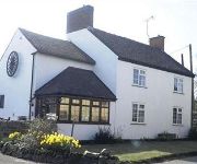
The Wheel House
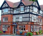
Station Hotel
Matlock
Videos from this area
These are videos related to the place based on their proximity to this place.
Hopton Hall Snowdrop Garden, near Wirksworth
Snowdrops and garden at Hopton Hall Derbyshire in February 2015.
'61 BSA A7 and '61 Enfield Clipper 350cc Ride out Part 1
June 14th 2009 and a nostalgic run through Derbyshire for old friends John Bennett and Pete Gray on their classic Brit. bikes. Both have had their machines since the very early 1970's, this...
Hopton Hall nr Matlock
A Short Visit to Hopton Hall, Near Matlock, Derbyshire, UK. It's well known for it's snowdrops and I only visited the Gardens as it was late on the last day of the season. Visit the site for...
Darley Dale Clay Pigeon Shooting Club
Darley Dale Clay Pigeon Shooting Ground Nov 2014 why dont you come and visit our shooting ground. Find out more at www.ddcpsc.org.uk.
BestVine - When your bitch is trying to start a fight and your not having it
"10 Min Best Vines Compilation 2013!" "Top 100 Vines Of All Time!" "BEST VINES Compilation JUNE 2013" "The Best VINES of 2013 Compilation! (77 VINES!)" "Top Vines's Video" "The Best VINES ...
GTA IV 1995 Ferrari F50 [ENB Series + Visual IV + Realizm IV + SimpleNative Trainer] HD
I hope you enjoy the show!! Don't forget to subscribe! Download Link: http://www.gta4-mods.com/vehicles/1995-ferrari-f50-f7089.
Self catering holiday cabins at Hoe Grange
Luxury self catering log cabins set on a working farm in the spectacular Peak District, Derbyshire. Dramatic views of the white peak limestone scenery from the decking area. Rainster can be...
Boma 7 field test at Hoe Grange Holidays
Hoe Grange Holidays in Derbyshire test out the Boma 7 off-road wheelchair over the rough and hilly terrain. An ideal soluion for holiday guests with limited mobility wishing to access the countrysi...
Rainster self catering log cabin at Hoe Grange Holidays
One of four self catering log cabins on a working farm in the spectacular Derbyshire countryside. Our 4 star gold holiday accommodation has two bedrooms, which have flexible bed arrangements...
Videos provided by Youtube are under the copyright of their owners.
Attractions and noteworthy things
Distances are based on the centre of the city/town and sightseeing location. This list contains brief abstracts about monuments, holiday activities, national parcs, museums, organisations and more from the area as well as interesting facts about the region itself. Where available, you'll find the corresponding homepage. Otherwise the related wikipedia article.
Carsington Water
Carsington Water is a reservoir operated by Severn Trent Water in Derbyshire, England. The reservoir takes water from the River Derwent at Ambergate during winter months, pumping up to the reservoir by 10.5-kilometre long tunnels and aqueduct. Water is released back into the river during summer months for water abstraction and treatment further downstream. It is England's ninth largest reservoir with a capacity of 35,412 megalitres.
West Derbyshire (UK Parliament constituency)
West Derbyshire was a county constituency represented in the House of Commons of the Parliament of the United Kingdom. From 1885 until it was replaced by the Derbyshire Dales constituency in the 2010 General Election, it elected one Member of Parliament (MP) by the first past the post voting system. It was a safe Conservative seat for most of its existence.
Hopton Incline
The Hopton Incline was a very steep section of a mineral railway in England worked by adhesion. Its gradient was 1 in 14 (7%).
A5012 road
The A5012 road is a main road in the south of the English county of Derbyshire. Around 9 miles in length it connects two primary north-south routes, the A6 at Cromford and the A515 between Buxton and Ashbourne. It passes through Pikehall and Grangemill and alongside Ible. The eastern part (Grangemill to Cromford, set in a deep valley) is known as the Via Gellia - named after its builders, the Gell family, who held lead-mining interests in and around Wirksworth.
Grangemill
Grangemill is a busy crossroads village in the English county of Derbyshire. It is made up of a cluster of houses, a farm and a pub called the Hollybush. There is a former cheese factory in the village, and the workings of this are still on display. Grangemill lies at the crossroads of the A5012 and B5056 roads and is on the south-eastern boundary of the Peak District National Park. The Limestone Way long-distance bridleway passes through Grangemill.
Longcliffe
Longcliffe is a crossroads hamlet in the English county of Derbyshire. Longliffe lies on the B5056 road where it is crossed by the Brassington-Elton road. The Midshires Way long-distance footpath skirts the south and west of Longcliffe.
Hopton Hall
Hopton Hall is an 18th century country house at Hopton, near Wirksworth, Derbyshire. It is a Grade II listed building. The Manor of Hopton, anciently the seat of the de Hopton family, was acquired by the Gell family in 1553 by Ralph Gell (1491–1564) who also purchased lands at Darley Abbey and Rocester. John Gell was created a baronet in 1642. The Baronetcy was extinct in 1719 and the estate passed to John Eyre who changed his name to Gell.
Bradbourne Hall
Bradbourne Hall is a privately owned 17th century country house at Bradbourne, near Ashbourne, Derbyshire. It is a Grade II* listed building. The church of All Saints at Bradbourne was in the ownership of the Priory of Dunstable from 1278 until it was forfeited to the Crown in the 16th century at the time of the Dissolution of the Monasteries. The former glebe lands of some 260 acres and the advowson of All Saints were purchased by George Buxton in 1609.


!['GTA IV 1995 Ferrari F50 [ENB Series + Visual IV + Realizm IV + SimpleNative Trainer] HD' preview picture of video 'GTA IV 1995 Ferrari F50 [ENB Series + Visual IV + Realizm IV + SimpleNative Trainer] HD'](https://img.youtube.com/vi/5rvglMw1h_4/mqdefault.jpg)


