Safety Score: 3,0 of 5.0 based on data from 9 authorites. Meaning we advice caution when travelling to United Kingdom.
Travel warnings are updated daily. Source: Travel Warning United Kingdom. Last Update: 2024-08-13 08:21:03
Discover Belper
Belper in Derbyshire (England) with it's 23,417 citizens is a city in United Kingdom about 119 mi (or 192 km) north-west of London, the country's capital city.
Local time in Belper is now 05:22 PM (Friday). The local timezone is named Europe / London with an UTC offset of zero hours. We know of 8 airports in the vicinity of Belper, of which 5 are larger airports. The closest airport in United Kingdom is East Midlands Airport in a distance of 15 mi (or 24 km), South-East. Besides the airports, there are other travel options available (check left side).
There are several Unesco world heritage sites nearby. The closest heritage site in United Kingdom is Liverpool – Maritime Mercantile City in a distance of 33 mi (or 53 km), North-East. Also, if you like golfing, there are a few options in driving distance. Looking for a place to stay? we compiled a list of available hotels close to the map centre further down the page.
When in this area, you might want to pay a visit to some of the following locations: Derby, Matlock, Yeldersley, Bradley and Shirley. To further explore this place, just scroll down and browse the available info.
Local weather forecast
Todays Local Weather Conditions & Forecast: 9°C / 48 °F
| Morning Temperature | 5°C / 41 °F |
| Evening Temperature | 8°C / 47 °F |
| Night Temperature | 5°C / 41 °F |
| Chance of rainfall | 0% |
| Air Humidity | 86% |
| Air Pressure | 1026 hPa |
| Wind Speed | Gentle Breeze with 6 km/h (4 mph) from North-East |
| Cloud Conditions | Overcast clouds, covering 100% of sky |
| General Conditions | Overcast clouds |
Saturday, 16th of November 2024
10°C (50 °F)
6°C (43 °F)
Overcast clouds, gentle breeze.
Sunday, 17th of November 2024
7°C (44 °F)
1°C (34 °F)
Few clouds, moderate breeze.
Monday, 18th of November 2024
1°C (34 °F)
0°C (32 °F)
Rain and snow, moderate breeze, overcast clouds.
Hotels and Places to Stay
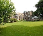
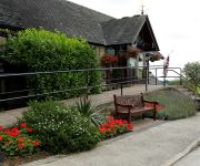
Makeney Hall Belper
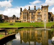
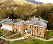
Breadsall Priory Marriott Hotel & Country Club
Lumb Farm Country Club
White Hart Inn
Morley Hayes
Alison House
The Greyhound Hotel
Ripley
Videos from this area
These are videos related to the place based on their proximity to this place.
Belper Churches Easter Flashmob 2015
Churches Together in Belper, as part of the Resurrection performance, did a surprise FlashMob in Belper's King Street. The choir sang Chris Tomlin's version of Amazing Grace, and then seguéd...
Violent Snowmelt flood at Belper Horseshoe weir January 27th 2013, look at that power!
If you Love Derby and Derbyshire follow me on Twitter: https://twitter.com/AndySavage1969 Here at Belper river Gardens in Derbyshire you can see the violent effect of all the snow melting suddenly...
belper north mill donations box
strutts north mill was built in 1804 and was the world's first iron structured building. now the north mill hosts a museum on the ground floor and basement. i was commissioned to make a #donations...
Good Friday 2010 in Belper
Christians in Belper, Derbyshire, mark Good Friday 2010, when Jesus died, by going out onto the streets.
Lavender grey Belper Spring 2013
Lavendergrey Spring Shop 2013 Interior Designer Lucy Coulthard's shop.
Cinema 101 - 008 - studio3cine Film School
This is one of the awesome short films which was created by the Year 8 students in Crew 2 at studio3cine's Cinema 101 workshop we conducted at Belper School in May 2014! Once finished, this...
love parks week installation 2014
love parks week is the last week of july and features activities and events across the uk. through corridor arts i was able to make the installation in belper parks. the installation was...
Derbyshire fire and rescue service Dennis Sabre on scene of Hoisery factory fire in Belper
FOOTAGE COURTESY OF MY DAD, also, this was recorded a long time ago-- © Copyright 2015 Gregoryemergencyvideos LIKE,COMMENT AND SUBSCRIBE! You can also like my facebook page at ...
How Can A Poor Man Stand Such Times and Live
"How Can A Poor Man Stand Such Times and Live" (Blind Alfred Reed, 1929) Recorded live at The Queen's Head, Belper on 14th March 2015. Taropatch by tinguitar.com.
Videos provided by Youtube are under the copyright of their owners.
Attractions and noteworthy things
Distances are based on the centre of the city/town and sightseeing location. This list contains brief abstracts about monuments, holiday activities, national parcs, museums, organisations and more from the area as well as interesting facts about the region itself. Where available, you'll find the corresponding homepage. Otherwise the related wikipedia article.
Derwent Valley Mills
Derwent Valley Mills is a World Heritage Site along the River Derwent in Derbyshire, England, designated in December 2001. It is administered by the Derwent Valley Mills Partnership. The modern factory, or 'mill', system was born here in the 18th century to accommodate the new technology for spinning cotton developed by Richard Arkwright. With advancements in technology, it became possible to produce cotton continuously.
North Midlands
The North Midlands is a loosely-defined area of England. It is typically held to include South Yorkshire and the northern parts of Derbyshire and Nottinghamshire, and in some definitions also covers southern Cheshire and parts of Lincolnshire and Staffordshire. The region's largest city is Sheffield. The North Midlands Helicopter Support Unit operated jointly by Nottinghamshire and Derbyshire Police covers these counties.
Belper railway station
Belper railway station is a railway station serving the town of Belper in Derbyshire, England. The station is located on the Midland Main Line from Derby to Leeds.
Milford Tunnel
Milford Tunnel in Derbyshire is a twin track railway tunnel on the Midland Main Line which runs under a hill called the Chevin between Duffield and Belper. It was built in 1840 by the Stephensons for the North Midland Railway. When finished, it was 855 yards long. The west side of the Derwent valley has a number of gritstone outcrops, one being Burley Hill to the south of Duffield, another being Castle Hill in Duffield itself.
Milford, Derbyshire
Milford is a village in Derbyshire, England, on the River Derwent, between Duffield and Belper on the A6 trunk road. Until the end of the 18th century it was no more than a few houses near the point, about a quarter of a mile further south, where a Roman road from the Wirksworth lead mines forded the river. The road still exists as it passes across the Chevin hill and descends into the village by what is now Sunny Hill.
Holbrook Sports F.C
Holbrook Sports Football Club is a football club established in 1931 as Holbrook Miners Welfare and based in Holbrook, near Derby, Derbyshire, England. They currently play in the East Midlands Counties League.
Forest of East Derbyshire
The Forest of East Derbyshire was, in medieval times, an area of wooded heath between the River Derwent and the River Erewash in Derbyshire. Unlike the Forest of High Peak and Duffield Frith it was not taken over by William I, but became a royal forest in the reign of Henry II. Stretching as it did over practically the whole length of the present-day county it was much larger than the other two.
List of mills in Derbyshire
This is a list of the cotton and other textile mills in Derbyshire, England. The first mills were built in the 1760s in the Derwent Valley by Arkwright and Strutt, and were powered by the water of the River Derwent. The abundance of water from the River Etherow and its tributaries led to mills being built in Longdendale and Glossopdale, and similarly along the River Wye in Millers Dale.


