Safety Score: 3,0 of 5.0 based on data from 9 authorites. Meaning we advice caution when travelling to United Kingdom.
Travel warnings are updated daily. Source: Travel Warning United Kingdom. Last Update: 2024-08-13 08:21:03
Delve into Alsop en le Dale
Alsop en le Dale in Derbyshire (England) is a town located in United Kingdom about 129 mi (or 208 km) north-west of London, the country's capital town.
Time in Alsop en le Dale is now 06:27 PM (Thursday). The local timezone is named Europe / London with an UTC offset of zero hours. We know of 8 airports closer to Alsop en le Dale, of which 5 are larger airports. The closest airport in United Kingdom is Manchester Woodford Airport in a distance of 23 mi (or 37 km), North-West. Besides the airports, there are other travel options available (check left side).
There are several Unesco world heritage sites nearby. The closest heritage site in United Kingdom is Liverpool – Maritime Mercantile City in a distance of 38 mi (or 61 km), North-East. Also, if you like the game of golf, there are some options within driving distance. We saw 1 points of interest near this location. In need of a room? We compiled a list of available hotels close to the map centre further down the page.
Since you are here already, you might want to pay a visit to some of the following locations: Bradley, Yeldersley, Rodsley, Shirley and Matlock. To further explore this place, just scroll down and browse the available info.
Local weather forecast
Todays Local Weather Conditions & Forecast: 2°C / 35 °F
| Morning Temperature | -0°C / 31 °F |
| Evening Temperature | 2°C / 35 °F |
| Night Temperature | 3°C / 37 °F |
| Chance of rainfall | 0% |
| Air Humidity | 80% |
| Air Pressure | 1000 hPa |
| Wind Speed | Moderate breeze with 13 km/h (8 mph) from East |
| Cloud Conditions | Broken clouds, covering 76% of sky |
| General Conditions | Light snow |
Friday, 22nd of November 2024
4°C (38 °F)
1°C (34 °F)
Rain and snow, fresh breeze, scattered clouds.
Saturday, 23rd of November 2024
4°C (40 °F)
13°C (55 °F)
Rain and snow, strong breeze, overcast clouds.
Sunday, 24th of November 2024
14°C (57 °F)
9°C (48 °F)
Moderate rain, high wind, near gale, overcast clouds.
Hotels and Places to Stay
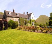
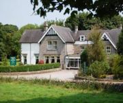
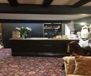
The Izaak Walton Hotel
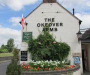
The Okeover Arms
Newton House
The Dog and Partridge Country Inn
Station Hotel
TRAVELODGE ASHBOURNE
Charles Cotton Hotel
CALLOW HALL COUNTRY HOUSE HOTE
Videos from this area
These are videos related to the place based on their proximity to this place.
dovedale
A slide presentation of the Dovedale walk showing the route map and various photographs of this beautiful stepping stones walk in Derbyshire.
Climbing Thorpe Cloud, Dovedale, with Labradoodle, Peak District mountain
Climb up Thorpe Cloud in Derbyshire, view from summit over Dovedale, Ilam, Thorpe and Manifold Valley, Plus shots of stepping stones and fluffy white labradoodle. Peak District National Park...
Charlie Tango Sunday DX on Bunster Hill 28-09-14
My second Charlie Tango activation on Bunster Hill 1079 ft (329 m) in the Staffordshire Peak District over looking Dovedale.
#12. Gospel Video Challenge - Come Thou Fount of Every Blessing (arr. P. Nambo)
It was a wonderful day for a walk around Dovedale. Even though my camera is not the best, I'm glad I had it with me to be able to record some decent looking video. It provides gentle scenery...
Tissington - Peak District Villages
http://www.peakdistrictonline.co.uk Presents Tissington. The picture-postcard village of Tissington has all the exquisite charm and character of the traditional English medieval country manor,...
Videos provided by Youtube are under the copyright of their owners.
Attractions and noteworthy things
Distances are based on the centre of the city/town and sightseeing location. This list contains brief abstracts about monuments, holiday activities, national parcs, museums, organisations and more from the area as well as interesting facts about the region itself. Where available, you'll find the corresponding homepage. Otherwise the related wikipedia article.
Dovedale
Dovedale is a popular dale in the Peak District of England. It is owned by the National Trust, and annually attracts a million visitors. The valley is cut by the River Dove and runs for just over 3 miles between Milldale in the north and a wooded ravine near Thorpe Cloud and Bunster Hill in the south. The wooded ravine contains an attractive set of stepping stones which are often featured on calendars, and two caves known as the Dove Holes.
Thorpe Cloud
Thorpe Cloud is an isolated limestone hill lying between the villages of Thorpe and Ilam at the southern end of Dovedale. It is a popular hill amongst the many day-trippers who visit the area, and provides a fine viewpoint north up the dale and south across the Midland plain. Like much of the dale, including Bunster Hill on the opposite bank, it is in the ownership of the National Trust, and is part of their South Peak Estate. These Dovedale properties were acquired by the Trust in 1934.
Tissington Hall
Tissington Hall is an early 17th century Jacobean mansion house situated at Tissington, near Ashbourne. Derbyshire. It is a Grade II* listed building. The FitzHerberts, descended from the Norman family of Norbury Hall, acquired Tissington by the marriage of Nicholas FitzHerbert (the second son of John FitzHerbert of Somersal Herbert) to Ciceley Frauncis, heiress of Tissington, in 1465.
Ashbourne Line
The Ashbourne Line was a railway from Buxton via Ashbourne to Uttoxeter. It was built by the London and North Western Railway using a section of the Cromford and High Peak Railway (C&HPR) and it joined the North Staffordshire Railway at Ashbourne, proceeding to Uttoxeter with a junction onto the main line at Rocester.
Alsop en le Dale railway station
Alsop en le Dale railway station was opened in 1899 near to Alsop en le Dale and Alstonefield, villages in Derbyshire south east of Buxton. It was on the Ashbourne Line built by the LNWR as a branch from the Cromford and High Peak Railway at Parsley Hay. At some time it was known as "Alsop en le Dale for Alstonefield."
Parwich Hall
Parwich Hall is a privately owned 18th century mansion house at Parwich, near Ashbourne, Derbyshire Dales. It is a Grade II* listed building. The Manor of Parwich was owned by the Cockaynes of Ashbourne until they sold it in about 1603 to Thomas Levinge of Norfolk. His great grandson, Richard Levinge, was Speaker of the House of Commons in Ireland and became the first of the Levinge Baronets.


