Safety Score: 3,0 of 5.0 based on data from 9 authorites. Meaning we advice caution when travelling to United Kingdom.
Travel warnings are updated daily. Source: Travel Warning United Kingdom. Last Update: 2024-08-13 08:21:03
Delve into Alderwasley
Alderwasley in Derbyshire (England) is a city located in United Kingdom about 124 mi (or 199 km) north-west of London, the country's capital town.
Current time in Alderwasley is now 06:18 PM (Friday). The local timezone is named Europe / London with an UTC offset of zero hours. We know of 8 airports closer to Alderwasley, of which 5 are larger airports. The closest airport in United Kingdom is East Midlands Airport in a distance of 19 mi (or 31 km), South-East. Besides the airports, there are other travel options available (check left side).
There are several Unesco world heritage sites nearby. The closest heritage site in United Kingdom is Liverpool – Maritime Mercantile City in a distance of 31 mi (or 50 km), North-East. Also, if you like playing golf, there are some options within driving distance. In need of a room? We compiled a list of available hotels close to the map centre further down the page.
Since you are here already, you might want to pay a visit to some of the following locations: Matlock, Bradley, Yeldersley, Derby and Shirley. To further explore this place, just scroll down and browse the available info.
Local weather forecast
Todays Local Weather Conditions & Forecast: 9°C / 48 °F
| Morning Temperature | 5°C / 41 °F |
| Evening Temperature | 8°C / 47 °F |
| Night Temperature | 5°C / 41 °F |
| Chance of rainfall | 0% |
| Air Humidity | 86% |
| Air Pressure | 1027 hPa |
| Wind Speed | Gentle Breeze with 6 km/h (4 mph) from East |
| Cloud Conditions | Overcast clouds, covering 100% of sky |
| General Conditions | Overcast clouds |
Saturday, 16th of November 2024
10°C (50 °F)
6°C (43 °F)
Overcast clouds, gentle breeze.
Sunday, 17th of November 2024
7°C (44 °F)
1°C (34 °F)
Light rain, moderate breeze, few clouds.
Monday, 18th of November 2024
1°C (33 °F)
0°C (32 °F)
Rain and snow, moderate breeze, overcast clouds.
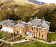
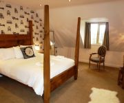
Hotels and Places to Stay
Alison House
New Bath Hotel
White Hart Inn
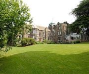
Makeney Hall Belper
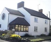
The Wheel House
The View at the White Horse Woolley Moor
The Greyhound Hotel
The Duke of Wellington
Matlock
Videos from this area
These are videos related to the place based on their proximity to this place.
Derbyshire Mountain Biking
various decents from around crich chase, blackrocks and shining cliff woods in derbyshire. Track Deadmau5-Raise your weapon.
Ecclesbourne Valley Railway,Wirksworth,Ravenstor,Idridgehay,Duffield,2012,England.
Ecclesbourne Valley Railway,Wirksworth,Ravenstor,Idridgehay,Duffield,2012,Full HD,England.Wirksworth Station is the main hub of Ecclesbourne Valley Railway,and the line runs through the ...
Half an Hour at (94) - Ecclesbourne Valley Railway 28.2.2015 -Wirksworth-Class 122 Derby Lightweight
Third visit of the day was to the Ecclesbourne Valley Railway at Wirksworth in the Peak District near Matlock. This line runs for 9 miles to Duffield and features predominantly heritage DMU's....
Multiple Memories at the Ecclesbourne Valley Railway: Part One
The Ecclesbourne Valley Railway nestles in the peak district of Derbyshire, and is unusual for a heritage railway in two distinct ways. Firstly, it has two routes: the Wirksworth to Duffield...
EVR,2013,Steam Gala,HD,Ecclesbourne Valley Railway,GWR 5643,5th May,England.
Steam at Ecclesbourne Valley Railway,EVR,Bank Holiday Weekend,5th May,2013,England,HD.Glorious weather,stunning countryside and Steam locomotives in action.We arrive at Wirksworth ...
Ecclesbourne Valley Railway,EVR,2013,HD,Diesel Weekend,2nd March,England,UK
Ecclesbourne Valley Railway,EVR,Diesel Weekend,2nd March,2013,Full HD,England ,UK.Beautiful Spring like day,9 degrees c and sunny.Starting off at EVR's Hub Station,Wirksworth,Derbyshire Dales ...
Duffield to Ravenstor on the Ecclesborne Valley Railway
A time lapse video on board M55006 of the trip from Duffield to Ravenstor with a short shunt in Wirksworth yard.
The Ecclesbourne Valley Railway
The Ecclesbourne Valley railway is a volunteer-restored train line running from Duffield to Wirksworth in Derbyshire. Railway historian Reg Nerps tells the story of the restoration of the line....
MTB Hardtail at Black Rocks, Derbyshire (Jan 2013)
First trip out of the new year having a play at Black Rocks, Derbyshire. First time there and only had an hour to kill but looks like there are some great routes around there. Didn't follow...
Videos provided by Youtube are under the copyright of their owners.
Attractions and noteworthy things
Distances are based on the centre of the city/town and sightseeing location. This list contains brief abstracts about monuments, holiday activities, national parcs, museums, organisations and more from the area as well as interesting facts about the region itself. Where available, you'll find the corresponding homepage. Otherwise the related wikipedia article.
Cromford and High Peak Railway
Black Rocks (Derbyshire)
The Black Rocks is a small outcrop of natural gritstone, in between Cromford and Wirksworth, situated in the Derbyshire Peak District (Landranger map 119), England. Parking is available for walking along the old railway path and up to the top of the crag, and there is a picnic area. The area has been a well-known rock climbing venue since the 1890s. A large number of hard lines were put up by some of the best climbers of the 1980s and 1990s.
Cromford railway station
Cromford railway station is a railway station owned by Network Rail and managed by East Midlands Trains (EMT) Train operating company (TOC). It is located in the village of Cromford in Derbyshire, England. The station is on the Derwent Valley Line 15+⁄2 miles north of Derby towards Matlock.
Whatstandwell railway station
Whatstandwell railway station is a railway station owned by Network Rail and managed by East Midlands Trains (EMT) Train operating company (TOC). It serves the villages of Whatstandwell and Crich Carr in Derbyshire, England. The station is located on the Derwent Valley Line from Derby to Matlock. The full range of tickets for travel for any destination in the country are purchased from the guard on the train at no extra cost.
Shining Cliff Woods, Derbyshire
Shining Cliff Woods are on the west bank of the River Derwent near to Ambergate Derbyshire. In medieval times "Schymynde-cliffe" was one of the seven royal parks within Duffield Frith and, as such, belonged to Edmund Crouchback, Earl of Lancaster. It was an estate within the manor of Alderwasley and in 1284 was given to William Foun who was given the job of maintaining the boundaries between the Pendleton and Peatpits Brooks.
Coddington, Derbyshire
Coddington is a place in Derbyshire, England. It is part of the civil parish of Crich, and is ½ mile west of that village. According to Kelly's Directory of 1891 there were two farms at Coddington.
High Peak Junction
High Peak Junction, near Cromford, Derbyshire, England, is the name now used to describe the site where the former Cromford and High Peak Railway (C&HPR), whose workshops were located here, meets the Cromford Canal. It lies within Derwent Valley Mills World Heritage Site, designated in 2001, and today marks the southern end of the High Peak Trail, a 17 miles trail for walkers, cyclists and horse riders.
Leawood Pump House
The Leawood Pump House was built in 1849 to supply water to the Cromford Canal, built some 50 years previously. It is a Grade II* listed building. Located a little along the canal towpath from High Peak Junction, it stands to a height of 45 feet on the right bank of the River Derwent, at the end of the Derwent Aqueduct, and has a 95 feet chimney stack with a cast-iron cap. The Watt-type beam engine was designed and erected by Graham and Company of Milton Works, Elsecar, Sheffield.


