Safety Score: 3,0 of 5.0 based on data from 9 authorites. Meaning we advice caution when travelling to United Kingdom.
Travel warnings are updated daily. Source: Travel Warning United Kingdom. Last Update: 2024-08-13 08:21:03
Discover Threlkeld
Threlkeld in Cumbria (England) is a city in United Kingdom about 247 mi (or 397 km) north-west of London, the country's capital city.
Local time in Threlkeld is now 09:03 AM (Monday). The local timezone is named Europe / London with an UTC offset of zero hours. We know of 9 airports in the vicinity of Threlkeld, of which 5 are larger airports. The closest airport in United Kingdom is Carlisle Airport in a distance of 24 mi (or 39 km), North-East. Besides the airports, there are other travel options available (check left side).
There are several Unesco world heritage sites nearby. The closest heritage site is Frontiers of the Roman Empire in Germany at a distance of 71 mi (or 114 km). The closest in United Kingdom is New Lanark in a distance of 79 mi (or 114 km), East. Also, if you like golfing, there are a few options in driving distance. Looking for a place to stay? we compiled a list of available hotels close to the map centre further down the page.
When in this area, you might want to pay a visit to some of the following locations: Carlisle, Greenhead, Haltwhistle, Dumfries and Bardon Mill. To further explore this place, just scroll down and browse the available info.
Local weather forecast
Todays Local Weather Conditions & Forecast: 6°C / 43 °F
| Morning Temperature | 7°C / 44 °F |
| Evening Temperature | 6°C / 43 °F |
| Night Temperature | 5°C / 41 °F |
| Chance of rainfall | 5% |
| Air Humidity | 81% |
| Air Pressure | 991 hPa |
| Wind Speed | Strong breeze with 22 km/h (13 mph) from North-East |
| Cloud Conditions | Overcast clouds, covering 90% of sky |
| General Conditions | Light rain |
Tuesday, 26th of November 2024
6°C (43 °F)
6°C (43 °F)
Light rain, fresh breeze, scattered clouds.
Wednesday, 27th of November 2024
6°C (42 °F)
4°C (38 °F)
Light rain, light breeze, broken clouds.
Thursday, 28th of November 2024
6°C (42 °F)
4°C (39 °F)
Light rain, gentle breeze, broken clouds.
Hotels and Places to Stay
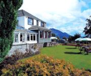
Craglands Guest House
Hunters Way
BEST WESTERN PLUS CASTLE INN
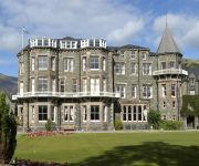
Keswick Country House Hotel
Videos from this area
These are videos related to the place based on their proximity to this place.
Yuneec Q500 Typhoon. Castlerigg Stone Circle, near Threlkeld & Keswick in the Lake District UK
Castlerigg is perhaps the most atmospheric and dramatically sited of all British stone circles, with panoramic views and the mountains of Helvellyn and High Seat as a backdrop. It is also among...
Start of Chestnut Hill, Keswick - Tour of Britain Stage 2 #TOB2013 #AllezWiggo
Tour of Britain Stage 2 in the wet! Bradley Wiggins, Ian Stannard, Bernie Eisel, Dan Martin, Nairo Quintana, Mark Cavendish.
Stone Circle at Castlerigg, Keswick, Lake District, North-West England, UK, July 2012
Castlerigg Stone Circle in Keswick, Lake District, Noth-West England, UK, July 2012.
Tour of Britain #ToB2013 Stage 2 Keswick with Bradley Wiggins
A very wet stage 2 of the Tour of Britain on Mon 16 Sept 2013 with Bradley Wiggins, Mark Cavendish, Nairo Quintana, Dan Martin & Alex Dowsett.
Helvellyn, The Lake District, England
Please reduce the screen image size for better quality.) An ascent of Helvellyn, England's third highest mountain. The climb starts in Patterdale and ascends to the 'Hole in The Wall', taking...
Rambler near miss!!
Recorded using GoPro HD helmetcam. Filmed in March 2011 on the Back o' Skiddaw descent to Mosedale. No ramblers were harmed in the making of this video.
Videos provided by Youtube are under the copyright of their owners.
Attractions and noteworthy things
Distances are based on the centre of the city/town and sightseeing location. This list contains brief abstracts about monuments, holiday activities, national parcs, museums, organisations and more from the area as well as interesting facts about the region itself. Where available, you'll find the corresponding homepage. Otherwise the related wikipedia article.
Glenderaterra Beck
Glenderaterra Beck is a watercourse in the English county of Cumbria. The beck runs from its source on Burnt Horse through the valley between Lonscale Fell and Blencathra to its confluence with the River Greta at Brundholme near Threlkeld. On its southerly course, Glenderaterra Beck is joined by Sinen Gill and Roughten Gill, draining Blease Fell on Blencathra, and, lower down, Whit Beck, emanating from Jenkin Hill on Skiddaw.
St. John's Beck
St. John's Beck is a river in the Lake District of Cumbria, England. The beck has its beginning as an outflow of Thirlmere, whence it flows northwards through St. John's in the Vale, towards Threlkeld, where it meets the River Glenderamackin to form the River Greta.
St John's in the Vale
St John's in the Vale is a glacial valley in the Lake District National Park, Cumbria, England. Within the vale are a number of farms and small settlements, in addition to several disused quarry and mining works. St Johns Beck meanders northward along the floor of the vale, and is the primary route of outflow from Thirlmere reservoir to the south. Alongside the beck runs the B5322, St Johns in the Vale Road.
Threlkeld railway station
Threlkeld railway station was situated on the Cockermouth, Keswick and Penrith Railway between Penrith and Cockermouth in Cumbria, England. The station served the village of Threlkeld. The station opened to passenger traffic on 2 January 1865, and closed on 6 March 1972.
Naddle Beck
Naddle Beck is a minor river of Cumbria, England. Rising beneath Dodd Crag, Naddle Beck flows northward to meet the River Greta. The major tributary of Naddle Beck is Shoulthwaite Gill, which drains the eastern side of High Seat and Bleaberry Fell. Mere Gill joins Shoulthwaite Gill beneath an old fort on Castle Crag. Other tributaries of Naddle Beck are Brown Beck and William's Beck.
St John's Church, St John's in the Vale
St John's Church, St John's in the Vale, is located in the valley of St John's in the Vale, Cumbria, England. It is an active Anglican parish church in the deanery of Derwent, the archdeaconry of West Cumberland, and the diocese of Carlisle. Its benefice is united with those of St Mary, Threlkeld, and Wythburn Church. The church has been designated by English Heritage as a Grade II listed building.


