Safety Score: 3,0 of 5.0 based on data from 9 authorites. Meaning we advice caution when travelling to United Kingdom.
Travel warnings are updated daily. Source: Travel Warning United Kingdom. Last Update: 2024-08-13 08:21:03
Delve into Mockerkin
Mockerkin in Cumbria (England) is a town located in United Kingdom about 253 mi (or 407 km) north-west of London, the country's capital town.
Time in Mockerkin is now 11:21 PM (Tuesday). The local timezone is named Europe / London with an UTC offset of zero hours. We know of 10 airports closer to Mockerkin, of which 4 are larger airports. The closest airport in United Kingdom is Barrow Walney Island Airport in a distance of 33 mi (or 53 km), South. Besides the airports, there are other travel options available (check left side).
There are several Unesco world heritage sites nearby. The closest heritage site in United Kingdom is New Lanark in a distance of 87 mi (or 141 km), North-East. Also, if you like the game of golf, there are some options within driving distance. We saw 1 points of interest near this location. In need of a room? We compiled a list of available hotels close to the map centre further down the page.
Since you are here already, you might want to pay a visit to some of the following locations: Dumfries, Carlisle, Blackpool, Maughold and Greenhead. To further explore this place, just scroll down and browse the available info.
Local weather forecast
Todays Local Weather Conditions & Forecast: 10°C / 51 °F
| Morning Temperature | 8°C / 47 °F |
| Evening Temperature | 10°C / 50 °F |
| Night Temperature | 11°C / 53 °F |
| Chance of rainfall | 0% |
| Air Humidity | 85% |
| Air Pressure | 1022 hPa |
| Wind Speed | Light breeze with 3 km/h (2 mph) from West |
| Cloud Conditions | Overcast clouds, covering 100% of sky |
| General Conditions | Overcast clouds |
Wednesday, 6th of November 2024
14°C (58 °F)
12°C (54 °F)
Overcast clouds, gentle breeze.
Thursday, 7th of November 2024
14°C (56 °F)
11°C (51 °F)
Sky is clear, light breeze, clear sky.
Friday, 8th of November 2024
12°C (54 °F)
10°C (50 °F)
Sky is clear, light breeze, clear sky.
Hotels and Places to Stay
TRAVELODGE COCKERMOUTH
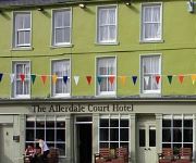
Allerdale Court Hotel
Allerdale Court
Videos from this area
These are videos related to the place based on their proximity to this place.
MMRA of Great Britain Minimoto Racing Promo Video
MMRA of GB racing promotional video from June 1995. Shot on location at Rowrah Kart Circuit in Cumbria on a glorious sunny day featuring some of the best minimoto riders of all time (I am biased...
Cockermouth Flood Risk Management Scheme with David 'the duck' Duckinson
Watch as David 'the duck' Duckinson gives you a tour of the Environment Agency's £4.4m Cockermouth flood risk management scheme. David Duckinson is delighted with the new scheme and shows...
Cockermouth, Cumbria UK - 2nd September, 2013
My next set of videos are from my September week in Cumbria and the Lake District. This video was filmed in the small town of Cockermouth, which famously flooded in 2009. Cockermouth has been...
Trout Hotel, Cockermouth, Cumbria, UK
SEE MY TRAVEL GROUP ON FACEBOOK : https://www.facebook.com/motorhomefulltime I stayed at the Trout Hotel in Cockermouth, Cumbria in September 2013. It is a traditional hotel set in the ...
Cockermouth part two of two
SEE MY TRAVEL GROUP ON FACEBOOK : https://www.facebook.com/motorhomefulltime Cockermouth is named as it is at the confluence of the River Cocker as it flows into the River Derwent on the ...
@sickkid1972 [#Cockermouth #flood 20th November 2009 - W...]
sickkid1972 [#Cockermouth #flood 20th November 2009 - Waters receding.... #twitvid] posted November 20th 2009 at 7:51am from TwitVid - http://twitvid.com/2CBE1.
Dragonfly Tattoo at Cockrock 2013, Cockermouth, Cumbria
Vicky and her band playing on the 100% Solar Powered Gatherer's Stage in the Green area. 21/07/2013.
RSPCA Video - Cumbria flood rescue
In November 2009 Cumbria was devastated by flooding caused by heavy rainfall. Cockermouth was one of the worst-hit areas, with an estimated 1400 people affected and some having to be rescued...
Red Squirrel making Drey
A short video of a Red Squirrel building its nest (Drey) in a tree in Cockermouth, Cumbria. Sunday 24th January 2010.
Videos provided by Youtube are under the copyright of their owners.
Attractions and noteworthy things
Distances are based on the centre of the city/town and sightseeing location. This list contains brief abstracts about monuments, holiday activities, national parcs, museums, organisations and more from the area as well as interesting facts about the region itself. Where available, you'll find the corresponding homepage. Otherwise the related wikipedia article.
Allerdale
Allerdale is a non-metropolitan district of Cumbria, England, with borough status. Its council is based in Workington and the borough has a population of 93,492 according to the 2001 census.
Branthwaite
Branthwaite is a hamlet in the borough of Allerdale. Branthwaite is approx. 5 miles from Workington and is 7 miles from Cockermouth, the small village has few amenities but is a sought after area. There is one pub, The Wild Duck. The River Marron runs through Branthwaite. There was once a Trout farm but its recently closed down. There’s also an old mill that was the main source for the village but again that has long closed down.
List of United Kingdom locations: As-Az
Ullock
Ullock is a village in Cumbria, England. It is located 254 miles from London.
St Oswald's Church, Dean
St Oswald's Church, Dean, is in the village of Dean, Cumbria, England. It is an active Anglican parish church in the deanery of Derwent, the archdeaconry of West Cumberland and the diocese of Carlisle. The church has been designated by English Heritage as a Grade I listed building.
Deanscales
Deanscales is a hamlet in the Allerdale District, in the county of Cumbria. Nearby settlements include the village of Dean, Cumbria and the town of Cockermouth. Deanscales is on the A5086 road. Deanscales has 1 pub.
Cogra Moss
Cogra Moss is a shallow reservoir to the east of the village of Lamplugh on the western edge of the English Lake District. It was created by the damming of Rakegill Beck in about 1880, though its function as a water supply ceased in 1975. The reservoir, which is surrounded by forestry plantations on three sides, is popular with walkers and anglers.


!['@sickkid1972 [#Cockermouth #flood 20th November 2009 - W...]' preview picture of video '@sickkid1972 [#Cockermouth #flood 20th November 2009 - W...]'](https://img.youtube.com/vi/bg0idDHD9jc/mqdefault.jpg)


