Safety Score: 3,0 of 5.0 based on data from 9 authorites. Meaning we advice caution when travelling to United Kingdom.
Travel warnings are updated daily. Source: Travel Warning United Kingdom. Last Update: 2024-08-13 08:21:03
Explore Lorton
Lorton in Cumbria (England) is located in United Kingdom about 252 mi (or 406 km) north-west of London, the country's capital.
Local time in Lorton is now 07:24 PM (Thursday). The local timezone is named Europe / London with an UTC offset of zero hours. We know of 10 airports in the wider vicinity of Lorton, of which 4 are larger airports. The closest airport in United Kingdom is Carlisle Airport in a distance of 30 mi (or 48 km), North-East. Besides the airports, there are other travel options available (check left side).
There are several Unesco world heritage sites nearby. The closest heritage site in United Kingdom is New Lanark in a distance of 84 mi (or 135 km), North-East. Also, if you like golfing, there are multiple options in driving distance. We found 1 points of interest in the vicinity of this place. If you need a place to sleep, we compiled a list of available hotels close to the map centre further down the page.
Depending on your travel schedule, you might want to pay a visit to some of the following locations: Carlisle, Dumfries, Blackpool, Greenhead and Haltwhistle. To further explore this place, just scroll down and browse the available info.
Local weather forecast
Todays Local Weather Conditions & Forecast: 4°C / 39 °F
| Morning Temperature | 2°C / 35 °F |
| Evening Temperature | 4°C / 39 °F |
| Night Temperature | 3°C / 38 °F |
| Chance of rainfall | 0% |
| Air Humidity | 66% |
| Air Pressure | 999 hPa |
| Wind Speed | Fresh Breeze with 13 km/h (8 mph) from South-East |
| Cloud Conditions | Broken clouds, covering 69% of sky |
| General Conditions | Rain and snow |
Friday, 22nd of November 2024
5°C (41 °F)
4°C (39 °F)
Rain and snow, moderate breeze, few clouds.
Saturday, 23rd of November 2024
5°C (40 °F)
11°C (52 °F)
Rain and snow, fresh breeze, overcast clouds.
Sunday, 24th of November 2024
10°C (51 °F)
9°C (49 °F)
Moderate rain, strong breeze, overcast clouds.
Hotels and Places to Stay
Armathwaite Hall
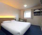
TRAVELODGE COCKERMOUTH
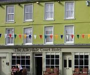
Allerdale Court Hotel
Allerdale Court
Videos from this area
These are videos related to the place based on their proximity to this place.
Sheep with large testicles
SEE MY FACEBOOK TRAVEL GROUP : https://www.facebook.com/motorhomefulltime Here we have a poor sheep filmed in the British Lake District with rather large testicles.
Lake District: High Lorton to Buttermere (B5289) drive
A drive along the B5289 from High Lorton towards Buttermere. I was told that the junction (left turn) for Buttermere is easy to miss, but I found it easily e...
Lake District Cumbria England
Slide show of a selection of photographs taken between 9 and 15 July 2011 during a holiday to The Lake District Cumbria England, the weather was glorious for the whole holiday unusual for here...
Hopegill Head, Lake District 22 August 20
Created on August 23, 2009 using FlipShare. A walk from to Hopegill Head via Ladysyke Pike starting and finishing in the village of Lorton.
Water
http://www.EscapeToCumbria.co.uk http://www.DiscoveringCumbria.com Mainly taken around Spout Force near Whinlatter, Cumbria. www.EscapeToCumbria.co.uk.
Dodd Wood in the school holidays
We went the green route - 2 hours to get to the summit. It took us 40 minutes to drive to Dodd Wood from the Tranquil Otter.
Whinlatter Red South Loop In The Rain
Me & Extreme Jim ( although weather affected) doing the south loop in the howling wind and pouring rain. Yes, i know we could have gone quicker (if we had brought a boat!)
A Cockermouth street view
Here are some Cockermouth Street Views. (had some problems rendering this probably best at 360p not HD) Hope you enjoy the video. Subscribe to my YouTube channel to see them all :)
@sickkid1972 [#Cockermouth #flood 20th November 2009 - W...]
sickkid1972 [#Cockermouth #flood 20th November 2009 - Waters receding.... #twitvid] posted November 20th 2009 at 8:19am from TwitVid - http://twitvid.com/41DA7.
Videos provided by Youtube are under the copyright of their owners.
Attractions and noteworthy things
Distances are based on the centre of the city/town and sightseeing location. This list contains brief abstracts about monuments, holiday activities, national parcs, museums, organisations and more from the area as well as interesting facts about the region itself. Where available, you'll find the corresponding homepage. Otherwise the related wikipedia article.
Embleton railway station
Embleton railway station was situated on the Cockermouth, Keswick and Penrith Railway between Penrith and Cockermouth in Cumbria, England. The station served the village of Embleton. The station opened to passenger traffic on 2 January 1865, and closed on 15 September 1958. All trace of the station building has gone although the Station Master's house survives as a private residence on the side of the A66.
Wythop
Wythop is a civil parish in the north of Cumbria, England between Cockermouth and Keswick. Wythop is within one mile of the hamlets of Dubwath (in the parish of Setmurthy) and Wythop Mill. Administratively Wythop forms part of the district of Allerdale.
Armaside
Armaside is an agricultural village in Cumbria, England, situated north of Low Lorton, south west of the River Cocker, and north west from Cockermouth - grid reference NY151275. The village consists of Armaside, Armaside Farm, Armaside Howe, and High Armaside. There is a local business dealing with wind turbines and other forms of renewable energy.


!['@sickkid1972 [#Cockermouth #flood 20th November 2009 - W...]' preview picture of video '@sickkid1972 [#Cockermouth #flood 20th November 2009 - W...]'](https://img.youtube.com/vi/YgSPQ6ix3pA/mqdefault.jpg)
