Safety Score: 3,0 of 5.0 based on data from 9 authorites. Meaning we advice caution when travelling to United Kingdom.
Travel warnings are updated daily. Source: Travel Warning United Kingdom. Last Update: 2024-08-13 08:21:03
Discover Farlam
Farlam in Cumbria (England) is a place in United Kingdom about 259 mi (or 416 km) north-west of London, the country's capital city.
Current time in Farlam is now 07:36 PM (Thursday). The local timezone is named Europe / London with an UTC offset of zero hours. We know of 8 airports near Farlam, of which 3 are larger airports. The closest airport in United Kingdom is Carlisle Airport in a distance of 5 mi (or 7 km), West. Besides the airports, there are other travel options available (check left side).
There are several Unesco world heritage sites nearby. The closest heritage site is Frontiers of the Roman Empire in Germany at a distance of 52 mi (or 83 km). The closest in United Kingdom is New Lanark in a distance of 55 mi (or 83 km), East. Also, if you like playing golf, there are a few options in driving distance. If you need a hotel, we compiled a list of available hotels close to the map centre further down the page.
While being here, you might want to pay a visit to some of the following locations: Greenhead, Haltwhistle, Carlisle, Bardon Mill and Birtley. To further explore this place, just scroll down and browse the available info.
Local weather forecast
Todays Local Weather Conditions & Forecast: 0°C / 33 °F
| Morning Temperature | -3°C / 26 °F |
| Evening Temperature | -1°C / 31 °F |
| Night Temperature | -1°C / 29 °F |
| Chance of rainfall | 0% |
| Air Humidity | 79% |
| Air Pressure | 997 hPa |
| Wind Speed | Moderate breeze with 10 km/h (6 mph) from East |
| Cloud Conditions | Few clouds, covering 19% of sky |
| General Conditions | Few clouds |
Friday, 22nd of November 2024
1°C (34 °F)
-0°C (32 °F)
Sky is clear, gentle breeze, clear sky.
Saturday, 23rd of November 2024
1°C (34 °F)
11°C (53 °F)
Rain and snow, fresh breeze, overcast clouds.
Sunday, 24th of November 2024
11°C (52 °F)
7°C (45 °F)
Moderate rain, strong breeze, overcast clouds.
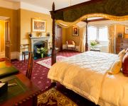
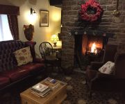
Hotels and Places to Stay
Heads Nook Hall
String of Horses Inn
FARLAM HALL
Videos from this area
These are videos related to the place based on their proximity to this place.
CareCo Zoom Plus Travel Mobility Scooter
The CareCo Zoom is one of the best products within the CareCo range. It is both versatile and reliable, making it an excellent travel mobility scooter. Due to this success CareCo are pleased...
A Year to sort myself out - Weight Loss Journey
The video is my into to my new weekly vlog. My aim is to lose 50 pounds in a year and to be come as healthy as possible by the time I turn 30!
Sim city 4 deluxe edition game 400k pop new city
Hello, I recently started playing deluxe edition , currently working on this city, this city got more then 400k pop and good jobs count too. Hoping to get around 1M pop . I will upload another...
Roma Valencia Mobility Scooter
The Shoprider Valencia Travel Mobility Scooter from Roma Medical is a great mobility scooter for those who are looking for a larger transportable scooter. It's dimensions allow it to accommodate...
GoPro Hero 4 Black - Timelapse Test #1 Brampton Police Station
Brampton Cumbria. A time-lapse from mainstreet to the Police Station. January 26th 2015.
Videos provided by Youtube are under the copyright of their owners.
Attractions and noteworthy things
Distances are based on the centre of the city/town and sightseeing location. This list contains brief abstracts about monuments, holiday activities, national parcs, museums, organisations and more from the area as well as interesting facts about the region itself. Where available, you'll find the corresponding homepage. Otherwise the related wikipedia article.
King Water
King Water is a river in the north of Cumbria, England. The Brampton Angling Association has a long term let from the Earl of Carlisle for fishing rights on a portion of the River Irthing and part of the King Water. Hadrian's Wall crossed the King Water to the east of the village of Walton
Brampton (Cumbria) railway station
Brampton railway station is on the Newcastle and Carlisle Railway in northern England, serving the town of Brampton. The station is located about a mile southeast of the town, near the village of Milton. Staff were removed from the station in 1967, with the main buildings demolished in stages during the 1970s and 80s.
Talkin
Talkin is a village in Cumbria, England situated close to Talkin Tarn. Area soil is dry and gravelly.
Talkin Tarn
Talkin Tarn is a glacial lake and country park in Cumbria, England. The lake is a kettle hole lake, formed 10,000 years ago by mass glacial action. Rowing is an activity at Talkin Tarn. The rowing club, TTARC (Talkin Tarn Amateur Rowing Club) celebrated its 150th anniversary in 2009. Talkin Tarn is the home of a legendary pike, which supposedly lives in its waters, although few have witnessed it. Research on Climate change carried out at Talkin Tarn was published in 2004.
Brampton Town railway station
Brampton Town railway station was a railway station in the centre of Brampton, Cumbria, and the terminus of the Brampton Town Branch. It was opened in 1775, to work on the Earl of Carlisle's Waggonway. By 1836, a horse-driven passenger service had been implemented when the track was realigned to meet up with the Newcastle and Carlisle Railway, allowing service to the Brampton Junction station about a mile out of town, near Milton.
St Martin's Church, Brampton
St Martin's Church, Brampton, is in Front Street, Brampton, Cumbria, England. It is an active Anglican parish church in the deanery of Brampton, the archdeaconry of Carlisle and the diocese of Carlisle. It has been designated by English Heritage as a Grade I listed building and is the only church designed by the Pre-Raphaelite architect Philip Webb. The architectural historian Nikolaus Pevsner described it as "a very remarkable building".


