Safety Score: 3,0 of 5.0 based on data from 9 authorites. Meaning we advice caution when travelling to United Kingdom.
Travel warnings are updated daily. Source: Travel Warning United Kingdom. Last Update: 2024-08-13 08:21:03
Discover Brigsteer
Brigsteer in Cumbria (England) is a town in United Kingdom about 222 mi (or 358 km) north-west of London, the country's capital city.
Current time in Brigsteer is now 03:18 AM (Monday). The local timezone is named Europe / London with an UTC offset of zero hours. We know of 9 airports near Brigsteer, of which 4 are larger airports. The closest airport in United Kingdom is Barrow Walney Island Airport in a distance of 22 mi (or 35 km), South-West. Besides the airports, there are other travel options available (check left side).
There are several Unesco world heritage sites nearby. The closest heritage site is Frontiers of the Roman Empire in Germany at a distance of 74 mi (or 119 km). The closest in United Kingdom is Castles and Town Walls of King Edward in Gwynedd in a distance of 88 mi (or 119 km), North-East. Also, if you like playing golf, there are a few options in driving distance. Looking for a place to stay? we compiled a list of available hotels close to the map centre further down the page.
When in this area, you might want to pay a visit to some of the following locations: Blackpool, Preston, Freckleton, Warton and Carlisle. To further explore this place, just scroll down and browse the available info.
Local weather forecast
Todays Local Weather Conditions & Forecast: 7°C / 44 °F
| Morning Temperature | 7°C / 45 °F |
| Evening Temperature | 6°C / 43 °F |
| Night Temperature | 5°C / 41 °F |
| Chance of rainfall | 4% |
| Air Humidity | 75% |
| Air Pressure | 992 hPa |
| Wind Speed | Strong breeze with 22 km/h (14 mph) from North-East |
| Cloud Conditions | Overcast clouds, covering 94% of sky |
| General Conditions | Light rain |
Tuesday, 26th of November 2024
6°C (43 °F)
5°C (41 °F)
Light rain, moderate breeze, few clouds.
Wednesday, 27th of November 2024
6°C (43 °F)
3°C (37 °F)
Light rain, light breeze, overcast clouds.
Thursday, 28th of November 2024
5°C (41 °F)
4°C (39 °F)
Light rain, calm, broken clouds.
Hotels and Places to Stay
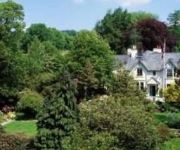
Gilpin Hotel & Lake House
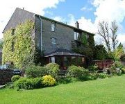
Millers Beck Country Guest House and Self Catering
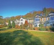
The Punch Bowl
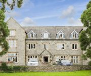
CASTLE GREEN HOTEL IN KENDAL
Stonecross Manor Hotel
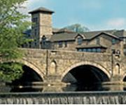
Riverside
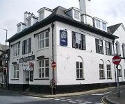
The Bulls Head
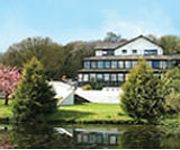
Damson Dene
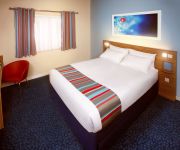
TRAVELODGE KENDAL
Kendal Central
Videos from this area
These are videos related to the place based on their proximity to this place.
Video detik - detik mobil FPI tabrak pengendara motor di Kendal
Sebuah video amatir saat anggota Front Pembela Islam (FPI) yang mengendarai Toyota Avanza menabrak motor di Kendal, Jawa Tengah, pada Kamis 18 Juli 2013 hingga menyebabkan satu orang ...
Kendal Town Hall Clock
It takes a while for Kendal Town Hall clock to complete its 'Westminster Chimes' routine and strike 6 o'clock, but then you get an additional tune to brighten up a dull, rainy day! Hopefully...
Sunset from Scout Scar nr Kendal - Saturday 6th February 2010
Timelapse of sunset from Scout Scar nr Kendal overlooking the Lyth Valley, the valley was filling up with fog, look at the hills in the background and you'll see the fog rising. This timelapse...
Motionhouse - Underground at Kendal's MintFest 2009 part of Lakesalive
Motionhouses festival piece performed by four dancers within a rocking tubular structure. Underground uses stunningly physical dance, poignant imagery and surprising aerial encounters to explore...
Rover 3500S from Kendal (A6/A591) to A590 (M6 Junction 36)
The footage starts just south of Kendal and ends just at the roundabout at junction 36 of the M6.
Tour of Britain 2013 - Stage 2 - Finish Beast Bank's, Kendal
Some clips I took today of the Tour of Britain race ending in Kendal, footage in Market Place, riders coming up Beast Banks and jersey presentation.
The Smiles Foundation : Tileagd Choir : Kendal : Sep 5th 2009
The young people from the Roma settlement at Tileagd have seen an amazing change in their lives. The last 8 years have seen a journey from hopelessness to happiness, through the work of the...
K Village Kendal
The £100 million redevelopment of K Village is well underway, remember how it used to look? February 2010.
Videos provided by Youtube are under the copyright of their owners.
Attractions and noteworthy things
Distances are based on the centre of the city/town and sightseeing location. This list contains brief abstracts about monuments, holiday activities, national parcs, museums, organisations and more from the area as well as interesting facts about the region itself. Where available, you'll find the corresponding homepage. Otherwise the related wikipedia article.
Sizergh Castle and Garden
Sizergh Castle and Garden is a castle, stately home and garden at Helsington in the English county of Cumbria, about 4 miles south of Kendal, and in the care of the National Trust.
Levens Hall
Levens Hall is a manor house in the county of Cumbria in northern England. The first house on the site was a pele tower built by the Redman family in around 1350. Much of the present building dates from the Elizabethan era, when the Bellingham family extended the house.
A591 road
The A591 is a major road in Cumbria, in the north-west of England. The stretch of the road between Windermere and Keswick has been voted Britain's Favourite Road.
River Pool, Cumbria
The River Pool is a river in the English county of Cumbria. The Pool rises at Waingap near the village of Crook and follows a southerly course, past the township of Underbarrow and into the Lyth Valley, where it joins the River Gilpin.
Scout Scar
Scout Scar, also called Underbarrow Scar, is a hill in the English Lake District, west of Kendal, Cumbria and above the village of Underbarrow. It is the subject of a chapter of Wainwright's book The Outlying Fells of Lakeland. It reaches 764 feet and Wainwright's anticlockwise recommended route also includes Cunswick Scar at 679 feet . There is a shelter, locally known as "The Mushroom", at the summit.


