Safety Score: 3,0 of 5.0 based on data from 9 authorites. Meaning we advice caution when travelling to United Kingdom.
Travel warnings are updated daily. Source: Travel Warning United Kingdom. Last Update: 2024-08-13 08:21:03
Delve into Beetham
Beetham in Cumbria (England) is a town located in United Kingdom about 217 mi (or 349 km) north-west of London, the country's capital town.
Time in Beetham is now 08:47 PM (Thursday). The local timezone is named Europe / London with an UTC offset of zero hours. We know of 9 airports closer to Beetham, of which 4 are larger airports. The closest airport in United Kingdom is Barrow Walney Island Airport in a distance of 21 mi (or 33 km), West. Besides the airports, there are other travel options available (check left side).
There are several Unesco world heritage sites nearby. The closest heritage site is Frontiers of the Roman Empire in Germany at a distance of 77 mi (or 124 km). The closest in United Kingdom is Castles and Town Walls of King Edward in Gwynedd in a distance of 84 mi (or 124 km), North-East. Also, if you like the game of golf, there are some options within driving distance. In need of a room? We compiled a list of available hotels close to the map centre further down the page.
Since you are here already, you might want to pay a visit to some of the following locations: Preston, Freckleton, Warton, Blackpool and Blackburn. To further explore this place, just scroll down and browse the available info.
Local weather forecast
Todays Local Weather Conditions & Forecast: 1°C / 34 °F
| Morning Temperature | -1°C / 30 °F |
| Evening Temperature | 2°C / 35 °F |
| Night Temperature | 2°C / 36 °F |
| Chance of rainfall | 2% |
| Air Humidity | 79% |
| Air Pressure | 999 hPa |
| Wind Speed | Moderate breeze with 9 km/h (6 mph) from East |
| Cloud Conditions | Overcast clouds, covering 93% of sky |
| General Conditions | Snow |
Friday, 22nd of November 2024
4°C (39 °F)
1°C (34 °F)
Light rain, gentle breeze, few clouds.
Saturday, 23rd of November 2024
5°C (41 °F)
12°C (53 °F)
Rain and snow, strong breeze, overcast clouds.
Sunday, 24th of November 2024
11°C (52 °F)
9°C (47 °F)
Moderate rain, fresh breeze, overcast clouds.
Hotels and Places to Stay
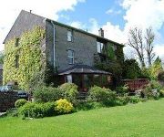
Millers Beck Country Guest House and Self Catering
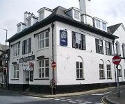
The Bulls Head
The George Washington
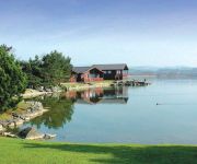
Pine Lake Resort by Diamond Resorts
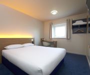
TRAVELODGE BURTON M6 NORTHBOUND
TRAVELODGE KENDAL
Longlands
Videos from this area
These are videos related to the place based on their proximity to this place.
Dollywood Vacation 2012
Our family had a great vacation at Dolly-wood and in the Pigeon Forge area. This was by far the best vacation we had, the kids loved it all.
A Trip on the Cinderbarrow Miniature Railway
A Trip on the Cinderbarrow Miniature Railway. This video takes us around the iner loop of the Cinderbarrow Miniature Railway run by Carnforth and District Model Engineers. The railway is open...
Arnside to Fairy Steps Walk 2013
The Walk from Arnside up to the Fairy Steps , as the was no Church in Arnside the Coffins were taken this way to the Next Village to be Buired . If you believe in Fairys tell me what you can...
Silverdale, overlooking Morecambe Bay...
A beautiful village past Arnside in South Cumbria which looks out onto the Bay of Morecambe....People were flying kites and the sun came out whilst filmimg.
Walking on quicksand on Morecambe Bay
Morecambe Bay in the UK is notorious for its quicksand. Bay Search and Rescue specialise in extracting people, animals and vehicles trapped in quicksand. This is what it looks like... This...
Getting Stuck in Quicksand
One of our regular helpers getting stuck in quicksand. This was the start of our regular quicksand rescue training session. it gives you an idea of how easy it can be to get stuck, this area...
Videos provided by Youtube are under the copyright of their owners.
Attractions and noteworthy things
Distances are based on the centre of the city/town and sightseeing location. This list contains brief abstracts about monuments, holiday activities, national parcs, museums, organisations and more from the area as well as interesting facts about the region itself. Where available, you'll find the corresponding homepage. Otherwise the related wikipedia article.
Ackenthwaite
Ackenthwaite is a hamlet in Cumbria, England. Ackenthwaite has a postbox, a telephone box a few farms, a small farmers pub and a few old buildings including the "old workhouse" which was in fact a workhouse, then a mental institution and then was a storage warehouse. It was then converted into flats and now stands as 5 houses. Built up around the old workhouse is the estate of Owlet Ash. Ackenthwaite was the location for Libby's which is an old factory for Nestle.
Storth
Storth, grid reference SD490790 is a hamlet in Cumbria, England, situated on the border with Lancashire. The village faces the estuary of the River Kent. Although the village is ancient the vast bulk of the homes are from the latter part of the 20th century. There is a village church (Methodist and Anglican, in the Methodist building). The only commercial enterprise in the village is the post office and shop, a locally owned co-operative.
River Bela
The River Bela is a short river in the county of Cumbria, England. It is in the ancient county of Westmorland. The river is formed by the confluence of Peasey Beck and Stainton Beck at Overthwaite. From there, it skirts around the town of Milnthorpe to the south, before pouring into the River Kent as it approaches its estuary. During World War II a prisoner of war camp was built beside the river at grid reference SD513802. After the war the camp became an open prison.
Lakeland Wildlife Oasis
The Lakeland Wildlife Oasis is a small zoological collection near the town of Milnthorpe, Cumbria, England, with a science and evolution theme. The centre is divided into several sections, including a butterfly hall and aquarium, as well as an outside walk-through area. The Lakeland Wildlife Oasis is a member of the BIAZA organisation, and participates in breeding schemes for several endangered species, notably the unusual Fossa (animal).
St Michael's Church, Beetham
St Michael's Church, Beetham, stands in the village of Beetham, Cumbria, England. It is an active Anglican parish church in the deanery of Kendal, the archdeaconry of Westmoreland and Furness, and the diocese of Carlisle. The church has been designated by English Heritage as a Grade I listed building.
Dog Hole Cave
Dog Hole Cave is an archaeologically significant cave near Storth, Cumbria, England. Other names for the cave include Haverbrack Bank Pot, Haverbrack Dog Hole, Fairy Cave, The Dog Hole and Doghole Cave. It has been excavated by J. W. ("Wilfred") Jackson in 1912, by local scouts in the 1950s, and by researchers from Liverpool John Moores University in 2003 and more recently.
Dallam Tower
Dallam Tower is a grade I listed country house in Beetham parish, near Milnthorpe, South Lakeland, Cumbria, England. It is a member of the Historic Houses Association but is not open to the public except for occasional charity events and visits to the garden through the National Gardens Scheme. The house is described as "Early C18 with C17 core, remodelled early C19" and has rainwater pipes dated 1722; its interiors include panelling by Gillow of Lancaster.
St Thomas' Church, Milnthorpe
St Thomas' Church, Milnthorpe, is located in the village of Milnthorpe, Cumbria, England. It is an active Anglican parish church in the deanery of Kendal, the archdeaconry of Westmorland and Furness, and the diocese of Carlisle.


