Safety Score: 3,0 of 5.0 based on data from 9 authorites. Meaning we advice caution when travelling to United Kingdom.
Travel warnings are updated daily. Source: Travel Warning United Kingdom. Last Update: 2024-08-13 08:21:03
Explore Sunderland Bridge
Sunderland Bridge in County Durham (England) is located in United Kingdom about 231 mi (or 372 km) north of London, the country's capital.
Local time in Sunderland Bridge is now 08:21 AM (Friday). The local timezone is named Europe / London with an UTC offset of zero hours. We know of 8 airports in the wider vicinity of Sunderland Bridge, of which 4 are larger airports. The closest airport in United Kingdom is Durham Tees Valley Airport in a distance of 17 mi (or 27 km), South. Besides the airports, there are other travel options available (check left side).
There are several Unesco world heritage sites nearby. The closest heritage site is Frontiers of the Roman Empire in Germany at a distance of 19 mi (or 31 km). The closest in United Kingdom is Durham Castle and Cathedral in a distance of 46 mi (or 31 km), North. Also, if you like golfing, there are multiple options in driving distance. We found 1 points of interest in the vicinity of this place. If you need a place to sleep, we compiled a list of available hotels close to the map centre further down the page.
Depending on your travel schedule, you might want to pay a visit to some of the following locations: Durham, Ferryhill, Bishop Middleham, West Rainton and Pittington. To further explore this place, just scroll down and browse the available info.
Local weather forecast
Todays Local Weather Conditions & Forecast: 3°C / 38 °F
| Morning Temperature | 2°C / 35 °F |
| Evening Temperature | 0°C / 32 °F |
| Night Temperature | 1°C / 33 °F |
| Chance of rainfall | 0% |
| Air Humidity | 58% |
| Air Pressure | 1004 hPa |
| Wind Speed | Moderate breeze with 13 km/h (8 mph) from South-East |
| Cloud Conditions | Clear sky, covering 2% of sky |
| General Conditions | Sky is clear |
Saturday, 23rd of November 2024
0°C (32 °F)
9°C (48 °F)
Rain and snow, fresh breeze, overcast clouds.
Sunday, 24th of November 2024
14°C (57 °F)
8°C (46 °F)
Moderate rain, strong breeze, overcast clouds.
Monday, 25th of November 2024
8°C (46 °F)
7°C (44 °F)
Light rain, high wind, near gale, scattered clouds.
Hotels and Places to Stay
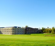
Ramside Hall Hotel Golf & Spa
Durham Radisson Blu Hotel
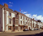
Durham Marriott Hotel Royal County
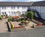
Garden House Inn
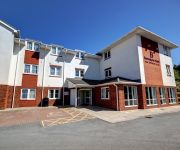
Hotel Bannatyne Durham
Park Head Hotel & Restaurant
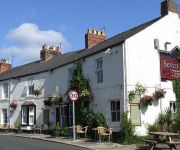
Seven Stars Inn
Durham City Centre
The Avenue Inn
High View Guest House
Videos from this area
These are videos related to the place based on their proximity to this place.
County Durham Floods November 2012 River Wear | Croxdale & Spring Gardens
A brief glimpse of the flood water damage around Croxdale & Spring Gardens flood defence near West Auckland County Durham. The A167 flooded once again at 'The Honest Lawyer' causing traffic...
DurhamGate Flythrough Visualisation
DurhamGate is a 53 acre mixed use development site at the gateway to Durham city centre and is the largest mixed-use regeneration scheme in the North East of England, incorporating commercial,...
Spennymoor 1950's
A rare glimpse of public transport in & around Spennymoor, County Durham, during the late 1950's. Filmed by an as yet unknown film maker? (The thumbs down are from international viewers, that...
Interesting driving out of junction
I came across this guy struggling with the concept of waiting at a junction on my way home from work the other day. Sorry that the camera angle is a bit wonky, but keep watching as you see...
Spennymoor Freedom Parade
D (Rifles) Company, 5th Battalion of the Royal Regiment of Fusiliers, receiving the freedom of Spennymoor on Armed Forces Day. The town mayor gave Afghanistan service medals to 3 soldiers and...
DRS 66 at Hett Mill
An unidentified DRS class 66 heading south on the ECML at Hett Mill near Ferryhill on 7th March 2009 with a Stobart/Tesco train.
Videos provided by Youtube are under the copyright of their owners.
Attractions and noteworthy things
Distances are based on the centre of the city/town and sightseeing location. This list contains brief abstracts about monuments, holiday activities, national parcs, museums, organisations and more from the area as well as interesting facts about the region itself. Where available, you'll find the corresponding homepage. Otherwise the related wikipedia article.
Croxdale
Croxdale is a village in the civil parish of Croxdale and Hett, about 3 miles south of Durham City, in County Durham in England and on the A167 road, formerly part of the Great North Road. The village has one shop, two pubs and a working men's club. A summer fun day has been held for the last three years to raise funds for a new play park. It is the location of Croxdale Hall, a Grade I listed building
Sunderland Bridge, County Durham
Not to be confused with Wearmouth Bridge, the principal road bridge across the River Wear in the city of Sunderland. Sunderland Bridge is both a bridge and a village in County Durham, England, about 3 miles south of Durham City. Both lie close to the confluence of the River Wear and River Browney.
Hett, County Durham
Hett is a large hamlet in County Durham, England. It is situated a few miles south of Durham. Hett is largely surrounded by farmland. To the south, rape fields are predominant while at the northern end, cattle are grazed year round. To the north-east of Hett lies Sunderland Bridge, a small hamlet with a population of under 50 people (2004). Hett contains a small pond and a football pitch.
Diocese of Durham
The Diocese of Durham is a Church of England diocese, based in Durham, and covering the historic County Durham (and therefore including the southern part of Tyne and Wear, the boroughs of Darlington, Hartlepool and the area of Stockton-on-Tees north of the River Tees). It was created in AD 1000 to replace the Diocese of Lindisfarne. The cathedral is Durham Cathedral and the bishop is the Bishop of Durham who lives at Auckland Castle, Bishop Auckland.
Durham University Botanic Garden
The Durham University Botanic Garden is a botanical garden located in Durham, England. The site is set in 25 acres of mature woodlands in the southern outskirts of the city. The botanic gardens have been located on their present site since 1970 before being officially opened in 1988 by the then Chancellor Dame Margot Fonteyn and now attract some 80,000 visitors annually.
Croxdale Hall
Croxdale Hall is a privately owned country mansion situated at Croxdale near Sunderland Bridge, County Durham. It is a Grade I listed building. The staunchly Roman Catholic Salvin family came to Croxdale by the marriage in 1402 of Gerard Salvin of Harswell, Yorkshire to Agnes Wharton, heiress of Croxdale. They have held the property ever since.
Josephine Butler Rugby Union Football Club
Josephine Butler RUFC is an English amateur, student rugby union team. The men's first team, which forms Josephine Butler RUFC, was derived from Josephine Butler College which was formed in 2006 as a brand new college at Durham University. Josephine Butler play their games between Maiden Castle and "The Racecourse", which is located in Durham, County Durham.
Oakthorpe Invitational
Oakthorpe Invitational Rugby Football Club, or ‘Oakthorpe‘ to its friends, is an invitational rugby club based in Oxfordshire, founded by a group of Rugby enthusiasts hailing various academic institutions amid the partisan climate of the summer of 2006. Since then the club has become an official ORFU recognised side, playing invitational exhibition fixtures against clubs and touring old boy sides and entering 7s, 10s and 15s competitions across the UK.


