Safety Score: 3,0 of 5.0 based on data from 9 authorites. Meaning we advice caution when travelling to United Kingdom.
Travel warnings are updated daily. Source: Travel Warning United Kingdom. Last Update: 2024-08-13 08:21:03
Discover Kelloe
Kelloe in County Durham (England) with it's 1,502 citizens is a place in United Kingdom about 229 mi (or 368 km) north of London, the country's capital city.
Current time in Kelloe is now 01:23 AM (Monday). The local timezone is named Europe / London with an UTC offset of zero hours. We know of 8 airports near Kelloe, of which 4 are larger airports. The closest airport in United Kingdom is Durham Tees Valley Airport in a distance of 15 mi (or 24 km), South. Besides the airports, there are other travel options available (check left side).
There are several Unesco world heritage sites nearby. The closest heritage site is Frontiers of the Roman Empire in Germany at a distance of 19 mi (or 31 km). The closest in United Kingdom is Durham Castle and Cathedral in a distance of 42 mi (or 31 km), North. Also, if you like playing golf, there are a few options in driving distance. We encountered 2 points of interest in the vicinity of this place. If you need a hotel, we compiled a list of available hotels close to the map centre further down the page.
While being here, you might want to pay a visit to some of the following locations: Bishop Middleham, Thornley, Fishburn, Pittington and Ferryhill. To further explore this place, just scroll down and browse the available info.
Local weather forecast
Todays Local Weather Conditions & Forecast: 7°C / 45 °F
| Morning Temperature | 8°C / 46 °F |
| Evening Temperature | 6°C / 43 °F |
| Night Temperature | 6°C / 42 °F |
| Chance of rainfall | 0% |
| Air Humidity | 64% |
| Air Pressure | 990 hPa |
| Wind Speed | Strong breeze with 20 km/h (12 mph) from North-East |
| Cloud Conditions | Scattered clouds, covering 28% of sky |
| General Conditions | Scattered clouds |
Tuesday, 26th of November 2024
7°C (44 °F)
5°C (40 °F)
Overcast clouds, fresh breeze.
Wednesday, 27th of November 2024
4°C (40 °F)
4°C (39 °F)
Moderate rain, moderate breeze, overcast clouds.
Thursday, 28th of November 2024
5°C (40 °F)
3°C (37 °F)
Sky is clear, gentle breeze, clear sky.
Hotels and Places to Stay
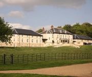
Best Western Hardwick Hall
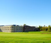
Ramside Hall Hotel Golf & Spa
Dun Cow Inn
The Avenue Inn
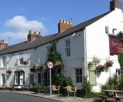
Seven Stars Inn
Hotel Bannatyne Durham
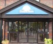
Days Inn Durham
TRAVELODGE SEDGEFIELD
BOWBURN HALL HOTEL
Hallgarth Manor
Videos from this area
These are videos related to the place based on their proximity to this place.
Avenue Street, High Shincliffe, Durham (Rise Sales & Lettings)
Occupying a private courtyard setting in this highly sought after village we are delighted to offer for sale this highly impressive three storey semi detached family home. Recently constructed...
North East England, the location for Chemical, Pharmaceutical, Bioresource and Polymer investment
The following video about why the North East of England is the location of choice for the Process industries (Biotechnology, Chemical, Renewables, Pharmaceuticals, Fine & Speciality, Polymer...
Hardwick Country Park Swan Family
A couple of adult swans (presumably the parents) and 5 cygnets. The tunnel is too small for them, so they had to cross over the footpath to get to the other part of the river.
Sedgefield Shrove Tuesday Football 2015
The game at Sedgefield has been played for hundreds of years, supposedly since the masons working on the church challenged the locals back in the fourteenth century. It starts when an honoured...
Sedgefield crash
Tuesday, Sept. 29/09, fourth race of the day; Begineers' Steeple Chase (class 4) at Sedgefields' Steeple Chase Racecourse, Stockton -on-Tees, UK. Jockey; Denis O'Regan takes a nasty fall on...
Videos provided by Youtube are under the copyright of their owners.
Attractions and noteworthy things
Distances are based on the centre of the city/town and sightseeing location. This list contains brief abstracts about monuments, holiday activities, national parcs, museums, organisations and more from the area as well as interesting facts about the region itself. Where available, you'll find the corresponding homepage. Otherwise the related wikipedia article.
Bishop Middleham
Bishop Middleham is a village in County Durham, in England. It is close to Sedgefield.
Quarrington Hill
Quarrington Hill is a village in County Durham, in England. It is situated a short distance to the north of Kelloe. Having been part of the extensive parish of Kelloe, it merged with the village of Cassop during the 19th Century to form the parish of Cassop-cum-Quarrington. As in most of County Durham, the chief trade here was coal mining and Cassop Colliery was were the miners worked. The inhabitants of Quarrington Hill also shared the church of St. Pauls (built in 1868), with Cassop.
Old Quarrington
Old Quarrington is a hamlet in County Durham, in England. It is situated between Bowburn and Quarrington Hill. It is also known locally as Heugh Hall.
Old Cassop
Old Cassop is a hamlet in County Durham, in England. It is situated a few miles to the south-east of Durham. Old Cassop lies within the Cassop-cum-Quarrington civil parish. Old Cassop is about a quarter of a mile south of the A181 road and is accessible only by an unclassified single-track road. It is covered by a conservation area to preserve its character.
Mainsforth
Mainsforth is a small village in County Durham, in England. It is situated to the east of Ferryhill, and lies within the ecclesiastical parish of Bishop Middleham The earliest settlement in Mainsforth may have been on Marble (Narble Hill). It has been suggested, without great historical foundation, that this was a Danish settlement. From medieval times through to the early twentieth century the village was in effect a small collection of farms and farm workers' cottages.
Shadforth
Shadforth is a village in County Durham, England. It is situated a few miles to the east of Durham. The historic centre of the village is designated a conservation area. Shadforth is also a civil parish that also incorporates Ludworth and Sherburn Hill.
West Cornforth
West Cornforth is a village in County Durham, in England. It is situated to the south of Cornforth, near the A1(M) motorway, Ferryhill and Spennymoor. It is referred to locally as "Doggie" possibly due to the production of dog iron there in the past though this etymology is disputed. The village was recently awarded 'Calor Durham Village of the Year'
Cassop-cum-Quarrington
Cassop-cum-Quarrington is a civil parish in County Durham, England. According to the 2001 census it had a population of 4,735. The parish covers a number of settlements: Bowburn Cassop Old Cassop Old Quarrington Parkhill Tursdale Unlike the ecclesiastical parish of Cassop-cum-Quarrington with Bowburn, the civil parish does not include Quarrington Hill.


