Safety Score: 3,0 of 5.0 based on data from 9 authorites. Meaning we advice caution when travelling to United Kingdom.
Travel warnings are updated daily. Source: Travel Warning United Kingdom. Last Update: 2024-08-13 08:21:03
Explore Saint Martins Green
Saint Martins Green in Cornwall (England) is a city in United Kingdom about 242 mi (or 389 km) south-west of London, the country's capital.
Local time in Saint Martins Green is now 12:54 AM (Saturday). The local timezone is named Europe / London with an UTC offset of zero hours. We know of 10 airports in the vicinity of Saint Martins Green, of which 3 are larger airports. The closest airport in United Kingdom is Land's End Airport in a distance of 22 mi (or 36 km), West. Besides the airports, there are other travel options available (check left side).
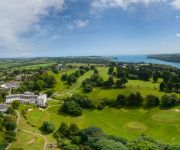
There is one Unesco world heritage site nearby. It's Cornwall and West Devon Mining Landscape in a distance of 25 mi (or 40 km), East. Also, if you like golfing, there is an option about 14 mi (or 23 km). away. If you need a place to sleep, we compiled a list of available hotels close to the map centre further down the page.
Depending on your travel schedule, you might want to pay a visit to some of the following locations: Landewednack, Wendron, Falmouth, Perranarworthal and St. Day. To further explore this place, just scroll down and browse the available info.
Local weather forecast
Todays Local Weather Conditions & Forecast: 12°C / 53 °F
| Morning Temperature | 10°C / 49 °F |
| Evening Temperature | 11°C / 53 °F |
| Night Temperature | 12°C / 53 °F |
| Chance of rainfall | 0% |
| Air Humidity | 74% |
| Air Pressure | 1021 hPa |
| Wind Speed | Gentle Breeze with 8 km/h (5 mph) from East |
| Cloud Conditions | Broken clouds, covering 78% of sky |
| General Conditions | Light rain |
Sunday, 17th of November 2024
12°C (53 °F)
9°C (48 °F)
Light rain, moderate breeze, overcast clouds.
Monday, 18th of November 2024
12°C (54 °F)
13°C (55 °F)
Moderate rain, strong breeze, overcast clouds.
Tuesday, 19th of November 2024
7°C (44 °F)
3°C (38 °F)
Rain and snow, fresh breeze, overcast clouds.
Hotels and Places to Stay
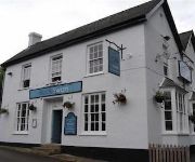
The Black Swan
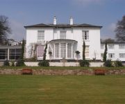
Budock Vean
Meudon
Penmorvah Manor
Polurrian Bay Hotel
Penmere Manor Hotel
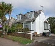
The Oasis Guesthouse
Videos from this area
These are videos related to the place based on their proximity to this place.
Kelpie of Falmouth Trailer to Part 1- Classic Yacht TV
Charlie Wroe, Captain of the Herreshoff schooner Mariette recently embarked on a mission to find "a suitable tender" for the big boat. Whether that was to be a vessel ready to sail or a restoration...
ST. KEVERNE, NEAR COVERACK £515,000
www.pdq-estates.co.uk DROP-DEAD-GORGEOUS! NEW IN - Near St. Keverne £515000 If you are looking for a comfortable home that offers charm, elegance, privacy and character, tucked out of the...
4K Trebah Gardens 2nd December 2014
4K Trebah Gardens 2nd December 2014. A quick walk around the gardens using a GoPro 4 on a Steadicam. More of a test than anything. There will also be a trip around Falmouth in 4K uploaded later.
Trebah Garden Cornwall June 1990
Trebah is a sub-tropical garden situated in Cornwall near Glendurgan Garden and above the Helford River.
Trebah Gardens A Sub-Tropical Oasis
A spring day in the sub-tropical gardens which border the Helford river in Cornwall. A stunning 26 Acre oasis, which has wonderful views, and its very own beach. AirVue specialise in getting...
Gweek village in Cornwall June 2012
Gweek is a small village in Cornwall. It is situated approximately three miles (5 km) east of Helston. Gweek is at the head of navigation of the Helford River. It has been a port since Roman...
Mawgan in Meneage SOLD - SIMILAR REQUIRED
Enjoying a wonderful, secluded and tranquil location within an area of outstanding natural beauty, this historic property is reputed to date back to the Domesday book and nestles within its...
Videos provided by Youtube are under the copyright of their owners.
Attractions and noteworthy things
Distances are based on the centre of the city/town and sightseeing location. This list contains brief abstracts about monuments, holiday activities, national parcs, museums, organisations and more from the area as well as interesting facts about the region itself. Where available, you'll find the corresponding homepage. Otherwise the related wikipedia article.
Goonhilly Satellite Earth Station
Goonhilly Satellite Earth Station is a large telecommunications site located on Goonhilly Downs near Helston on the Lizard peninsula in Cornwall, England, UK. Owned by BT Group plc, it was at one time the largest satellite earth station in the world, with more than 25 communications dishes in use and over 60 in total. The site also links into undersea cable lines.
The Lizard
The Lizard is a peninsula in south Cornwall, England, United Kingdom. The most southerly point of the British mainland is near Lizard Point at grid reference SW 701 115. Lizard village, the most southerly village on the British mainland, is in Landewednack, the most southerly civil parish. The peninsula measures approximately 14 miles x 14 miles . It is situated southwest of Falmouth ten miles (16 km) east of Penzance.
Halliggye Fogou
Halliggye Fogou is one of many fogous in Cornwall, England, United Kingdom. The site is under the guardianship of English Heritage, and managed by The Trelowarren Estate. Although entry to the fogou is free (2011), there is a charge to enter the rest of the Trelowarren Estate.
Traboe
Traboe (pronounced tray-bow) is a hamlet within the Lizard Peninsula, Cornwall. It is approximately a mile down the road from Goonhilly Satellite Earth Station. It contains eleven houses and a building which used to house Rosuick Farm Shop, this being the purpose for which it was built. The list of houses includes a converted inn and a converted school house. There is well situated at the back of the green.
Porth Navas
Porth Navas (Cornish: Porth an Navas) is a small village in Cornwall, England, United Kingdom. It is at the head of the west end of Port Navas Creek, part of the Helford River, near Mawnan Smith and Falmouth. It lies within the civil parish of Constantine. Porth Navas's prosperity – for jobs, living and recreation – depends on its once pristine beauty as part of the Helford River.
Meneage
The Meneage /mɨˈneɪɡ/ (Cornish: Menaghek or Manahek) is a district in west Cornwall, United Kingdom. The nearest large towns are Falmouth and Penryn. The meaning of the name Meneage is "Monkish (land)" and the probability is that in the post-Roman period the land was in the possession of a confederacy of small Celtic monasteries. These may have been founded by missionaries from Brittany. "The north-eastern half of the Lizard peninsula ...
Merthen Manor
Merthen Manor (Cornish: Merdhin, meaning sea fort) is a 16th century manor house in west Cornwall, England, UK. For the majority of its usage it has been in the ownership of the prominent Cornish family, the Vyvyan family. The house is set in over 100 acres of woodland which, along with the shoreline of the Helford River, is designated as Merthen Woods Site of Special Scientific Interest (SSSI).
Rock Cottage
Rock Cottage is 16th-century cottage, situated on Mawgan Creek, a tributary of the Helford River, in Cornwall, England. The cottage was discovered by the current owner's parents in 1954, purchased from the Trelowarren Estate. The property was condemned as unfit for habitation, and as it was Grade II Listed for being "the only recorded example of a traditional Cornish Cottage built on a projecting rock foundation", work was unable to be carried out.


