Safety Score: 3,0 of 5.0 based on data from 9 authorites. Meaning we advice caution when travelling to United Kingdom.
Travel warnings are updated daily. Source: Travel Warning United Kingdom. Last Update: 2024-08-13 08:21:03
Delve into Saint Erth
Saint Erth in Cornwall (England) is located in United Kingdom about 249 mi (or 401 km) west of London, the country's capital town.
Current time in Saint Erth is now 02:33 AM (Saturday). The local timezone is named Europe / London with an UTC offset of zero hours. We know of 9 airports close to Saint Erth, of which two are larger airports. The closest airport in United Kingdom is Land's End Airport in a distance of 11 mi (or 18 km), South-West. Besides the airports, there are other travel options available (check left side).
There is one Unesco world heritage site nearby. It's Cornwall and West Devon Mining Landscape in a distance of 36 mi (or 58 km), East. Also, if you like playing golf, there is an option about 17 mi (or 27 km). away. If you need a hotel, we compiled a list of available hotels close to the map centre further down the page.
While being here, you might want to pay a visit to some of the following locations: Germoe, Penzance, Wendron, St. Buryan and Redruth. To further explore this place, just scroll down and browse the available info.
Local weather forecast
Todays Local Weather Conditions & Forecast: 12°C / 54 °F
| Morning Temperature | 10°C / 51 °F |
| Evening Temperature | 12°C / 54 °F |
| Night Temperature | 12°C / 54 °F |
| Chance of rainfall | 0% |
| Air Humidity | 79% |
| Air Pressure | 1022 hPa |
| Wind Speed | Moderate breeze with 10 km/h (6 mph) from East |
| Cloud Conditions | Overcast clouds, covering 97% of sky |
| General Conditions | Light rain |
Sunday, 17th of November 2024
12°C (53 °F)
10°C (51 °F)
Light rain, moderate breeze, overcast clouds.
Monday, 18th of November 2024
13°C (55 °F)
13°C (55 °F)
Moderate rain, strong breeze, overcast clouds.
Tuesday, 19th of November 2024
7°C (45 °F)
3°C (38 °F)
Rain and snow, strong breeze, overcast clouds.
Hotels and Places to Stay
Bostrase
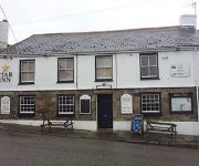
Star Inn
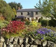
The Old Farmhouse
The Atlantic
Carbis Bay
Tregenna Castle Estate
Tregenna Castle Hotel
Primrose Valley Hotel
Chy an Albany Hotel
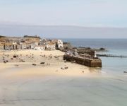
St Ives Harbour Porthminster
Videos from this area
These are videos related to the place based on their proximity to this place.
Hayle Harbour Fly Through Animation
http://www.hayleharbour.com/how-can-you-help.htm Find out how you can support the campaign for the redevelopment of Hayle Harbour.
Hayle Sluice kayaking
Timelapse footage of Falmouth Student Kayaking Club at the Hayle sluice wave, Cornwall, UK.
ASDA Construction in Hayle, Cornwall 17th October 2014
The view from the road. Only way I'm going to get daylight footage.
Mollie Cam at Hayle Beach
My first try with my GoPro Hero 4 on our English Springer Spaniel, Mollie. Video taken at Hayle Beach in Cornwall. unfortunately the harness mount was not tightened up enough so when Mollie...
Videos provided by Youtube are under the copyright of their owners.
Attractions and noteworthy things
Distances are based on the centre of the city/town and sightseeing location. This list contains brief abstracts about monuments, holiday activities, national parcs, museums, organisations and more from the area as well as interesting facts about the region itself. Where available, you'll find the corresponding homepage. Otherwise the related wikipedia article.
St Ives Bay Line
The St Ives Bay Line is a 4.25 miles railway line from St Erth to St Ives in Cornwall, United Kingdom. It was opened in 1877, the last new 84 broad gauge passenger railway to be constructed in the country. Converted to standard gauge in 1892, it continues to operate as a community railway which carries a large number of tourists as well as local passengers.
Hayle Estuary and Carrack Gladden SSSI
The Hayle Estuary and Carrack Gladden SSSI is a Site of Special Scientific Interest, noted for its biological interest, in Cornwall, England, UK. It consists of three distinct parts, each of which is covered in a separate article: the Hayle Estuary the sand-dune system of Porth Kidney Sands the coastal headland at Carrack Gladden
Canonstown
Canonstown is a hamlet in Cornwall, England, UK, situated on the A30 between Penzance and Hayle.
Joppa, Cornwall
Joppa is a farmstead settlement in Cornwall, United Kingdom. It is situated approximately one mile (1.6 km) southeast of Hayle and is in Hayle civil parish.
St Michael's Hospital (Hayle)
St Michael's Hospital, Hayle is a small hospital located in Hayle, Cornwall, United Kingdom. The hospital carries out approximately 5,000 operations each year. The range of operations carried out at the hospital has expanded over recent years and now includes procedures in orthopaedics including hip and knee replacements. St Michael's also has a breast surgery unit.
St Uny's Church, Lelant
St Uny's Church, Lelant, is the Church of England parish church of Lelant, Cornwall, England, UK. It is dedicated to St Uny (or Euny) who is also the patron saint of Redruth. The church is medieval and entirely built of granite. Parts of the nave arcades are Norman, but all of the windows are Perpendicular in style. The earliest reference to the church is in 1170, when Thomas Becket, Archbishop of Canterbury, referred to "The Church of Saint Euni".
Paradise Park, Cornwall
Paradise Park is a zoo situated in Hayle, Cornwall, England. It has over 650 birds and animals. It is currently the home of the World Parrot Trust. The site includes a circular 750-foot long 15 gauge railway, opened in 1976, which encircles the house at the centre of the park. The railway is open for trains to carry passengers in good weather, and is operated from April through October.
List of United Kingdom locations: Lel-Lez


