Safety Score: 3,0 of 5.0 based on data from 9 authorites. Meaning we advice caution when travelling to United Kingdom.
Travel warnings are updated daily. Source: Travel Warning United Kingdom. Last Update: 2024-08-13 08:21:03
Discover Nanpean
Nanpean in Cornwall (England) with it's 2,563 citizens is a city in United Kingdom about 221 mi (or 356 km) west of London, the country's capital city.
Local time in Nanpean is now 10:43 PM (Friday). The local timezone is named Europe / London with an UTC offset of zero hours. We know of 10 airports in the vicinity of Nanpean, of which 3 are larger airports. The closest airport in United Kingdom is Newquay Cornwall Airport in a distance of 7 mi (or 12 km), North-West. Besides the airports, there are other travel options available (check left side).
There is one Unesco world heritage site nearby. It's Cornwall and West Devon Mining Landscape in a distance of 20 mi (or 32 km), South-East. Also, if you like golfing, there is an option about 12 mi (or 19 km). away. Looking for a place to stay? we compiled a list of available hotels close to the map centre further down the page.
When in this area, you might want to pay a visit to some of the following locations: Roche, Tregoney, Padstow, Helland and Newquay. To further explore this place, just scroll down and browse the available info.
Local weather forecast
Todays Local Weather Conditions & Forecast: 12°C / 53 °F
| Morning Temperature | 7°C / 44 °F |
| Evening Temperature | 9°C / 48 °F |
| Night Temperature | 8°C / 46 °F |
| Chance of rainfall | 0% |
| Air Humidity | 85% |
| Air Pressure | 1027 hPa |
| Wind Speed | Light breeze with 5 km/h (3 mph) from West |
| Cloud Conditions | Broken clouds, covering 61% of sky |
| General Conditions | Broken clouds |
Saturday, 16th of November 2024
12°C (53 °F)
11°C (52 °F)
Light rain, gentle breeze, overcast clouds.
Sunday, 17th of November 2024
11°C (51 °F)
9°C (48 °F)
Light rain, moderate breeze, overcast clouds.
Monday, 18th of November 2024
12°C (53 °F)
12°C (54 °F)
Light rain, strong breeze, overcast clouds.
Hotels and Places to Stay
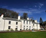
The Cornwall Hotel Spa & Estate
Guesthouse Topos
Bradleigh Lodge
The Bugle Inn
The White Hart Hotel
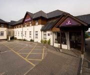
TRAVELODGE ST AUSTELL
TRAVELODGE BODMIN ROCHE
Newquay (A30/Fraddon)
WOODLAND HOMES
THE CORNWALL HOTEL SPA AND ESTATE
Videos from this area
These are videos related to the place based on their proximity to this place.
St Ives Web Roche year 2000
This is a snap shot of how the factory was back in 2000; it's a lot different now. This was taken on a weekend.
FPOS - I Training - Scene Safety & Management
Training with In Safe Hands Training, Roche, Cornwall.
Linde Forklift camera moving cars @ Combellack using a Go Pro
Time lapse video, go-pro mounted on one of our fork lift trucks. A little while in the life of one of our forklifts scuttling around shunting stock around our yard in Roche, Cornwall. See...
Tamiya Mad Bull
This is my Tamiya Mad Bull I got a new shell and junked the mechanical speed controller it goes well will up load a video of it up and running shortly on next dry day .
Ancient World title screen
After being set a challenge David (The guy behind the web-series ancient world) wanted me to think out the box without shifting from the ancient theme. After a lot of thought whilst waiting...
Martin Jennings Run 2009
The 2009 Martin Jennings Run filmed from a bridge over the A30 before Indian Queens. A bike run dedicated to the memory of Martin Jennings raising money every year for local charities.
St Austell Torchlight Carnival 2014
Torchlight Carnival in St Austell, Cornwall. Saturday 15 November 2014.
Videos provided by Youtube are under the copyright of their owners.
Attractions and noteworthy things
Distances are based on the centre of the city/town and sightseeing location. This list contains brief abstracts about monuments, holiday activities, national parcs, museums, organisations and more from the area as well as interesting facts about the region itself. Where available, you'll find the corresponding homepage. Otherwise the related wikipedia article.
Coombe, St Austell
Coombe is a village in Cornwall, England, United Kingdom. The village is situated approximately four miles (6 km) west of St Austell at grid reference SW 951 514 .
Goss Moor
Goss Moor is a National Nature Reserve in Cornwall, located in the parishes of St. Dennis, St. Columb Major, Roche and St. Enoder. It is the largest continuous mire complex in South-West Britain and consists of mainly Peatland and Lowland Heath. Together with the neighbouring moor to the east, it forms the Goss And Tregoss Moors Site of Special Scientific Interest as well as Breney Common and Goss and Tregoss Moors Special Area of Conservation.
Roche, Cornwall
Roche (pronounced Roach, Cornish: Tregarrek, meaning homestead of the rock) is a civil parish and village in mid-Cornwall, England, United Kingdom. The village gets its name from a granite outcrop east of the village. Roche is the Norman-French word for Rock. On the northern flank of the village is the 20-metre high Roche Rock, a large granite outcrop. Nearby are the towns of Bodmin and St Austell, as well as the Eden Project.
St Dennis Junction
1849 - 1960[edit] The history of railway lines through the Cornish village of St. Dennis dates back as far as 1849. In that year, a tramway was opened linking the harbour in Newquay to areas where clay was - and still is - mined. This railway ran from Newquay, through the localities of Quintrell Downs, St Columb Road and St. Dennis. On 14 July 1864 an Act of Parliament was obtained for the Newquay and Cornwall Junction Railway.
Nanpean
Nanpean is a village in the civil parish of St Stephen-in-Brannel in Cornwall, United Kingdom. It is situated on the B3279 road approximately four miles (6.5 km) northwest of St Austell in the heart of 'clay country', the china clay quarrying area of mid-Cornwall. Nanpean church was built in 1879 dedicated to St George the Martyr. The building has an apsidal chancel, nave and south aisle, and a small bell turret. Nanpean also had a Wesleyan Methodist chapel.
Disused railway stations (Cornish Main Line)
There are seventeen disused railway stations between Plymouth in Devon and Penzance in Cornwall, United Kingdom. The remains of nine of these can be seen from passing trains. While a number of these were closed following the so-called "Beeching Axe" in the 1960s, many of them had been closed much earlier, the traffic for which they had been built failing to materialise.
Roseland Observatory
Roseland Observatory is located in Court Farm, one mile (1.6 km) south-east of St Stephen-in-Brannel, in central Cornwall, United Kingdom. Roseland observatory was started in 1998 by Clive Purchase in preparation for the solar eclipse of that year. It was established at the Roseland Community School in Cornwall and had an array of large telescopes, including a four inch Coheilostat for the study of the Sun.
Bodella
Bodella is a settlement in central Cornwall, United Kingdom. It is situated half-a-mile southwest of St Dennis in an area of china clay quarries.


