Safety Score: 3,0 of 5.0 based on data from 9 authorites. Meaning we advice caution when travelling to United Kingdom.
Travel warnings are updated daily. Source: Travel Warning United Kingdom. Last Update: 2024-08-13 08:21:03
Discover Longrock
Longrock in Cornwall (England) is a town in United Kingdom about 253 mi (or 407 km) south-west of London, the country's capital city.
Current time in Longrock is now 04:56 AM (Saturday). The local timezone is named Europe / London with an UTC offset of zero hours. We know of 9 airports near Longrock, of which two are larger airports. The closest airport in United Kingdom is Land's End Airport in a distance of 8 mi (or 13 km), West. Besides the airports, there are other travel options available (check left side).
There is one Unesco world heritage site nearby. It's Cornwall and West Devon Mining Landscape in a distance of 39 mi (or 63 km), East. Also, if you like playing golf, there is an option about 20 mi (or 33 km). away. Looking for a place to stay? we compiled a list of available hotels close to the map centre further down the page.
When in this area, you might want to pay a visit to some of the following locations: Penzance, Germoe, St. Buryan, Sennen and Wendron. To further explore this place, just scroll down and browse the available info.
Local weather forecast
Todays Local Weather Conditions & Forecast: 12°C / 54 °F
| Morning Temperature | 11°C / 53 °F |
| Evening Temperature | 13°C / 55 °F |
| Night Temperature | 13°C / 55 °F |
| Chance of rainfall | 0% |
| Air Humidity | 80% |
| Air Pressure | 1022 hPa |
| Wind Speed | Moderate breeze with 11 km/h (7 mph) from East |
| Cloud Conditions | Overcast clouds, covering 100% of sky |
| General Conditions | Light rain |
Sunday, 17th of November 2024
12°C (53 °F)
11°C (53 °F)
Light rain, fresh breeze, overcast clouds.
Monday, 18th of November 2024
13°C (55 °F)
13°C (56 °F)
Moderate rain, high wind, near gale, overcast clouds.
Tuesday, 19th of November 2024
8°C (46 °F)
4°C (40 °F)
Moderate rain, strong breeze, overcast clouds.
Hotels and Places to Stay
Hotel Penzance
Artist Residence
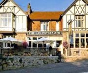
The Coldstreamer
Pedn Olva
St Ives Harbour Porthminster
Primrose Valley Hotel
The Old Farmhouse
Chy an Albany Hotel
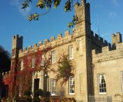
Tregenna Castle Hotel
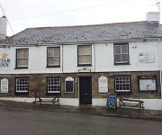
Star Inn
Videos from this area
These are videos related to the place based on their proximity to this place.
British Int'l Helicopters S-61N - Flight from Penzance Land's End (PZE) to Tresco (TSO) Scilly Isles
Sikorsky S-61N Mk.II / G-BFFJ British International Helicopters / BS310 Departure: Penzance Land's End Heliport (PZE), UK Arrival: Tresco Scilly Islands Heliport (TSO), UK Date: 15th September...
Kitesurfing and Windsurfing at Marazion, Cornwall
For http://www.intocornwall.com - Winter kiting and windsurfing in Mount's Bay, Marazion, Cornwall.
Windsurfing Marazion - 4th Jan 2014
Windsurfing Marazion - 4th Jan 2013. Sailing on my custom Hot Sails Maui SuperFreak 5.3 and 9'8" SUP. Wind was pretty light at times, waves around head high, great fun in the sunshine.
St. Michael's Mount and Marazion Cornwall June 1990.
St Michael's Mount is a tidal island located 366 m off the Mount's Bay coast of Cornwall.
Trevean House, Marazion, Cornwall. Luxury Holiday Cottage
Trevean House is an impressive newly built architect designed home located on Cornwall's stunning South coast within close proximity to the beaches at Marazion and Mount's Bay. Trevean House...
Windsurfing Marazion 9th November 2013
Few clips added together testing out the GoPro. Wind was light and waves were tiny, few crimes against wavesailing committed on 9'8" sup (K4 Fins) with Hot Sails Maui 5.8 SuperFreak.
Aaron Alfaro kitesurf lesson Marazion Cornwall
Here is Aaron getting up and riding at Marazion, Cornwall during a 1 to 1 lesson with Lawrence Smith of Ocean High Kiteboarding. Aaron had only managed a few metres before but here it all...
Doctor Gonzo and Rowan at Marazion
Me and Shaun took the dogs to Cornwall just after our Civil Partnership. Because it was before Easter we were allowed to take the dogs onto the beach. Dr Gonzo is the white lurcher, Rowan...
St Michaels Mount 2012
Created on 17 June, 2012. During our 2012 Cornwall tour in Herman we visit St. Michaels Mount which is a castle and village on a small island. During low tide you can walk to the island via...
Videos provided by Youtube are under the copyright of their owners.
Attractions and noteworthy things
Distances are based on the centre of the city/town and sightseeing location. This list contains brief abstracts about monuments, holiday activities, national parcs, museums, organisations and more from the area as well as interesting facts about the region itself. Where available, you'll find the corresponding homepage. Otherwise the related wikipedia article.
Ludgvan
Ludgvan is a civil parish and village in Cornwall, England, United Kingdom. The village is 2+⁄2 miles northeast of Penzance. The parish includes the villages of Ludgvan, Crowlas, Canon's Town and Long Rock. It is bounded by the parishes of Towednack and Lelant to the north, Madron and Penzance to the west, by St Erth, St Hilary and Marazion to the east and by the sea to the south. For the purposes of local government, Ludgvan elects a parish council every four years.
Chyandour
Chyandour (Cornish: Chi an Dowr, meaning "house of the water") is a small settlement within in the parish of Penzance in west Cornwall, England, United Kingdom. It is on the north-east edge of the town straddling the A30 trunk road. Historically Chyandour was one of the boundaries of the Borough of Penzance, and was the site of large tin smelting works.
Crowlas
Crowlas is a village in Cornwall, England, United Kingdom. It is situated on the A30 about three miles east of Penzance and forms a small conurbation with Ludgvan "Lower Quarter", within the parish of the same name. The hamlet of Whitecross lies to the north.
Varfell
Varfell is a hamlet within the parish of Ludgvan, Cornwall, UK. Varfell was formerly the ancestral home of chemist Humphry Davy. Varfell is now one the centres of production for the large flower and bulb growers Winchester Bulbs. Varfell Farm is the world's largest producers of daffodil bulbs.
Penzance TMD
Penzance TMD, also known as Long Rock TMD, is a railway Traction Maintenance Depot situated in the village of Long Rock east of Penzance, Cornwall, England, and is the most westerly and southerly rail depot in the country. The depot operator is First Great Western. The depot code is PZ.
Lescudjack Hill Fort
Lescudjack Hill fort is the name given to the unexcavated Iron Age settlement located in Penzance, Cornwall. The name might originate from the Cornish words lan (enclosure) and scosek (shielded)- shielded enclosure or, more likely, "nans" (valley) and "cosek" (wooded). It is positioned on the summit of a steep hill in the east of Penzance and consists of a single rampart enclosing an area of 3 acres .
Castle Gate, Cornwall
Castle Gate is a hamlet in west Cornwall, England, United Kingdom. It is situated approximately three miles (4.5 km) north-northeast of Penzance at OS grid ref SW491342 in a former mining area.
Red River, Marazion
The Red River (Cornish: Dowr Amal, meaning boundary river) which discharges into the sea to the west of Marazion is one of two watercourses in Cornwall in southwest England, UK, which share this name. It rises in the parish of Towednack and flows in a generally southeasterly direction, passing through the parish of Ludgvan before turning to the southwest and an exit into Mount's Bay.


