Safety Score: 3,0 of 5.0 based on data from 9 authorites. Meaning we advice caution when travelling to United Kingdom.
Travel warnings are updated daily. Source: Travel Warning United Kingdom. Last Update: 2024-08-13 08:21:03
Discover Delabole
Delabole in Cornwall (England) with it's 1,647 citizens is a place in United Kingdom about 209 mi (or 336 km) west of London, the country's capital city.
Current time in Delabole is now 06:21 PM (Friday). The local timezone is named Europe / London with an UTC offset of zero hours. We know of 9 airports near Delabole, of which 3 are larger airports. The closest airport in United Kingdom is Newquay Cornwall Airport in a distance of 17 mi (or 28 km), South-West. Besides the airports, there are other travel options available (check left side).
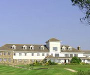
There is one Unesco world heritage site nearby. It's Cornwall and West Devon Mining Landscape in a distance of 34 mi (or 55 km), South. Also, if you like playing golf, there is an option about 29 mi (or 47 km). away. If you need a hotel, we compiled a list of available hotels close to the map centre further down the page.
While being here, you might want to pay a visit to some of the following locations: Helland, Jacobstow, Padstow, Poundstock and Roche. To further explore this place, just scroll down and browse the available info.
Local weather forecast
Todays Local Weather Conditions & Forecast: 12°C / 53 °F
| Morning Temperature | 6°C / 42 °F |
| Evening Temperature | 9°C / 48 °F |
| Night Temperature | 6°C / 43 °F |
| Chance of rainfall | 0% |
| Air Humidity | 79% |
| Air Pressure | 1027 hPa |
| Wind Speed | Light breeze with 4 km/h (2 mph) from West |
| Cloud Conditions | Scattered clouds, covering 35% of sky |
| General Conditions | Scattered clouds |
Saturday, 16th of November 2024
11°C (52 °F)
10°C (50 °F)
Light rain, gentle breeze, overcast clouds.
Sunday, 17th of November 2024
10°C (50 °F)
8°C (46 °F)
Light rain, moderate breeze, overcast clouds.
Monday, 18th of November 2024
11°C (52 °F)
12°C (53 °F)
Moderate rain, fresh breeze, overcast clouds.
Hotels and Places to Stay
Tremoren
Bowood Park
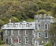
Wellington
Atlantic View Hotel
Port William
Videos from this area
These are videos related to the place based on their proximity to this place.
Cornwall Coastal Walk Tintagel to Trebarwith Strand and Tintagel Castle round
Our video is a guided walk in North Cornwall. We start in Tintagel and walk to Trebarwith Strand via the outskitrts of Treknow. We return on the South West Coast Path to Tintagel Castle the...
Tintagel Castle - Tintagel, Cornwall, England, United Kingdom
http://tripwow.tripadvisor.com/tripwow/ta-00a0-61a0-a4c5?ytv2=1 - Created at TripWow by TravelPod Attractions (a TripAdvisor™ company) Tintagel Castle This brooding 13th-century castle...
Q-pod leads sledge convoy in Tintagel snow
Tintagel snow on Tuesday 3 February. Look what we got up to - can you guess who is being towed up the main street by the Q-pod?
First ever view of the sea - Barn holiday Cornwall
Richard, from land-locked Slovakia, has never seen the sea. So, on the Barn holiday to Cornwall, he agreed we could blindfold him and take him in the minibus to Trebarwith Strand for his first...
Uno game - Barn holiday, Cornwall
The game of Uno, played by a group of international students on a holiday in Tintagel, Cornwall.
31st March 2006 Mugsey Tintagel Thoughts
This Trip Across Cornwall To Discover Myself Has Been Amazing At Present I'm On The Cliff Of Tintagel Massive! Looking At Back At My Past What There Could Be Coming And My Next Objective Quite ...
Tintagel Castle walls and view - Cornwall
You can see the deep blue sea and the castle walls in this nice video.
Silage 2014 - Mowing with a view part 1
First cut started in my local village this weekend so went down and had a look. Mowing with a great view looking down on Tintagle (Cornwall) and over to Trebarwith. John Deere 7530 with a set...
storytelling.mpg
Just an Extract: Jill Lamede, The Tintagel Storyteller, and Wilberforce, her White Mouse companion, tell the first part of an ancient folktale.
Videos provided by Youtube are under the copyright of their owners.
Attractions and noteworthy things
Distances are based on the centre of the city/town and sightseeing location. This list contains brief abstracts about monuments, holiday activities, national parcs, museums, organisations and more from the area as well as interesting facts about the region itself. Where available, you'll find the corresponding homepage. Otherwise the related wikipedia article.
St Teath
St Teath is civil parish and village in north Cornwall, England, United Kingdom. The village is situated approximately three miles (5 km) southwest of Camelford and seven miles (11 km) northeast of Wadebridge. The hamlet of Whitewell lies to the west. The church is dedicated to Saint Tethe who was one of the twenty-four children of St Brychan, a 4th century Welsh saint and king. The church was a Norman foundation but was rebuilt in the 15th century. It is large, with a nave and two aisles.
Trebarwith Strand
Trebarwith Strand (locally sometimes shortened to The Strand), is a coastal settlement and section of coastline located on the north coast of Cornwall, United Kingdom, 2+⁄2 miles south of Tintagel. It has 800m of sandy beach, contained by cliffs, in which natural caves are found.
HMS Vulture II (Treligga Aerodrome)
HMS Vulture II was an aerial bombing and gunnery range at Treligga, 2 km west of Delabole, Cornwall, United Kingdom. The station was a satellite of the Fleet Air Arm base RNAS St Merryn (HMS Vulture) near Padstow, Cornwall. Although HMS Vulture II had landing strips they were however rarely used. Unusually, the entire operation at HMS Vulture II was staffed by the Women's Royal Naval Service.
Helstone
Helstone is a settlement in north Cornwall, United Kingdom. It is situated two miles (3 km) southwest of Camelford on the A39 road.
Pengelly
Pengelly is a hamlet in Cornwall, England, United Kingdom, part of the village of Delabole. Once Pengelly was a settlement separate from the neighbouring hamlets of Medrose and Rockhead, but the three were merged with the introduction of the railway and the new village adopted the name Delabole.
Delabole wind farm
The Delabole wind farm is a wind farm located in Delabole, Cornwall, England. It was the first commercial wind farm constructed in the UK. The farm was first proposed in 1989, and was opened in 1991. For its first two decades, it operated ten wind turbines, built by Vestas. In February 2011, an £11.8 million rebuilding of the facility was completed, which replaced the original ten with four new turbines, which are larger than the original ones.
Bodulgate
Bodulgate is a house in the parish of St Teath, Cornwall, England, UK.
Trenale
Trenale is a hamlet in Cornwall, England, UK. It is located within the civil parish of Tintagel, to the south-east of Tintagel village. Near Trenale was the Iron Age fort of Trenale Bury which was ploughed up during the Second World War. The first Methodist meeting house in the parish of Tintagel was established at Trenale in 1807.


