Safety Score: 3,0 of 5.0 based on data from 9 authorites. Meaning we advice caution when travelling to United Kingdom.
Travel warnings are updated daily. Source: Travel Warning United Kingdom. Last Update: 2024-08-13 08:21:03
Discover Constantine
Constantine in Cornwall (England) with it's 819 citizens is a place in United Kingdom about 240 mi (or 387 km) south-west of London, the country's capital city.
Current time in Constantine is now 10:29 PM (Friday). The local timezone is named Europe / London with an UTC offset of zero hours. We know of 10 airports near Constantine, of which 3 are larger airports. The closest airport in United Kingdom is Land's End Airport in a distance of 22 mi (or 35 km), West. Besides the airports, there are other travel options available (check left side).
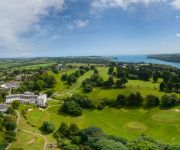
There is one Unesco world heritage site nearby. It's Cornwall and West Devon Mining Landscape in a distance of 25 mi (or 40 km), East. Also, if you like playing golf, there is an option about 11 mi (or 17 km). away. If you need a hotel, we compiled a list of available hotels close to the map centre further down the page.
While being here, you might want to pay a visit to some of the following locations: Wendron, Perranarworthal, Falmouth, St. Day and Redruth. To further explore this place, just scroll down and browse the available info.
Local weather forecast
Todays Local Weather Conditions & Forecast: 13°C / 55 °F
| Morning Temperature | 9°C / 48 °F |
| Evening Temperature | 11°C / 51 °F |
| Night Temperature | 9°C / 48 °F |
| Chance of rainfall | 0% |
| Air Humidity | 73% |
| Air Pressure | 1026 hPa |
| Wind Speed | Gentle Breeze with 8 km/h (5 mph) from West |
| Cloud Conditions | Broken clouds, covering 56% of sky |
| General Conditions | Broken clouds |
Saturday, 16th of November 2024
12°C (53 °F)
12°C (53 °F)
Light rain, gentle breeze, broken clouds.
Sunday, 17th of November 2024
12°C (53 °F)
9°C (48 °F)
Light rain, moderate breeze, overcast clouds.
Monday, 18th of November 2024
12°C (54 °F)
13°C (55 °F)
Moderate rain, strong breeze, overcast clouds.
Hotels and Places to Stay
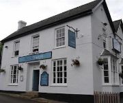
The Black Swan
Budock Vean
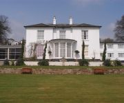
Penmorvah Manor
Meudon
Penmere Manor Hotel
Helston
Videos from this area
These are videos related to the place based on their proximity to this place.
RUN - Firework Fail
This is what happens when you light a wet old firework! This video was uploaded from an Android phone.
Patches first show jump
This is me riding my 14.2hh 14yr old pony on loan Patch, I have done a little bit of jumping over rustic fences but this is the first time she's been over a show jump :) I know my riding isn't...
Kelpie of Falmouth Trailer to Part 1- Classic Yacht TV
Charlie Wroe, Captain of the Herreshoff schooner Mariette recently embarked on a mission to find "a suitable tender" for the big boat. Whether that was to be a vessel ready to sail or a restoration...
4K Trebah Gardens 2nd December 2014
4K Trebah Gardens 2nd December 2014. A quick walk around the gardens using a GoPro 4 on a Steadicam. More of a test than anything. There will also be a trip around Falmouth in 4K uploaded later.
Trebah Garden Cornwall June 1990
Trebah is a sub-tropical garden situated in Cornwall near Glendurgan Garden and above the Helford River.
Videos provided by Youtube are under the copyright of their owners.
Attractions and noteworthy things
Distances are based on the centre of the city/town and sightseeing location. This list contains brief abstracts about monuments, holiday activities, national parcs, museums, organisations and more from the area as well as interesting facts about the region itself. Where available, you'll find the corresponding homepage. Otherwise the related wikipedia article.
Cornish Seal Sanctuary
Gweek Seal Sanctuary (or Cornish Seal Sanctuary) is owned by Merlin Entertainments and is a sanctuary for injured seal pups. It is situated on the banks of the Helford River in Cornwall, England, UK and there is a road along the creek from the centre of Gweek village to the sanctuary's large car park.
High Cross, Constantine
High Cross is a hamlet in south Cornwall, England, United Kingdom. It is situated one mile east of Constantine village and approximately four miles (6 km) southwest of Falmouth. High Cross is in the civil parish of Constantine, Cornwall. In 1993 a mediaeval stone cross was found built into a collapsing Cornish hedge at the junction of the road from Constantine to Penryn and the road from Mawnan Smith. The cross was re-erected nearby, at the crossroad, in April 2000.
Porth Navas
Porth Navas (Cornish: Porth an Navas) is a small village in Cornwall, England, United Kingdom. It is at the head of the west end of Port Navas Creek, part of the Helford River, near Mawnan Smith and Falmouth. It lies within the civil parish of Constantine. Porth Navas's prosperity – for jobs, living and recreation – depends on its once pristine beauty as part of the Helford River.
Trenarth Bridge
Trenarth Bridge (Cornish: Pons Tre Nerth, meaning bridge of Nerth's farm) is at the head of the centre head of Port Navas Creek and is between Mawnan Smith and
Brill, Cornwall
Brill (Cornish: Bre Helgh, meaning hunt hill) is a village in south-west Cornwall, England, UK. It is located within the civil parish of Constantine, 1 kilometre north-west of the village of the same name.
Merthen Manor
Merthen Manor (Cornish: Merdhin, meaning sea fort) is a 16th century manor house in west Cornwall, England, UK. For the majority of its usage it has been in the ownership of the prominent Cornish family, the Vyvyan family. The house is set in over 100 acres of woodland which, along with the shoreline of the Helford River, is designated as Merthen Woods Site of Special Scientific Interest (SSSI).
Kerrier Rural District
Kerrier Rural District was a local government division of Cornwall in England, UK, between 1934 and 1974. The rural district was created in 1934 through the abolition of East Kerrier Rural District, Helston Rural District and Redruth Rural District. In 1974 the district was abolished under the Local Government Act 1972, forming part of the new Kerrier district.
East Kerrier Rural District
East Kerrier Rural District was a local government division of Cornwall in England, UK, between 1894 and 1934. Established under the Local Government Act 1894, the rural district was abolished in 1934 to create Kerrier Rural District, as well as enlarging Falmouth Municipal Borough, Penryn Municipal Borough and Truro Rural District.


