Safety Score: 3,0 of 5.0 based on data from 9 authorites. Meaning we advice caution when travelling to United Kingdom.
Travel warnings are updated daily. Source: Travel Warning United Kingdom. Last Update: 2024-08-13 08:21:03
Discover Carbis Bay
Carbis Bay in Cornwall (England) is a town in United Kingdom about 250 mi (or 402 km) west of London, the country's capital city.
Current time in Carbis Bay is now 02:44 AM (Saturday). The local timezone is named Europe / London with an UTC offset of zero hours. We know of 9 airports near Carbis Bay, of which two are larger airports. The closest airport in United Kingdom is Land's End Airport in a distance of 11 mi (or 18 km), South-West. Besides the airports, there are other travel options available (check left side).
There is one Unesco world heritage site nearby. It's Cornwall and West Devon Mining Landscape in a distance of 38 mi (or 61 km), East. Also, if you like playing golf, there is an option about 17 mi (or 28 km). away. Looking for a place to stay? we compiled a list of available hotels close to the map centre further down the page.
When in this area, you might want to pay a visit to some of the following locations: Penzance, Germoe, St. Buryan, Wendron and Redruth. To further explore this place, just scroll down and browse the available info.
Local weather forecast
Todays Local Weather Conditions & Forecast: 11°C / 53 °F
| Morning Temperature | 10°C / 50 °F |
| Evening Temperature | 12°C / 53 °F |
| Night Temperature | 12°C / 53 °F |
| Chance of rainfall | 0% |
| Air Humidity | 80% |
| Air Pressure | 1021 hPa |
| Wind Speed | Moderate breeze with 10 km/h (6 mph) from East |
| Cloud Conditions | Overcast clouds, covering 100% of sky |
| General Conditions | Light rain |
Sunday, 17th of November 2024
11°C (52 °F)
10°C (50 °F)
Light rain, moderate breeze, overcast clouds.
Monday, 18th of November 2024
12°C (54 °F)
12°C (54 °F)
Moderate rain, high wind, near gale, overcast clouds.
Tuesday, 19th of November 2024
7°C (44 °F)
3°C (37 °F)
Rain and snow, strong breeze, overcast clouds.
Hotels and Places to Stay
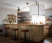
Artist Residence
Hotel Penzance
Bostrase
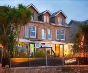
The Atlantic
Carbis Bay
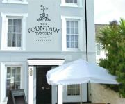
The Fountain Tavern
The Dolphin Tavern
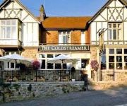
The Coldstreamer
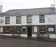
Star Inn
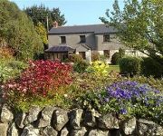
The Old Farmhouse
Videos from this area
These are videos related to the place based on their proximity to this place.
Cornwall 2010 holiday clip
An impression of a great summer breeze Cornish holiday at the Beachside holiday park in Hayle, July 2010 !!
Carbis Bay Holidays - www.carbisbayholidays.co.uk
At Carbis Bay Holidays, we specialise in luxury four and five star self catering holidays in the St. Ives area of West Cornwall. For more information on our apartments and holiday homes...
St Ives Cornwall June 1990
St Ives is a seaside town and port in Cornwall, England. The town lies north of Penzance and west of Camborne. 14-06-1990.
Coxswain of the St Ives Lifeboat; Paul Whiston
Coxswain of the St Ives Lifeboat; Paul Whiston talks about his service and experiences at the lifeboat as a crew and Coxswain. "A Potter at the wheel". Commissioned by : http://www.stivesholidays.c...
St Ives in the Storm of 10 March 2008
A record of the storm,which peaked on the afternoon of 10 March, with sea conditions described by the Met Office as 'phenomenal'. Comments welcomed from St Ives fans.
St Ives Feast Day 2015
St Ives Feast Day 2015 presented by Councillor Linda Taylor - Mayor of St Ives. more info : http://stivestv.co.uk/
Videos provided by Youtube are under the copyright of their owners.
Attractions and noteworthy things
Distances are based on the centre of the city/town and sightseeing location. This list contains brief abstracts about monuments, holiday activities, national parcs, museums, organisations and more from the area as well as interesting facts about the region itself. Where available, you'll find the corresponding homepage. Otherwise the related wikipedia article.
Carbis Bay
Carbis Bay (Cornish: Porth reb Tor, meaning cove beside the eminance) is a seaside resort and village (Cornish: Karrbons, meaning causway) in Cornwall, England, UK. It lies one mile southeast of St Ives on the west side of St Ives Bay on the Atlantic coast. The South West Coast Path passes the village.
Barbara Hepworth Museum
The Barbara Hepworth Museum and Sculpture Garden in St Ives, Cornwall preserves the 20th century sculptor Barbara Hepworth's studio and garden much as they were when she lived and worked there.
St Ives Bay Line
The St Ives Bay Line is a 4.25 miles railway line from St Erth to St Ives in Cornwall, United Kingdom. It was opened in 1877, the last new 84 broad gauge passenger railway to be constructed in the country. Converted to standard gauge in 1892, it continues to operate as a community railway which carries a large number of tourists as well as local passengers.
Carrack Gladden
Carrack Gladden(Cornish: Karrek Gladn, meaning rock on a bank) is a coastal headland in St Ives Bay just north of the Hayle Estuary between Hayle and St Ives, Cornwall. The cliffs between Carrack Gladden headland and Hawks Point to the east are of metamorphosed Devonian slates and rise to 60 metres high. The acidic soils exhibit a range of vegetation types including maritime heathland, grassland and scrub.
St Ia's Church, St Ives
St Ia, St. Ives Parish Church, St Ives is a parish church in the Church of England located in St Ives, Cornwall. It is dedicated to Saint Ia of Cornwall, a 5th- or 6th-century Irish saint.
Trencrom Hill
Trencrom Hill (or Trecrobben) is a prominent hill fort, owned by the National Trust, near Lelant, Cornwall. It is crowned by an univallate Neolithic tor enclosure and was re-used as a hillfort in the Iron Age. Cairns or hut circles can be seen in the level area enclosed by the stone and earth banks. The hill overlooks the Hayle Estuary and river, and Mount's Bay and St. Michael’s Mount can be seen to the south. Trink lies one kilometre to the North West.
The Sloop Inn
The Sloop Inn is an inn in St Ives, Cornwall, England, UK located on the wharf. It is one of the best known and oldest inns in Cornwall. The 14th century public house is dated to "circa 1312". The Sloop was the favourite haunt of Louis Grier and many of his paintings hung there in earlier years. The Rogers family hosted the Sloop Inn for nearly a century.
B3306 road
The B3306, also known as the West Cornwall Coast Road, is a major road of southwestern Cornwall. It connects St Ives in the east to St Just in the west, and eventually joins the A30 road to the northeast of Sennen in the southwest of the Penwith peninsula. This thirteen-mile road is often voted one of the greatest driving roads in the United Kingdom for its scenery, with most of the road having views both across the Bristol Channel to the north, and the Cornish Moorland to the south.


