Safety Score: 3,0 of 5.0 based on data from 9 authorites. Meaning we advice caution when travelling to United Kingdom.
Travel warnings are updated daily. Source: Travel Warning United Kingdom. Last Update: 2024-08-13 08:21:03
Explore Bude
Bude in Cornwall (England) with it's 7,011 inhabitants is located in United Kingdom about 197 mi (or 317 km) west of London, the country's capital.
Local time in Bude is now 02:29 PM (Friday). The local timezone is named Europe / London with an UTC offset of zero hours. We know of 11 airports in the wider vicinity of Bude, of which 5 are larger airports. The closest airport in United Kingdom is Newquay Cornwall Airport in a distance of 33 mi (or 53 km), South-West. Besides the airports, there are other travel options available (check left side).
There are two Unesco world heritage sites nearby. The closest heritage site in United Kingdom is Cornwall and West Devon Mining Landscape in a distance of 48 mi (or 77 km), South. Also, if you like golfing, there is an option about 31 mi (or 51 km). away. If you need a place to sleep, we compiled a list of available hotels close to the map centre further down the page.
Depending on your travel schedule, you might want to pay a visit to some of the following locations: Poundstock, Jacobstow, Boyton, Trewen and Werrington. To further explore this place, just scroll down and browse the available info.
Local weather forecast
Todays Local Weather Conditions & Forecast: 11°C / 52 °F
| Morning Temperature | 6°C / 43 °F |
| Evening Temperature | 9°C / 48 °F |
| Night Temperature | 8°C / 47 °F |
| Chance of rainfall | 0% |
| Air Humidity | 77% |
| Air Pressure | 1027 hPa |
| Wind Speed | Light breeze with 5 km/h (3 mph) from West |
| Cloud Conditions | Few clouds, covering 10% of sky |
| General Conditions | Sky is clear |
Saturday, 16th of November 2024
12°C (54 °F)
10°C (50 °F)
Light rain, moderate breeze, scattered clouds.
Sunday, 17th of November 2024
11°C (52 °F)
9°C (49 °F)
Light rain, fresh breeze, overcast clouds.
Monday, 18th of November 2024
10°C (50 °F)
12°C (54 °F)
Moderate rain, strong breeze, overcast clouds.
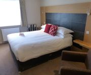
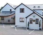
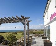
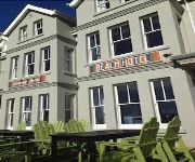
Hotels and Places to Stay
AN MOR HOTEL
Hebasca
Bude Haven Hotel
Oak Lodge Bed and Breakfast
Elements
Atlantic House Hotel
Upton Cross
Tommy Jacks
The Cliff Hotel
Falcon
Videos from this area
These are videos related to the place based on their proximity to this place.
15th November 2009 Mugsey Grant Bude Holiday
Today Myself Along With Roy And Alex Landed With The Pikey Caravan Down In Bude Of Course DC Jones Still Trying To Find Us Three And Been Bothering Carla. We All Went Nuts Fighting With ...
Holidays in Bude
Bude is a popular spot in North Cornwall for the whole family to relax and unwind, Bude is also popular for surfing, fishing and lots of other activities. Visit http://www.holidaycottages.co.uk...
Вебкамера Великобритания Бад (United Kingdom Bude)
Вебкамера Великобритания Бад (United Kingdom Bude) http://travel-cam.net.
Вебкамера Великобритания Бад (United Kingdom Bude)
Вебкамера Великобритания Бад (United Kingdom Bude) http://travel-cam.net.
Hubsan x4 107c High Altitude Flight when Wind Crashes it into a Tree
Flying the hubsan x4 107c up high when a gust of wind took it away and into a tree. Luckily I managed to get it down with no damage but did lose a blade. I also got a few nettle stings as well.
Adventure International 2013 - High Ropes
Recorded on 22nd May 2013 at Adventure international, Bude.
Videos provided by Youtube are under the copyright of their owners.
Attractions and noteworthy things
Distances are based on the centre of the city/town and sightseeing location. This list contains brief abstracts about monuments, holiday activities, national parcs, museums, organisations and more from the area as well as interesting facts about the region itself. Where available, you'll find the corresponding homepage. Otherwise the related wikipedia article.
Bude Canal
The Bude Canal was a canal built to serve the hilly hinterland in the Devon and Cornwall border territory in the United Kingdom, chiefly to bring lime-bearing sand for agricultural fertiliser. The Bude Canal system was one of the most unusual in Britain. It was remarkable in using inclined planes to haul tub boats on wheels to the upper levels. There were only two conventional locks, in the short broad canal section near the sea at Bude itself.
Maer, Cornwall
Maer is a coastal hamlet in north Cornwall, United Kingdom. It is situated one mile (1.6 km) northeast of Bude at grid reference SS 205 075 in the civil parish of Bude-Stratton. The National Trust maintains Maer Down and Maer Cliff immediately west of the hamlet. The South West Coast Path runs along the clifftop past Maer.
Bude–Stratton
Bude-Stratton is a coastal civil parish with a town council in Cornwall, England, United Kingdom. According to the 2001 census it had a population of 9,242. Away from the coast, much of the parish is rural in character but it also encompasses the sizeable urban areas of Bude and Stratton. Other settlements include Poughill (formerly a separate parish), Bush, Flexbury, Lynstone, Maer, Northcott, Thorne and Upton.
Poughill
Poughill (pronounced "Pofil" or "Puffil") is a hamlet in north-east Cornwall, England, United Kingdom. It is located one mile north of Bude .
Stratton, Cornwall
See also: Battle of Stratton 1643 Stratton is a small town situated near the coastal resort of Bude in north Cornwall, England, UK. It was also the name of one of ten ancient administrative shires of Cornwall - see "Hundreds of Cornwall". A battle of the English civil war took place here on 16 May 1643. A local saying at Stratton is "Stratton was a market town when Bude was just a furzy down", meaning Stratton was long established when Bude was just gorse-covered downland.
Bude railway station
Bude railway station was the western terminus of the Bude Branch. It was opened in 1898 by the London and South Western Railway (LSWR) to serve the coastal town of Bude and closed in 1966 after having been proposed for closure in the Beeching Report.
Cornish Way
The Cornish Way is a cycle route which is part of the National Cycle Network that links Bude to Lands End. The route is via Padstow or St Austell and is 180 miles in length.
St Michael and All Angels Church, Bude
St Michael and All Angels Church is a Grade II listed church in Bude, Cornwall. It was originally built in 1834 by George Wightwick for Sir Thomas Dyke Acland, 10th Baronet as a Chapel of Ease to Stratton Parish Church. The church was expanded in 1878 by Edward Ashworth for Sir Thomas Dyke Acland, 11th Baronet. It became a listed building on 9 September 1985.


