Safety Score: 3,0 of 5.0 based on data from 9 authorites. Meaning we advice caution when travelling to United Kingdom.
Travel warnings are updated daily. Source: Travel Warning United Kingdom. Last Update: 2024-08-13 08:21:03
Explore Tarvin
Tarvin in Cheshire (England) with it's 2,309 inhabitants is located in United Kingdom about 161 mi (or 260 km) north-west of London, the country's capital.
Local time in Tarvin is now 11:03 AM (Thursday). The local timezone is named Europe / London with an UTC offset of zero hours. We know of 8 airports in the wider vicinity of Tarvin, of which 4 are larger airports. The closest airport in United Kingdom is Hawarden Airport in a distance of 9 mi (or 14 km), West. Besides the airports, there are other travel options available (check left side).
There are several Unesco world heritage sites nearby. The closest heritage site in United Kingdom is Pontcysyllte Aqueduct and Canal in a distance of 17 mi (or 27 km), South. Also, if you like golfing, there are multiple options in driving distance. If you need a place to sleep, we compiled a list of available hotels close to the map centre further down the page.
Depending on your travel schedule, you might want to pay a visit to some of the following locations: Waverton, Mouldsworth, Guilden Sutton, Elton and Ince. To further explore this place, just scroll down and browse the available info.
Local weather forecast
Todays Local Weather Conditions & Forecast: 3°C / 38 °F
| Morning Temperature | 0°C / 33 °F |
| Evening Temperature | 1°C / 34 °F |
| Night Temperature | 4°C / 39 °F |
| Chance of rainfall | 3% |
| Air Humidity | 67% |
| Air Pressure | 1001 hPa |
| Wind Speed | Moderate breeze with 13 km/h (8 mph) from East |
| Cloud Conditions | Overcast clouds, covering 87% of sky |
| General Conditions | Moderate rain |
Friday, 22nd of November 2024
6°C (42 °F)
2°C (35 °F)
Moderate rain, fresh breeze, overcast clouds.
Saturday, 23rd of November 2024
5°C (42 °F)
14°C (57 °F)
Moderate rain, strong breeze, overcast clouds.
Sunday, 24th of November 2024
14°C (57 °F)
11°C (52 °F)
Moderate rain, fresh breeze, overcast clouds.
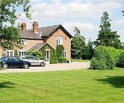
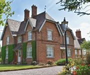
Hotels and Places to Stay
Newton Hall
Willington Hall Hotel
Mercure Chester Abbots Well Hotel
Peckforton Castle
Thornleigh
New Hall Farm B&B
Days Inn Chester East
TRAVELODGE CHESTER WARRINGTON ROAD
Videos from this area
These are videos related to the place based on their proximity to this place.
A54 - Kelsall to Tarvin - Front View with Rearview Mirror
The A54 runs from the A51 at Tarvin to the east of Chester, to the A53 near Buxton, a distance of 42.0 miles (67.6km). It runs through the towns of Winsford, Middlewich, Holmes Chapel and Congleton...
Scrutiny Committee 18 March 2010 - Part 1
The meeting of the Cheshire West and Chester Council Overview and Scrutiny Committee on 18 March 2010 was held at Tarvin Community Centre, Cheshire.
The Fellsman Chopper
DRS Class 20s Nos. 20303 & 20304 thrash through Acton Bridge with the Spitfire Railtours 1Z20 07:22 'The Fellsman Chopper' Birmingham International-Carlisle excursion, with Class 57 No. 57601...
MADLE0N Minecraft: TIME TRAVEL #35
In this weeks a MADLE0N Minecraft, myself (MADLE0N) and Keira (My 5yr old Daughter) revisit our world (FunTimes) we travel back in time to happy place where everyone is still alive and do our...
MINECRAFT LETS PLAY: THE VILLAGE HUNT (Ep4)
After many weeks of having the idea floating around my head, At the start of this week, i started my new lets play, on a fresh new world, playing on survival with the game set at normal. ...
Cheshire's Gardens of Distinction
Cheshire's Gardens of Distinction seasonal images by Alistair & Jan Campbell of UK City Images (www.ukcityimages.com)
Videos provided by Youtube are under the copyright of their owners.
Attractions and noteworthy things
Distances are based on the centre of the city/town and sightseeing location. This list contains brief abstracts about monuments, holiday activities, national parcs, museums, organisations and more from the area as well as interesting facts about the region itself. Where available, you'll find the corresponding homepage. Otherwise the related wikipedia article.
A54 road
The A54 road is a road in England linking Chester in Cheshire with Buxton in Derbyshire. Its route through both urban and steep rural areas presents a challenge to Cheshire County Council in maintaining the safety of the road.
Bruen Stapleford
Bruen Stapleford is a civil parish in the unitary authority of Cheshire West and Chester and the ceremonial county of Cheshire, England. According to the 2001 census it had a population of 66.
Tarvin Rural District
Tarvin was, from 1894 to 1974, a rural district in the administrative county of Cheshire, England. The district was named after the village of Tarvin, and saw considerable boundary changes throughout its life.
Baker Way
The Baker Way is a footpath running from Chester railway station to Delamere railway station within the English county of Cheshire. The total length of the trail is 13 miles .
St Andrew's Church, Tarvin
St Andrew's Church, Tarvin, is in the village of Tarvin, Cheshire, England. The church is designated by English Heritage as a Grade I listed building. It is an active Anglican parish church in the diocese of Chester, the archdeaconry of Chester and the deanery of Chester. Its benefice is united with that of St Peter, Duddon.
Hockenhull Platts
Hockenhull Platts consists of three bridges southwest of the village of Tarvin, Cheshire, England. They are also known as the "Packhorse Bridges" and are designated by English Heritage as Grade II listed buildings. The bridges are situated where Platts Lane crosses the River Gowy.
Hockenhull Platts Nature Reserve
Hockenhull Platts Nature Reserve is a nature reserve beside the River Gowy, near Tarvin in Cheshire, England. It is managed by the Cheshire Wildlife Trust. The reserve includes a trail (the Mill Trail) and two Grade-II-listed 18th-century packhorse bridges (known as the "Roman Bridges"). Habitats include a poplar plantation, reedbed and species-rich wet meadows. The poplar plantation is sparse and its wet nature has created an unusual stand of common reed at the ground layer.
Peel Hall, Cheshire
Peel Hall is a country house near the village of Ashton Hayes, Cheshire, England. It has been designated by English Heritage as a Grade II* listed building. The hall was built in 1637, but has since been reduced in size. It is constructed in sandstone and has slate roofs. Its architectural style is Jacobean.


