Safety Score: 3,0 of 5.0 based on data from 9 authorites. Meaning we advice caution when travelling to United Kingdom.
Travel warnings are updated daily. Source: Travel Warning United Kingdom. Last Update: 2024-08-13 08:21:03
Discover Beeston
Beeston in Cheshire (England) is a town in United Kingdom about 155 mi (or 249 km) north-west of London, the country's capital city.
Current time in Beeston is now 10:34 PM (Sunday). The local timezone is named Europe / London with an UTC offset of zero hours. We know of 8 airports near Beeston, of which 4 are larger airports. The closest airport in United Kingdom is Hawarden Airport in a distance of 13 mi (or 21 km), West. Besides the airports, there are other travel options available (check left side).
There are several Unesco world heritage sites nearby. The closest heritage site in United Kingdom is Pontcysyllte Aqueduct and Canal in a distance of 14 mi (or 22 km), South-West. Also, if you like playing golf, there are a few options in driving distance. Looking for a place to stay? we compiled a list of available hotels close to the map centre further down the page.
When in this area, you might want to pay a visit to some of the following locations: Tiverton, Harthill, Bickley, Oakmere and Carden. To further explore this place, just scroll down and browse the available info.
Local weather forecast
Todays Local Weather Conditions & Forecast: 8°C / 47 °F
| Morning Temperature | 7°C / 45 °F |
| Evening Temperature | 7°C / 45 °F |
| Night Temperature | 7°C / 45 °F |
| Chance of rainfall | 3% |
| Air Humidity | 77% |
| Air Pressure | 1015 hPa |
| Wind Speed | Moderate breeze with 10 km/h (6 mph) from East |
| Cloud Conditions | Broken clouds, covering 80% of sky |
| General Conditions | Moderate rain |
Monday, 18th of November 2024
5°C (42 °F)
1°C (34 °F)
Rain and snow, moderate breeze, overcast clouds.
Tuesday, 19th of November 2024
2°C (35 °F)
-1°C (30 °F)
Snow, gentle breeze, broken clouds.
Wednesday, 20th of November 2024
3°C (37 °F)
0°C (33 °F)
Snow, gentle breeze, broken clouds.
Hotels and Places to Stay
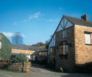
Pheasant Inn
Peckforton Castle
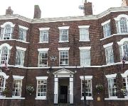
The Swan at Tarporley
Macdonald Portal
Willington Hall Hotel
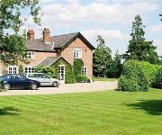
Newton Hall
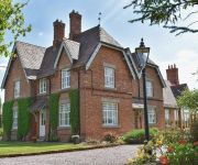
New Hall Farm B&B
Videos from this area
These are videos related to the place based on their proximity to this place.
Beeston Cattle Market Clips - Tour of Cheshire 2013
Autotests at Beeston Cattle Market during the Tour of Cheshire 2013.
60163 Tornado @ Beeston Cheshire
60163 Tornado passing though beeston Cheshire with a cathedral express on the 22:05:10.Video spolt by a moden day virgin express (how many have had this happen to them?)
Beeston Castle Sir Cei with the Dane Axe
Sir Cei of Gwynedd demonstrating the Dane Axe at Beeston Castle 30 May 2009 Harlech Medieval Society.
Beeston Castle Tournament 1
Fighting Knights: Paul of Liverpool (Black & Yellow) Vs Sir Matthew of Chester (Green & Blue) of the Harlech Medieval Society. Beeston Castle, Cheshire, England. 29 May 2009.
Beeston Castle Tournament 2
Fighting Knights: Sir Roberto Fortez (Black & White) Vs Sir Cei of Gwynedd (Blue) of the Harlech Medieval Society. Beeston Castle, Cheshire, England. 29 May 2009.
Beeston Castle
A 500 foot craggy outcrop from the Cheshire plain with far reaching views to the Pennines and the Welsh mountains. With Peckforton Castle as a close neighbour.
Peckforton Garden Railway - March 2008
A goods train running around the main circuit in 2008 before Beeston Castle and Peckforton stations or the extension to Beeston Market had been built. The swing bridge (based on the original...
Cathedrals Express 22nd Nov
22nd November 2014 and Bittern was in charge of the Cath Ex, London to Chester. Seen here crossing the Cheshire Plain between Crewe and Chester, from the top of Beeston Castle. It turned out...
Xmas Cheshireman 22nd Nov
Standing in for Tangmere, 44871 and 45407 hauled the Xmas Cheshireman from Bristol to Chester. The ECS then ran to Crewe for service and turning. As Bittern had gone the other way some 25 ...
Oliver Cromwell, 44871 & 45407, in Cheshire, Saturday 30th November 2013
On Saturday 30th November 2013, The cathedrals Express ran from London to Chester hauled by 44871 and 45407, and The Christmas Cheshireman ran from Bristol to Crewe via Chester hauled by ...
Videos provided by Youtube are under the copyright of their owners.
Attractions and noteworthy things
Distances are based on the centre of the city/town and sightseeing location. This list contains brief abstracts about monuments, holiday activities, national parcs, museums, organisations and more from the area as well as interesting facts about the region itself. Where available, you'll find the corresponding homepage. Otherwise the related wikipedia article.
Beeston, Cheshire
Beeston is a village and civil parish in the unitary authority of Cheshire West and Chester, which itself is located in the ceremonial county of Cheshire in the north of England. It is located approximately 10km south-east of Chester, and approximately 3.5km south-west of Tarporley, close to the Shropshire Union Canal. According to the 2011 census, Beeston had a population of 188.
Sandstone Trail
The Sandstone Trail is a 55-kilometre long-distance walkers' path, following sandstone ridges running north–south from Frodsham in central Cheshire to Whitchurch just over the Shropshire border. The path was created in 1974 and extended in the 1990s. Much of the route follows the Mid Cheshire Ridge but in places the trail also passes through the Cheshire Plain, including farmland, woodland and canal towpaths.
Peckforton Hills
The Peckforton Hills are a sandstone ridge running broadly northeast–southwest in the west of the English county of Cheshire. They form a significant part of the longer Mid Cheshire Ridge which extends southwards from Frodsham towards Malpas. Bulkeley Hill stands at the south end, and the ridge is continued southwards by Bickerton Hill. The high points are Peckforton Point, immediately north of Bulkeley Hill, and Stanner Nab, towards the northern end of the ridge.
Ridley, Cheshire
Ridley is a civil parish in the unitary authority of Cheshire East and the ceremonial county of Cheshire, England, which lies to the north east of Malpas and to the west of Nantwich. The parish is largely rural with scattered farms and buildings and no significant settlements. In 2001, the population was a little over 100. Nearby villages include Bulkeley, Bunbury, Faddiley, Peckforton and Spurstow.
Bishop Bennet Way
The Bishop Bennet Way is a route for horse riding in south west Cheshire, England, which can also be used by walkers and cyclists. It is named after William Bennet (4 March 1745 - 1820), Bishop of Cork and Ross (1790–1794) and subsequently Bishop of Cloyne (1794–1820), who carried out detailed surveys of roman roads including those between Deva and Mediolanum. The way starts near Beeston Castle and as of 2008 finishes near Wirswall on the Cheshire-Shropshire border.
Haycroft, Cheshire
Haycroft, near Spurstow, in Cheshire, England is a deserted village located at SJ554573. Aerial photography has shown evidence of a medieval village and a field system. The site is a Scheduled Ancient Monument.
Beeston Towers
Beeston Towers (now the Wild Boar Hotel) is a former country house near the village of Beeston, Cheshire, England. It stands on the A49 road some 1 mile to the east of the village. It was built in 1886 for John Naylor, a timber merchant from Warrington. Extensive additions were made in the early part of the 20th century. The building is timber-framed, with additions in rendered brick. It is in three storeys, with a tower of four storeys.
Bulkeley Methodist Church
Bulkeley Methodist Church is located on Wrexham Road in the village of Bulkeley, Cheshire, England. It is designated by English Heritage as a Grade II listed building.


