Safety Score: 3,0 of 5.0 based on data from 9 authorites. Meaning we advice caution when travelling to United Kingdom.
Travel warnings are updated daily. Source: Travel Warning United Kingdom. Last Update: 2024-08-13 08:21:03
Explore Swettenham
Swettenham in Cheshire East (England) is located in United Kingdom about 149 mi (or 239 km) north-west of London, the country's capital.
Local time in Swettenham is now 04:14 AM (Sunday). The local timezone is named Europe / London with an UTC offset of zero hours. We know of 8 airports in the wider vicinity of Swettenham, of which 5 are larger airports. The closest airport in United Kingdom is Manchester Airport in a distance of 11 mi (or 17 km), North. Besides the airports, there are other travel options available (check left side).
There are several Unesco world heritage sites nearby. The closest heritage site in United Kingdom is Pontcysyllte Aqueduct and Canal in a distance of 30 mi (or 48 km), South-West. Also, if you like golfing, there are multiple options in driving distance. If you need a place to sleep, we compiled a list of available hotels close to the map centre further down the page.
Depending on your travel schedule, you might want to pay a visit to some of the following locations: Peover Superior, Siddington, Eaton, Mobberley and Ringway. To further explore this place, just scroll down and browse the available info.
Local weather forecast
Todays Local Weather Conditions & Forecast: 14°C / 57 °F
| Morning Temperature | 15°C / 59 °F |
| Evening Temperature | 10°C / 49 °F |
| Night Temperature | 9°C / 48 °F |
| Chance of rainfall | 17% |
| Air Humidity | 81% |
| Air Pressure | 987 hPa |
| Wind Speed | Strong breeze with 20 km/h (12 mph) from North |
| Cloud Conditions | Overcast clouds, covering 100% of sky |
| General Conditions | Heavy intensity rain |
Monday, 25th of November 2024
8°C (46 °F)
4°C (38 °F)
Broken clouds, fresh breeze.
Tuesday, 26th of November 2024
6°C (43 °F)
3°C (37 °F)
Sky is clear, moderate breeze, clear sky.
Wednesday, 27th of November 2024
5°C (42 °F)
3°C (37 °F)
Overcast clouds, light breeze.
Hotels and Places to Stay
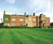
De Vere Cranage Estate PH Hotels
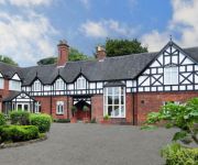
Moss Wood
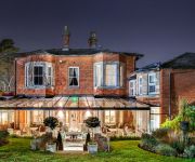
Chimney House Hotel & Restaurant
Alexandra Court
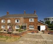
Bridge Farm Bed & Breakfast
Videos from this area
These are videos related to the place based on their proximity to this place.
A535 - Chelford to Holmes Chapel - Rear View
The A535 runs for 6 miles (10km) from the A50 in Holmes Chapel in the South to Chelford on the A537 in the North. Apart from passing through pleasant Cheshire countryside, the A535 passes...
A535 - Holmes Chapel to Chelford - Rear View
The A535 runs for 6 miles (10km) from the A50 in Holmes Chapel in the South to Chelford on the A537 in the North. Apart from passing through pleasant Cheshire countryside, the A535 passes...
A50 - Arclid to Holmes Chapel - Front View with Rearview Mirror
The A50 runs from Leicester to Warrington, but originally ran to Hockliffe just north west of Luton. Between Stoke-on-Trent and the M1 near Nottingham, the A50 is a major dual carriageway,...
60009, Scarborough Flyer 2nd August
Union of South Africa hurries out of the darkness through Goostrey station heading back to Crewe. The strange colour tint is because I was trying the 'Night Vision' setting on the camera,...
Wheelton PC Camp 2011 - Show Jumping snr
Wheelton Pony Club, Summer Camp at Somerford Park, Cheshire. This is part of the Show Jumping ..
Springfield Symphony & Laura Deas XC fun
Springfield Symphony and Laura Deas XC training 31/3/09 at Somerford Farm.
VDW 800 permeable resin jointing mortar
Case study following the jointing of a decorative sett paved circle to a private driveway using the permeable VDW800 epoxy resin mortar from GftK and distributed by NCC Streetscape.
Listers at 1000 engine rally 2012.
A wet and windy video of some of the Lister engines at the 1000 engine rally at Astle Park Cheshire. Sorry about the stills but there was quite a lot of wind noise on some clips.
Hell-E-Cats 2013 Scale fly in
On 5th of May 2013, Members from the NERCHC (North East RC Helicopter Club) Travelled down to a field just off Holmes Chapel Rd near Chelford, Macclesfield to take part in the Hell-E-Cats Scale...
Steam @ Astle Park
Steam engines at Astle Park Rally which was held on the 14th/15th August 2010 at Chelford in Cheshire.
Videos provided by Youtube are under the copyright of their owners.
Attractions and noteworthy things
Distances are based on the centre of the city/town and sightseeing location. This list contains brief abstracts about monuments, holiday activities, national parcs, museums, organisations and more from the area as well as interesting facts about the region itself. Where available, you'll find the corresponding homepage. Otherwise the related wikipedia article.
Swettenham Meadows Nature Reserve
Swettenham Meadows is a nature reserve in Cheshire, England, on the north bank of Swettenham Brook, a short distance north east of Swettenham village and 2.5 miles (4 km) east of Holmes Chapel village O. The Swettenham Meadows reserve is managed by Cheshire Wildlife Trust. It covers an area of 21.5 acres (8.6 ha) and its species-rich grassland is particularly ecologically important as this type of habitat represents only 0.15% of the total land area of Cheshire.
St Peter's Church, Swettenham
St Peter's Church, Swettenham is in the village of Swettenham, Cheshire, England. The church is designated by English Heritage as a Grade II* listed building. It is an active Anglican parish church in the diocese of Chester, the archdeaconry of Macclesfield and the deanery of Congleton. Its benefice is combined with that of St Luke, Goostrey.
All Saints Chapel, Somerford
All Saints Chapel, Somerford is in an isolated position near the hamlet of Brereton Heath, between Congleton and Holmes Chapel, Cheshire, England. It is designated by English Heritage as a Grade II* listed building. It is in the Anglican benefice of Astbury and Smallwood in the deanery of Congleton, the archdeaconry of Macclesfield and the diocese of Chester.
Lower Withington
Lower Withington is a civil parish and village in the unitary authority of Cheshire East and the ceremonial county of Cheshire, England. At the 2001 census, it had a total population of 492. It contains a tin tabernacle church and a brick built chapel, two pubs, a few B&B's and various other businesses. The village keeps a great sense of tradition, and every year there is a Rose Day Parade and fair. There is also a carol service during the Christmas season.
Terra Nova School
Terra Nova School is a prep school in Cheshire for children from three to thirteen years of age. It began as a school for boys in 1897, and now educates both boys and girls. Children aged three to seven attend the pre-preparatory department, and pupils aged eight to thirteen attend the preparatory department. A charitable trust since 1955, the life and work of the school are overseen by a governing body drawn from varied, appropriate backgrounds.
Clonterbrook House
Clonterbrook House is a former manor house in the parish of Swettenham, Cheshire, England. It was built in 1697 for Jeffery and Katherine Lockett. It passed from the Lockett family in 1769, but was bought by Derek and Elizabeth Lockett in 1939. They restored the house in 1949. The house is constructed in brick, and it has a stone-slate roof. There are two storeys plus an attic, and it is in five bays. It has been designated by English Heritage as a Grade II* listed building.
Swettenham Hall
Swettenham Hall is a country house standing to the southeast of the village of Swettenham, Cheshire, England. It dates from the 17th century and was remodelled in the 19th century. The house is constructed in pebbledashed brick on a stone plinth with a slate roof. It has a symmetrical façade in seven bays. The central bay has a single-storey canted bay window, and the second and sixth bays have two-storey canted bay windows. All the windows are sashes.
Somerford Park, Cheshire
Somerford Park is situated off the A54 road midway between Congleton and Holmes Chapel in Cheshire. Somerfield Hall was a Georgian brick-built country house which used to stand in the park as the seat of the Shakerley family, but was demolished in 1926. The original house was built around 1720 for Peter Shakerley. The Shakerleys had owned land in the area since the reign of Henry III.


