Safety Score: 3,0 of 5.0 based on data from 9 authorites. Meaning we advice caution when travelling to United Kingdom.
Travel warnings are updated daily. Source: Travel Warning United Kingdom. Last Update: 2024-08-13 08:21:03
Discover Salford
Salford in Central Bedfordshire (England) is a city in United Kingdom about 43 mi (or 69 km) north-west of London, the country's capital city.
Local time in Salford is now 12:10 AM (Friday). The local timezone is named Europe / London with an UTC offset of zero hours. We know of 11 airports in the vicinity of Salford, of which 5 are larger airports. The closest airport in United Kingdom is London Luton Airport in a distance of 16 mi (or 26 km), South-East. Besides the airports, there are other travel options available (check left side).
There are several Unesco world heritage sites nearby. The closest heritage site in United Kingdom is Blenheim Palace in a distance of 14 mi (or 22 km), South. Also, if you like golfing, there are a few options in driving distance. We discovered 1 points of interest in the vicinity of this place. Looking for a place to stay? we compiled a list of available hotels close to the map centre further down the page.
When in this area, you might want to pay a visit to some of the following locations: Woburn Sands, Aspley Guise, Cranfield, Husborne Crawley and Wavendon. To further explore this place, just scroll down and browse the available info.
Local weather forecast
Todays Local Weather Conditions & Forecast: 8°C / 46 °F
| Morning Temperature | 4°C / 40 °F |
| Evening Temperature | 6°C / 43 °F |
| Night Temperature | 4°C / 40 °F |
| Chance of rainfall | 0% |
| Air Humidity | 81% |
| Air Pressure | 1028 hPa |
| Wind Speed | Gentle Breeze with 6 km/h (4 mph) from North-East |
| Cloud Conditions | Overcast clouds, covering 99% of sky |
| General Conditions | Overcast clouds |
Saturday, 16th of November 2024
7°C (45 °F)
7°C (45 °F)
Light rain, gentle breeze, overcast clouds.
Sunday, 17th of November 2024
7°C (44 °F)
3°C (38 °F)
Light rain, moderate breeze, overcast clouds.
Monday, 18th of November 2024
5°C (41 °F)
1°C (34 °F)
Moderate rain, moderate breeze, broken clouds.
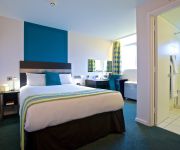
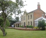
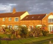
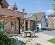
Hotels and Places to Stay
Cranfield Management Development Centre
Woodleys Farm House
The Old Stables
The Woburn Hotel previously Inn at Woburn
Chicheley Hall
Hilton Milton Keynes
The Bell Hotel Woburn
Kents Hill Park Training & Conference centre
JCT.14 Holiday Inn MILTON KEYNES EAST M1
Holiday Inn Express MILTON KEYNES
Videos from this area
These are videos related to the place based on their proximity to this place.
Woburn Sands - Brown stain of shame
A very wet and windy ride around some of the newly discovered trails at Woburn Sands. A combination of static views showing some of the trails at Woburn Sands. A new helmet is on order after...
Woburn Sands - Lens down! (Helmet & Seatpost POV)
A very wet and slippery ride at Woburn Sands in between showers after 2 weeks away with work. I knock the wide angle lens off of my bullet cam at 1:21 - which is now lost to this world......
Woburn Sands - A Haddon for Dust (Chest POV)
Recorded with the ISAW A3 Extreme, 1080p @ 60fps. A VERY hot 2 days riding at Woburn Sands. A good friend Haddon stayed for the weekend and was keen to sample some of the riding available...
Woburn Sands - DIY Cable Cam Test
EDIT: I messed up and rather than using 120 and 60 fps I accidentally selected the wrong frame rate... at least it means the footage can only get better!) THIS IS JUST A PROOF OF CONCEPT!...
60010 R.M.C.train passing woburn sands station
60010 BLETCHLEY R.M.C. to PEAK FOREST CEMEX SDGS at Woburn Sands on 8 April 2014.
Bmx Sorry
Xool Filmed at Woburn Sands Skate Park in , (). Credits: Council (Skater, Filmer). (Submitted using the media mapping mobile app for skateboarding, Skate It All, by Stalefish Labs. For more...
Science for the Green Economy Seminar Series - Water Stress Mitigating Future Impacts
Register for the next Seminar: www.cranfield.ac.uk/sas/s4ge Chaired by Professor Simon Pollard, Cranfield University and Julie Vaughan, Senior Associate, Herbert Smith Freehills LLP Managing...
Cranfield University - Rail Accident Investigation Courses
The Cranfield Safety and Accident Investigation Centre (CSAIC) is a specialist unit within Cranfield University, dedicated to high-quality teaching, research and consultancy in transportation...
Blackburn Buccaneer, Cranfield 1993 - Final Public Air Display
In 1993, Carol gave a clearance to take-off and the display Buccaneer departed RAF Woodvale for its penultimate show. Rob decided to video its final display at Cranfield. To this idea, Carol...
Ultimate 13th Birthday 1st flying lesson Cranfield EGTC Piper PA28 Archer part 1
surprise day out for lewis who believes we are at Cranfield to visit the cafe on our way to a model show . lewis is flight sim mad and thinks he cant fly till he is 14 the truth is you can...
Videos provided by Youtube are under the copyright of their owners.
Attractions and noteworthy things
Distances are based on the centre of the city/town and sightseeing location. This list contains brief abstracts about monuments, holiday activities, national parcs, museums, organisations and more from the area as well as interesting facts about the region itself. Where available, you'll find the corresponding homepage. Otherwise the related wikipedia article.
Cranfield University
Cranfield University is a British postgraduate and research-based university with two campuses. The main campus is at Cranfield, Bedfordshire and the second is the Defence Academy of the United Kingdom at Shrivenham, Oxfordshire. The main campus is unique in the United Kingdom for having an operational airport next to the main campus. The airport facilities are used by Cranfield University's own aircraft in the course of aerospace teaching and research.
Marston Vale Line
The Marston Vale Line (Network Rail route MD 140) is the community rail line between Bletchley and Bedford in England, formerly part of the "Varsity Line" between Oxford and Cambridge.
Milton Keynes North East (UK Parliament constituency)
North East Milton Keynes was a county constituency represented in the House of Commons of the Parliament of the United Kingdom from 1992 to 2010. It elected one Member of Parliament (MP) by the first past the post system of election.
Cranfield School of Management
Cranfield School of Management is part of Cranfield University and one of the world's leading business schools. Cranfield University has provided management training since the late 1940s. The first MBA programme was run in 1964, but the School of Management was founded later in 1967. The school is located about 50 miles from London, midway between the towns of Bedford and Milton Keynes, in the village of Cranfield in Bedfordshire.
A5130 road
The A5130 is a road in the United Kingdom. It starts on a roundabout with the A509 near Junction 14 of the M1 motorway and proceeds south round the eastern edge of the original Milton Keynes designated area. After crossing the A421 the 5130 continues past the village of Wavendon. It then crosses the Bedford-Bletchley railway by means of a level crossing and passes through Woburn Sands. It terminates a short distance to the south upon meeting the A4012 just inside the village of Woburn.
Church of St Nicholas, Hulcote, Bedfordshire
Church of St Nicholas is a Grade I listed church in Hulcote, Bedfordshire, England. It became a listed building on 23 January 1961.
Church of St Mary the Virgin, Salford, Bedfordshire
Church of St Mary the Virgin is a Grade I listed church in Salford, Bedfordshire, England.
Magna Park, Milton Keynes
Magna Park is a large new distribution site on the part of Wavendon civil parish that is east of the A421 and in the 'Eastern Expansion Area', an element of the expansion plans for Milton Keynes. For details, see Wavendon#Magna Park


