Safety Score: 3,0 of 5.0 based on data from 9 authorites. Meaning we advice caution when travelling to United Kingdom.
Travel warnings are updated daily. Source: Travel Warning United Kingdom. Last Update: 2024-08-13 08:21:03
Explore Heath and Reach
Heath and Reach in Central Bedfordshire (England) with it's 1,346 inhabitants is located in United Kingdom about 38 mi (or 61 km) north-west of London, the country's capital.
Local time in Heath and Reach is now 12:10 AM (Friday). The local timezone is named Europe / London with an UTC offset of zero hours. We know of 11 airports in the wider vicinity of Heath and Reach, of which 5 are larger airports. The closest airport in United Kingdom is London Luton Airport in a distance of 13 mi (or 21 km), East. Besides the airports, there are other travel options available (check left side).
There are several Unesco world heritage sites nearby. The closest heritage site in United Kingdom is Blenheim Palace in a distance of 7 mi (or 12 km), South. Also, if you like golfing, there are multiple options in driving distance. We found 1 points of interest in the vicinity of this place. If you need a place to sleep, we compiled a list of available hotels close to the map centre further down the page.
Depending on your travel schedule, you might want to pay a visit to some of the following locations: Potsgrove, Woburn, Battlesden, Bow Brickhill and Stanbridge. To further explore this place, just scroll down and browse the available info.
Local weather forecast
Todays Local Weather Conditions & Forecast: 8°C / 46 °F
| Morning Temperature | 4°C / 40 °F |
| Evening Temperature | 6°C / 42 °F |
| Night Temperature | 4°C / 39 °F |
| Chance of rainfall | 0% |
| Air Humidity | 82% |
| Air Pressure | 1028 hPa |
| Wind Speed | Light breeze with 5 km/h (3 mph) from North-East |
| Cloud Conditions | Overcast clouds, covering 100% of sky |
| General Conditions | Overcast clouds |
Saturday, 16th of November 2024
7°C (44 °F)
7°C (44 °F)
Broken clouds, gentle breeze.
Sunday, 17th of November 2024
6°C (44 °F)
3°C (37 °F)
Light rain, moderate breeze, overcast clouds.
Monday, 18th of November 2024
5°C (41 °F)
1°C (34 °F)
Moderate rain, moderate breeze, broken clouds.
Hotels and Places to Stay
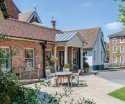
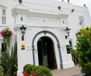
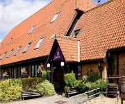
The Woburn Hotel previously Inn at Woburn
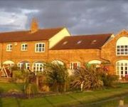
The Old Stables
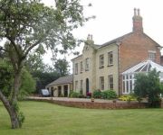
Woodleys Farm House
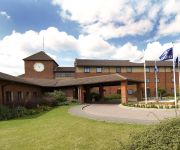
Hilton Milton Keynes
Doubletree by Hilton Milton Keynes
Woughton House - MGallery by Sofitel
The Bell Hotel Woburn
Campanile - Milton Keynes - Fenny Stratford
Milton Keynes South
Videos from this area
These are videos related to the place based on their proximity to this place.
RARE MICRO MACHINES LORRY TRUCK THAT OPENING INTO A CITY
Let's open up this old Micro Chinese just recovered from my loft. Link to view or buy on Amazon.com here ; http://amzn.to/1DFCsmt UK use Amazon.co.uk : http://amzn.to/1AQ19x4.
Minecraft Lets Build a Village-Part 1-The Lumber Mill.
If you enjoyed this video please leave a like, I appreciate it. :)
Minecraft Lets Build a Village-Part 4-The Windmill
If you enjoyed this video please leave a like, I appreciate it. :) Also check out an awesome Youtuber: http://www.youtube.com/user/MrConnbon?feature=plcp.
Minecraft Lets Build a Village-Part 3-The saw
If you enjoyed this video please leave a like, I appreciate it. :)
Virgin trains Pendolino Class 390 journey London Euston to Birmingham New Street West Coast Mainline
High speed train going round the bends near Leighton Buzzard.
Minecraft Lets Build a Village-Part 5-Blocks
If you enjoyed this video please leave a like, I appreciate it. :) Awesome Youtuber: http://www.youtube.com/user/MrConnbon?feature=g-user-u.
Minecraft Lets Build a Village-Part 13-The Dodgey balcony thingy
If you enjoyed this video please leave a like, I appreciate it. :) Awesome Youtuber: http://www.youtube.com/user/MrConnbon?feature=g-user-u.
Minecraft Lets Build a Village-Part 7-The Stables
If you enjoyed this video please leave a like, I appreciate it. :) Awesome Youtuber: http://www.youtube.com/user/MrConnbon?feature=g-user-u.
Minecraft Lets Build a Village-Part 15-The Inn
If you enjoyed this video please leave a like, I appreciate it. :) Awesome Youtuber: http://www.youtube.com/user/MrConnbon?feature=g-user-u.
Minecraft Lets Build a Village-Part 10-The Wishing Well
If you enjoyed this video please leave a like, I appreciate it. :) Awesome Youtuber: http://www.youtube.com/user/MrConnbon?feature=g-user-u.
Videos provided by Youtube are under the copyright of their owners.
Attractions and noteworthy things
Distances are based on the centre of the city/town and sightseeing location. This list contains brief abstracts about monuments, holiday activities, national parcs, museums, organisations and more from the area as well as interesting facts about the region itself. Where available, you'll find the corresponding homepage. Otherwise the related wikipedia article.
Stockgrove Country Park
Stockgrove Country Park is located in England on the Bedfordshire/Buckinghamshire border near the village of Heath and Reach, with access from the A5. With an area of about 80 acres, it is now managed by the Greensand Trust as part of a larger area called Rushmere Park. The hand-dug lake features the remains of a boathouse that burned down in 1963 – only its brick arches are left. Mandarin Ducks took up residence in 1997 and have bred there ever since.
King's Wood, Heath and Reach
King's Wood is an area of woodland in the parish of Heath and Reach in the English county of Bedfordshire. The wood lies north of the village of Heath and Reach and east of Great Brickhill. Much of it forms part of a National Nature Reserve owned and managed by the Wildlife Trust for Bedfordshire, Cambridgeshire and Northamptonshire, Central Bedfordshire Council and Lafarge Aggregates. The Wildlife Trust reserve is called King's Wood and Rammamere Heath.
Bedfordshire Greensand Ridge
Bedfordshire Greensand Ridge is an escarpment which runs through Buckinghamshire, Bedfordshire, and Cambridgeshire in the south and East of England. A pathway runs along the ridge. In 2009, the Greensand Ridge Local Action Group was formed to help enhance and develop the Greensand Ridge area. The Group bid for funding from the Rural Development Programme for England and were successful.
Linslade Urban District
Linslade was an urban district in the administrative county of Buckinghamshire, England from 1897 to 1965. It comprised the single civil parish of Linslade which prior to 1897 was part of Wing Rural District and had been part of the Leighton Buzzard Rural Sanitary District until 1894. As part of a county boundary change in 1965 Linslade UD was abolished along with Leighton Buzzard Urban District in Bedfordshire and the new Bedfordshire urban district of Leighton-Linslade was created.
Leighton-Linslade Urban District
Leighton-Linslade was an urban district in Bedfordshire, England from 1965 to 1972. It comprised the single civil parish of Leighton-Linslade. Leighton-Linslade UD was created on 1 April 1965 coinciding with an adjustment to county boundaries which led to the disbanding of Leighton Buzzard Urban District in Bedfordshire and Linslade Urban District in Buckinghamshire.
Leighton Buzzard Urban District
Leighton Buzzard was an urban district in Bedfordshire, England from 1894 to 1965. It comprised the single civil parish of Leighton Buzzard. The urban district was created in 1894 from the abolution of the Leighton Buzzard urban sanitary district. In 1933 the Eaton Bray Rural District was abolished and the area transferred to enlarge Leighton Buzzard UD.
Leighton Buzzard Golf Club
Leighton Buzzard Golf Club is a golf club near Leighton Buzzard in Bedfordshire, England, not far from Mentmore Golf and Country Club. It lies north of Leighton Buzzard, just to the southwest of the village of Heath and Reach. It was established in September 1905. In 1942, petrol restrictions imposed upon the members resulted in 30 members quitting the club.
Church of St Mary, Linslade
Church of St Mary is a Grade I listed church in Linslade, Bedfordshire, England. It became a listed building on 20 February 1954.


