Safety Score: 3,0 of 5.0 based on data from 9 authorites. Meaning we advice caution when travelling to United Kingdom.
Travel warnings are updated daily. Source: Travel Warning United Kingdom. Last Update: 2024-08-13 08:21:03
Explore Church End, Eversholt
The district Church End, Eversholt of Eversholt in Central Bedfordshire (England) with it's 680 inhabitants Church End, Eversholt is located in United Kingdom about 38 mi north-west of London, the country's capital.
If you need a place to sleep, we compiled a list of available hotels close to the map centre further down the page.
Depending on your travel schedule, you might want to pay a visit to some of the following locations: Ridgmont, Milton Bryan, Battlesden, Steppingley and Toddington. To further explore this place, just scroll down and browse the available info.
Local weather forecast
Todays Local Weather Conditions & Forecast: 8°C / 46 °F
| Morning Temperature | 4°C / 40 °F |
| Evening Temperature | 6°C / 43 °F |
| Night Temperature | 4°C / 40 °F |
| Chance of rainfall | 0% |
| Air Humidity | 81% |
| Air Pressure | 1028 hPa |
| Wind Speed | Gentle Breeze with 6 km/h (4 mph) from North-East |
| Cloud Conditions | Overcast clouds, covering 99% of sky |
| General Conditions | Overcast clouds |
Saturday, 16th of November 2024
7°C (45 °F)
7°C (45 °F)
Light rain, gentle breeze, overcast clouds.
Sunday, 17th of November 2024
7°C (44 °F)
3°C (38 °F)
Light rain, moderate breeze, overcast clouds.
Monday, 18th of November 2024
5°C (41 °F)
1°C (34 °F)
Moderate rain, moderate breeze, broken clouds.
Hotels and Places to Stay
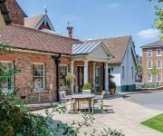
The Woburn Hotel previously Inn at Woburn
Hallmark Flitwick Manor
The Bell Hotel Woburn
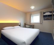
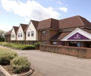
TRAVELODGE TODDINGTON M1 SOUTH
TRAVELODGE BEDFORD MARSTON MORETAINE
Dunstable South A5
Videos from this area
These are videos related to the place based on their proximity to this place.
Guitar Lesson - Dm Blues lick using Blues scale
This lick is almost the same a lick played at about 3:55 from my video http://youtu.be/J_Ks-WaAC2g I will be adding more licks from this video so please keep your eyes peeled for updates. The...
Pro quality jamming track - Dm Blues Rockabilly Shuffle Brian Setzer Style
Download here https://itunes.apple.com/gb/album/dm-walking-blues/id820350428?i=820350438 Fun little track in Dm with a Stray cats Brian Setzer kinda groove going on. All the usual jamming...
Random Videos from England
Ahh, the British Isles. I spent around 10 months living and traveling throughout England, Scotland and Wales and enjoyed every minute of it. The Brits are a fascinating bunch and the phrase...
Random Videos from England
Ahh, the British Isles. I spent around 10 months living and traveling throughout England, Scotland and Wales and enjoyed every minute of it. The Brits are a ...
Random Videos from England
Ahh, the British Isles. I spent around 10 months living and traveling throughout England, Scotland and Wales and enjoyed every minute of it. The Brits are a fascinating bunch and the phrase...
Diamond Jubilee Toddington Village 2012.wmv
Toddington Village. Diamond Jubilee 2nd June 2012. It was good to see a lot of people out and about for this event.
People doing the WOP at the UK rec center
my best guy friends doing the dance wop for the camera at the UK rec center.
Bike Taxi chasing partybus- Zyggy,Galvin,DaveMay!
we all went out lookin for mcdonalds but had to be back in time for the party bus-after eating we decided to find an off licence-found one somewhere miles away from the nite club we left from-...
Why Use ProCare Office Cleaning Management? Home Counties
ProCare Home Counties explain the key advantages that they offer to their commercial meeting including their "Performance Bond", VAT advantage, management processes to ensure standards and...
WOBURN FOREST! Center Parcs Out and About Vlog w/ Fin, Tom And Aidan
Hey Guys! Trying to post more regularly now! Hope you enjoy this vlog, I put alot of effort in to it! Sorry about the ending, it was due to lack of storage space and just plain procrastination....
Videos provided by Youtube are under the copyright of their owners.
Attractions and noteworthy things
Distances are based on the centre of the city/town and sightseeing location. This list contains brief abstracts about monuments, holiday activities, national parcs, museums, organisations and more from the area as well as interesting facts about the region itself. Where available, you'll find the corresponding homepage. Otherwise the related wikipedia article.
Marston Vale Line
The Marston Vale Line (Network Rail route MD 140) is the community rail line between Bletchley and Bedford in England, formerly part of the "Varsity Line" between Oxford and Cambridge.
Toddington, Bedfordshire
Toddington is a large village and civil parish in the county of Bedfordshire, England which is situated 5 miles NNW of Luton, 4 miles north of Dunstable, 6 miles south west of Woburn and 35 miles NNW of London on the A5120 and B579. It is 0.5 miles from Junction 12 of the M1 motorway and lends its name to the nearby motorway service station. The hamlet of Fancott also forms part of the Toddington civil parish.
Harlington railway station
Harlington railway station is located in Bedfordshire, at the west of Harlington village. It was built by the Midland Railway in 1868 on its extension to St. Pancras. The original intention had been to call it "Harlington for Toddington". The station buildings still exist and were carefully restored in the early 1980s. The station is situated on the Midland Main Line, managed by First Capital Connect, and is served by the Thameslink line service.
Eggington House
Eggington House is the manor house of the village of Eggington situated near Leighton Buzzard, Bedfordshire, England. The house is regarded as a very fine example of late 17th century domestic architecture, and is a Grade II* listed building. At the time of its construction in 1696 it was completely up to date and innovative in its design - which was unusual in the provinces, where architectural styles usually lagged behind that of the larger cities.
Flitwick railway station
Flitwick railway station is in the centre of Flitwick, in Bedfordshire, England. The station is situated on the Midland Main Line. The station is managed by First Capital Connect, and is served by the Thameslink line service. As well as Flitwick itself, the station also serves the adjoining town of Ampthill, which no longer has its own station.
A4012 road
The A4012 is a road in the United Kingdom. It starts in the village of Husborne Crawley to the south east of Milton Keynes and heads southwest to the village of Woburn. Here it meets the A5130 and changes direction, heading southeast past Milton Bryan before crossing the A5 at right angles in the village of Hockliffe. After this it continues west on into the town of Leighton Buzzard.
Woburn Safari Park
Woburn Safari Park is a safari park located in Woburn, Bedfordshire, England. Visitors to the park can drive through the large animal exhibits, which contain species such as White Rhino, Elephants, Tigers and Black Bears. It is part of the estates of the Duke of Bedford that also includes Woburn Abbey and its 3,000-acre deer park. Woburn Safari Park is a member of the British and Irish Association of Zoos and Aquariums (BIAZA) and the European Association of Zoos and Aquaria (EAZA).
Ampthill railway station
This article is about the former Midland Railway station in Bedfordshire. For the similarly named Ampthill (Marston) station see the article on Millbrook (Bedfordshire) railway station Ampthill railway station was built over a mile from the town of Ampthill in the English county of Bedfordshire by the Midland Railway in 1868 on its extension to St. Pancras.
A507 road
The A507 is an A-class road in England, linking the M1 motorway near Milton Keynes to the A10 at Buntingford. Beginning at junction 13 of the M1, the road heads east past Ridgmont to Ampthill. Here it passes between Ampthill and its close neighbour Flitwick, essentially separating the two. After this it passes Flitton before encountering the A6 at a roundabout. Passing Shefford the road briefly multiplexes with the A600 before crossing the A6001 and bypassing Stotfold.
A5120 road
The A5120 is an A-class road in Bedfordshire, linking the conjoined towns of Ampthill and Flitwick to Dunstable and, via the M1 motorway, Luton and London. It connects with the M1 at junction 12, being the sole road at this junction, in close proximity to the Toddington services. On its route from Ampthill to Dunstable, the A5120 serves Westoning, Harlington, Toddington and Tebworth.
Froxfield, Bedfordshire
Froxfield is a small hamlet in Bedfordshire, England. {{#invoke:Coordinates|coord}}{{#coordinates:51|59|24|N|0|34|48|W| |primary |name= }}
Ampthill Tunnel
Ampthill tunnel is a railway tunnel on the London Midland region between Bedford and Flitwick. There are two bores; one carrying a pair of fast lines, the other a pair of slow lines. Both are 715 yards long.
Millbrook Priory
Millbrook Priory was a priory in Bedfordshire, England. It was established in 1097 and disestablished in 1143. The little Priory of Beaulieu at Moddry, owned land at Millbrook, where originally a small cell had been founded by Nigel de Wast, as a cell of St. Albans, but when Beaulieu was founded, as a cell of St. Albans, the two cells, Beaulieu and Millbrook, were amalgamated.
Toddington Town Band
Toddington Town Band, is an English brass band with over one hundred and fifty years of history. http://blars. adlibsoft. com/wwwopac. exe?&DATABASE=catalo%3Eitems&LANGUAGE=0&DEBUG=0&BRIEFADAPL=.. /web/adapls/wwwbr1ef&DETAILADAPL=.. /web/adapls/wwwreq&GC=Z50/142/249&LIMIT=0 The band has won many prizes and competitions over the years and has remained active in public performance and tuitions.
St Mary's Church, Potsgrove
St Mary's Church, Potsgrove, is a redundant Anglican church in the village of Potsgrove, Bedfordshire. England. It has been designated by English Heritage as a Grade II* listed building, and is under the care of the Churches Conservation Trust. The church stands at the end of a country lane, north of the A5 road, some 5 miles northeast of Leighton Buzzard.
Church of All Saints, Chalgrave
Church of All Saints is a Grade I listed church in Chalgrave, Bedfordshire, England. It became a listed building on 3 February 1967. The church, dedicated to All Saints, is an old structure. Its consecration recorded as taking place in 1219. It features a nave, chancel, and aisles. The large square tower contains three bells. The nave has five bays. Some of the arches are Early English Period, with foliage decorated caps, while other caps are moulded. The register dates from the year 1539.
Church of St Nicholas, Hulcote, Bedfordshire
Church of St Nicholas is a Grade I listed church in Hulcote, Bedfordshire, England. It became a listed building on 23 January 1961.
Church of St Peter, Milton Bryan
Church of St Peter is a Grade I listed church in Milton Bryan, Bedfordshire, England. It became a listed building on 23 January 1961.
Church of St Peter & All Saints, Battlesden
Church of St Peter & All Saints is a Grade I listed church in Battlesden, Bedfordshire, England. It became a listed building on 23 January 1961.
Church of St Peter & St Paul, Flitwick
Church of St Peter & St Paul is a Grade I listed church in Flitwick, Bedfordshire, England. It became a listed building on 23 January 1961.
Church of All Saints, Tilsworth
Church of All Saints is a Grade I listed church in Tilsworth, Bedfordshire, England. It became a listed building on 3 February 1967.
Church of Saint Mary the Virgin, Harlington, Bedfordshire
Church of Saint Mary the Virgin is a Grade I listed church in Harlington, Bedfordshire, England. It became a listed building on 23 January 1961.
Church of St John the Baptist, Stanbridge, Bedfordshire
Church of St John the Baptist is a Grade I listed church in Stanbridge, Bedfordshire, England. It became a listed building on 3 February 1967.
Church of St Nicholas, Tingrith
Church of St Nicholas is a Grade I listed church in Tingrith, Bedfordshire, England. It became a listed building on 23 January 1961.
Church of St George, Toddington, Bedfordshire
Church of St George is a Grade I listed church in Toddington, Bedfordshire, England. It became a listed building on 3 February 1967.


