Safety Score: 3,0 of 5.0 based on data from 9 authorites. Meaning we advice caution when travelling to United Kingdom.
Travel warnings are updated daily. Source: Travel Warning United Kingdom. Last Update: 2024-08-13 08:21:03
Delve into Eaton Bray
Eaton Bray in Central Bedfordshire (England) with it's 3,912 habitants is located in United Kingdom about 32 mi (or 52 km) north-west of London, the country's capital town.
Current time in Eaton Bray is now 03:17 AM (Friday). The local timezone is named Europe / London with an UTC offset of zero hours. We know of 11 airports close to Eaton Bray, of which 5 are larger airports. The closest airport in United Kingdom is London Luton Airport in a distance of 10 mi (or 15 km), East. Besides the airports, there are other travel options available (check left side).
There are several Unesco world heritage sites nearby. The closest heritage site in United Kingdom is Blenheim Palace in a distance of 3 mi (or 5 km), South-West. Also, if you like playing golf, there are some options within driving distance. We encountered 1 points of interest near this location. If you need a hotel, we compiled a list of available hotels close to the map centre further down the page.
While being here, you might want to pay a visit to some of the following locations: Totternhoe, Stanbridge, Hockliffe, Dunstable and Battlesden. To further explore this place, just scroll down and browse the available info.
Local weather forecast
Todays Local Weather Conditions & Forecast: 8°C / 46 °F
| Morning Temperature | 4°C / 39 °F |
| Evening Temperature | 6°C / 42 °F |
| Night Temperature | 4°C / 39 °F |
| Chance of rainfall | 0% |
| Air Humidity | 82% |
| Air Pressure | 1028 hPa |
| Wind Speed | Light breeze with 5 km/h (3 mph) from North-East |
| Cloud Conditions | Overcast clouds, covering 100% of sky |
| General Conditions | Overcast clouds |
Saturday, 16th of November 2024
7°C (44 °F)
7°C (44 °F)
Light rain, gentle breeze, broken clouds.
Sunday, 17th of November 2024
6°C (43 °F)
3°C (37 °F)
Light rain, moderate breeze, overcast clouds.
Monday, 18th of November 2024
5°C (41 °F)
2°C (35 °F)
Moderate rain, moderate breeze, broken clouds.
Hotels and Places to Stay
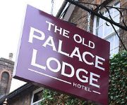
Old Palace Lodge
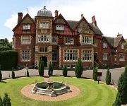
Pendley Manor
Highwayman Hotel
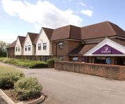
Dunstable South A5
Videos from this area
These are videos related to the place based on their proximity to this place.
LONDON COUNTRY GUY GS17 Restoration
The Guy Vixen GS is a bus of two halves (well almost), the Eastern-Coach-Works aluminium body is combined with the bonnet and front wings from a Ford Thames-Trader truck. This thin steel six-piece.
LONDON COUNTRY RT3125 Restoration
Many years of outdoor storage had taken a heavy toll on the timber and steel structure of this RT, the owner had wisely stock-piled a large amount of new replacement parts and these were supplied...
LONDON TRANSPORT T792 Restoration
T792 features the same design of Mann Egerton body as used on TD89 but is carried on a AEC Regent chassis, unlike TD89 this body was originally built with a closing passenger door. The timber...
LONDON TRANSPORT TD89 Restoration (in progress)
This 1948 Leyland Tiger with Mann Egerton ash frame body has been extensively rebuilt and will ultimately return to passenger carrying duties, it will feature a number of modifications that...
Ivinghoe at Risk – Help!
The village of Ivinghoe, Buckinghamshire, UK, is well known for its many historic buildings, and for the beauty of the surrounding countryside. At the heart of the village is the Lawn, a village...
Electric Ivinghoe Films presents: Propylaeum
The Euston Arch was the first great monument of the railway age. It should be reinstated as part of the redevelopment at Euston Station, London UK.
Ivinghoe Beacon Easter 2015
Hiking around Ivinghoe Beacon with my family & staying at Town Farm campsite. Camping at one of the loveliest campsites I have stayed at, we had a go at fire lighting with flint & steel &...
Ivinghoe Enduroland 4.3.wmv
Filmed from a gasgas ec200 hobby . Just a short clip from Enduroland, to get my head around the settings required to upload videos.
Videos provided by Youtube are under the copyright of their owners.
Attractions and noteworthy things
Distances are based on the centre of the city/town and sightseeing location. This list contains brief abstracts about monuments, holiday activities, national parcs, museums, organisations and more from the area as well as interesting facts about the region itself. Where available, you'll find the corresponding homepage. Otherwise the related wikipedia article.
Northall
Northall is a hamlet in the civil parish of Edlesborough Northall and Dagnall, in Buckinghamshire, England. This large hamlet straddles the A4146 road halfway between Edlesborough and Billington, Bedfordshire. It has one large Baptist chapel which is still in use. The hamlet has one public house 'The Swan'. An old 16th century public house 'the Village Green' was recently converted to a private house. The village was formerly part of the Ashridge Estate of the Earls and Dukes of Bridgwater.
Eaton Bray Rural District
Eaton Bray was a rural district in Bedfordshire, England from 1894 to 1933. It was created by the Local Government Act 1894 based on that part of the Leighton Buzzard rural sanitary district which was in Bedfordshire. The headquarters of the district were in the village of Eaton Bray. It was abolished in 1933 under a County Review Order and merged into the Luton Rural District.
Totternhoe Stone
Totternhoe Stone is a relatively hard chalk outcropping in the middle of the Lower Chalk in the Chiltern Hills in Hertfordshire, Buckinghamshire, Bedfordshire and Cambridgeshire, England. Geologically, it is located in the upper part of the Cenomanian stage of the Cretaceous. Unusually among chalks, it is sufficiently strong for use as a building stone, and has been used as such in these localities, notably in Woburn Abbey, Luton parish church and several smaller local churches.
Dunstable Branch Lines
The Dunstable Branch Lines were railway branch lines that joined the English town of Dunstable to the main lines at Leighton Buzzard and Welwyn. The two lines were under separate ownership and joined just east of the Dunstable North station. The London and North Western Railway built the line from Leighton Buzzard station to Dunstable. This opened in 1848. The Luton, Dunstable and Welwyn Junction Railway planned a connecting line from the Great Northern Railway at Welwyn.
Stanbridgeford railway station
Stanbridgeford railway station on the London and North Western Railway's branch line to Dunstable served the Bedfordshire villages of Stanbridge, Totternhoe, Eaton Bray and Tilsworth from 1849 to 1964. Once popular with visitors to the nearby Totternhoe Knolls and ramblers, the station closed against a background of falling passenger numbers and declining freight returns.
Cottesloe Hundred
Cottesloe Hundred was a hundred in the county of Buckinghamshire, England. It extended from close to the north of the county and Northamptonshire south-east to the Hertfordshire boundary at Berkhampsted.
Church of St Mary, Eaton Bray
Church of St Mary is a Grade I listed church in Eaton Bray, Bedfordshire, England. It became a listed building on 3 February 1967.
Church of St Giles, Totternhoe
Church of St Giles is a Grade I listed church in Totternhoe, Bedfordshire, England. It became a listed building on 3 February 1967.


