Safety Score: 3,0 of 5.0 based on data from 9 authorites. Meaning we advice caution when travelling to United Kingdom.
Travel warnings are updated daily. Source: Travel Warning United Kingdom. Last Update: 2024-08-13 08:21:03
Explore West Wratting
West Wratting in Cambridgeshire (England) with it's 502 inhabitants is a city in United Kingdom about 48 mi (or 78 km) north-east of London, the country's capital.
Local time in West Wratting is now 09:56 AM (Friday). The local timezone is named Europe / London with an UTC offset of zero hours. We know of 9 airports in the vicinity of West Wratting, of which 5 are larger airports. The closest airport in United Kingdom is Cambridge Airport in a distance of 8 mi (or 14 km), North-West. Besides the airports, there are other travel options available (check left side).
There are several Unesco world heritage sites nearby. The closest heritage site in United Kingdom is Palace of Westminster and Westminster Abbey including Saint Margaret’s Church in a distance of 45 mi (or 73 km), South. Also, if you like golfing, there are multiple options in driving distance. We found 2 points of interest in the vicinity of this place. If you need a place to sleep, we compiled a list of available hotels close to the map centre further down the page.
Depending on your travel schedule, you might want to pay a visit to some of the following locations: Linton, Fulbourn, Cambridge, Grantchester and Barton. To further explore this place, just scroll down and browse the available info.
Local weather forecast
Todays Local Weather Conditions & Forecast: 9°C / 47 °F
| Morning Temperature | 5°C / 41 °F |
| Evening Temperature | 6°C / 43 °F |
| Night Temperature | 5°C / 41 °F |
| Chance of rainfall | 0% |
| Air Humidity | 78% |
| Air Pressure | 1028 hPa |
| Wind Speed | Gentle Breeze with 6 km/h (3 mph) from North-East |
| Cloud Conditions | Overcast clouds, covering 87% of sky |
| General Conditions | Overcast clouds |
Saturday, 16th of November 2024
8°C (46 °F)
7°C (45 °F)
Light rain, gentle breeze, broken clouds.
Sunday, 17th of November 2024
6°C (43 °F)
3°C (38 °F)
Light rain, moderate breeze, overcast clouds.
Monday, 18th of November 2024
5°C (41 °F)
1°C (33 °F)
Moderate rain, moderate breeze, broken clouds.
Hotels and Places to Stay
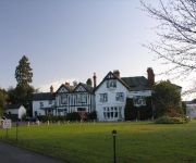
PADDOCKS HOUSE
Videos from this area
These are videos related to the place based on their proximity to this place.
Stetchworth Parish Church, Cambridgeshire, PART I, by Sheila, June 8, 2014
Stetchworth one of a group of Cambridgeshire villages very close to one another and where many of my Ancestors lived and are buried--Briggs, Claydon/Clayton, Webb, Stuteville and other associated...
Dullingham Re Visit by Sheila, 'Ancestors are Here', June 6, 2014
Dullingham village where many of my Cambridgeshire Ancestors once lived and are now buried--the Isaacson, Oaks,(Oakes), Briggs, Edwards, Browns and other associated names thru ...
don't laugh at us coz we have Hydrocephalus by mr G S Sloan.wmv
don't laugh at us coz we have Hydrocephalus coz it's are live & not your's so if you dont know what Hydrocephalus is dont just laugh at us coz you dont what Hydrocephalus just ask us & we will...
2011 Thurlow Ride
Late September 2011: the Thurlow Hunt ride. A sunny day in Suffok with Morgan, Mickey, Shiloh and Fergal.
Videos provided by Youtube are under the copyright of their owners.
Attractions and noteworthy things
Distances are based on the centre of the city/town and sightseeing location. This list contains brief abstracts about monuments, holiday activities, national parcs, museums, organisations and more from the area as well as interesting facts about the region itself. Where available, you'll find the corresponding homepage. Otherwise the related wikipedia article.
South East Cambridgeshire (UK Parliament constituency)
South East Cambridgeshire is a constituency represented in the House of Commons of the UK Parliament since 1987 by James Paice, a Conservative.
Balsham
Balsham is a rural village and civil parish in the county of Cambridgeshire, United Kingdom which has much expanded since the 1960s and is now one of several dormitory settlements of Cambridge. The village is south east of the centre of Cambridge beyond the A11 road and also within comfortable driving distance of Newmarket and Haverhill where many residents work and shop.
Lower Wood
Lower Wood is managed as a nature reserve by the Wildlife Trust for Bedfordshire, Cambridgeshire, Northamptonshire and Peterborough. It lies north of the village of Weston Green in the county of Cambridgeshire.
Cambridgeshire Lodes
The Cambridgeshire Lodes are a series of man-made waterways, believed to be Roman in origin, located in the county of Cambridgeshire, England. Bottisham, Swaffham Bulbeck, Reach, Burwell, Wicken and Monks Lodes all connect to the River Cam, while Soham Lode connects to the River Great Ouse. All have been navigable historically, but some are no longer officially navigable.


