Safety Score: 3,0 of 5.0 based on data from 9 authorites. Meaning we advice caution when travelling to United Kingdom.
Travel warnings are updated daily. Source: Travel Warning United Kingdom. Last Update: 2024-08-13 08:21:03
Delve into Tetworth
Tetworth in Cambridgeshire (England) is located in United Kingdom about 46 mi (or 73 km) north of London, the country's capital town.
Current time in Tetworth is now 05:40 AM (Friday). The local timezone is named Europe / London with an UTC offset of zero hours. We know of 11 airports close to Tetworth, of which 5 are larger airports. The closest airport in United Kingdom is RAF Wyton in a distance of 14 mi (or 23 km), North. Besides the airports, there are other travel options available (check left side).
There are several Unesco world heritage sites nearby. The closest heritage site in United Kingdom is Blenheim Palace in a distance of 28 mi (or 46 km), South-West. Also, if you like playing golf, there are some options within driving distance. If you need a hotel, we compiled a list of available hotels close to the map centre further down the page.
While being here, you might want to pay a visit to some of the following locations: Everton, Potton, Sutton, Little Barford and Tempsford. To further explore this place, just scroll down and browse the available info.
Local weather forecast
Todays Local Weather Conditions & Forecast: 9°C / 47 °F
| Morning Temperature | 5°C / 41 °F |
| Evening Temperature | 7°C / 44 °F |
| Night Temperature | 5°C / 41 °F |
| Chance of rainfall | 0% |
| Air Humidity | 78% |
| Air Pressure | 1028 hPa |
| Wind Speed | Gentle Breeze with 6 km/h (4 mph) from North-East |
| Cloud Conditions | Overcast clouds, covering 87% of sky |
| General Conditions | Overcast clouds |
Saturday, 16th of November 2024
8°C (47 °F)
7°C (45 °F)
Light rain, gentle breeze, overcast clouds.
Sunday, 17th of November 2024
7°C (44 °F)
4°C (39 °F)
Light rain, moderate breeze, overcast clouds.
Monday, 18th of November 2024
6°C (42 °F)
0°C (33 °F)
Rain and snow, moderate breeze, overcast clouds.
Hotels and Places to Stay
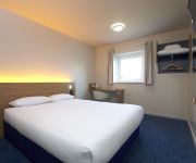
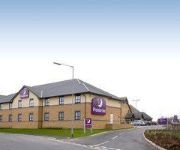
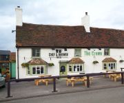
The Waterfront Hotel Spa & Golf
TRAVELODGE BEDFORD WYBOSTON
St. Neots (Colmworth Park)
St. Neots (A1/Wyboston)
Videos from this area
These are videos related to the place based on their proximity to this place.
Alex Hill - 360 Flip 8 Set Attempts
About a month and a half ago my mate Alex asked me to film him throwing a 360 Flip down the 8 set right in St Neots town. It doesn't get skated much because it goes straight in to a river and...
I'll Cover You sung by Wolfie Hammerbacker and Josh Sinclair
Wolfie Hammerbacker and Josh Sinclair singing 'I'll Cover You' from their show Rent at the St Neots Players and VAMPS awards night at St Neots Football Club.
Fakie 360 Rock over Spine
Been wanting to do this trick for years, only finally decided to make myself go for it today. Thought I'd get one on film as I haven't uploadd anything in ages, I have no recording equipment...
GTA V Playthrough: Mission 1 - The Prologue
So I've managed to complete the game once through and I am now going to be recording through the second time I complete it. So it all starts here, episode one of many to come in my GTA V series....
Stoat predates a rabbit at RSPB The Lodge, Sandy - Dec 2014 *Warning, quite graphic*
Although a frightfully cold day today we ventured up to RSPB Sandy to stretch our legs. Shortly after popping the walking boots on and checking the camera was ready we popped under the shelter...
ECML @ Sandy 22 10 12 feat 5L21 & RHTT
A short lunchtime visit to the footbridge next to Sunderland Road Industrial Estate(Beamish Close), Sandy to get the GBRf 66's on the southern ECML water cannons and 321447 freshly overhauled...
Sandy revisited (6 years later) - HSTs at speed
A class 180 rushes through Sandy station at the beginning, then glorious HSTs, ending with a class 321 stopping at Sandy. Note the very brief glimpse of an HST at speed seen through the stopping...
Sandy: Sunderland Road Industrial Estate
A footbridge situated near to the Industrial Estate in Sandy, which crosses over the East Coast Main Line.
91007 'Skyfall' ECML Debut Run HD
91007 'Skyfall' makes its debut run on 1Z07 Kings Cross to Edinburgh seen just north of Sandy at speed with matching rake of '007' gun logo Mk4's and DVT 82231 on the rear in matching James...
Videos provided by Youtube are under the copyright of their owners.
Attractions and noteworthy things
Distances are based on the centre of the city/town and sightseeing location. This list contains brief abstracts about monuments, holiday activities, national parcs, museums, organisations and more from the area as well as interesting facts about the region itself. Where available, you'll find the corresponding homepage. Otherwise the related wikipedia article.
Potton railway station
Potton was a railway station on the Varsity Line which served the small town of the same name in Bedfordshire. Opened in 1858 as part of Sir William Peel's Sandy and Potton Railway, the station was initially situated further south near the Biggleswade Road. Upon being taken over by the Bedford and Cambridge Railway in 1862 a new station was opened which remained in service for over one hundred years before closing in 1968. The station building has survived and is now a private house.
Gamlingay Meadows
Gamlingay Meadows is managed as a nature reserve by the Wildlife Trust for Bedfordshire, Cambridgeshire and Northamptonshire. It lies north-east of Potton and south-west of the village of Gamlingay in the county of Cambridgeshire in England. The Southern part of the meadow forms part of the boundary between Cambridgeshire and Bedfordshire.
Gamlingay Cinques Common
Gamlingay Cinques Common is managed as a nature reserve by the Wildlife Trust for Bedfordshire, Cambridgeshire, Northamptonshire and Peterborough. It lies west of the village of Gamlingay in the county of Cambridgeshire.
Gamlingay Wood
Gamlingay Wood is 46 ha (114 acres) of woodland managed as a nature reserve by the Wildlife Trust for Bedfordshire, Cambridgeshire, Northamptonshire and Peterborough. It has been designated a Site of Special Scientific Interest since 1955. It was listed in the Domesday Book and appears to have been woodland for at least 1000 years. However during the 20th century, much of the wood was felled and planted with a mix of oak and conifers.
Potton Sands
The Potton Sands is a geological formation in Bedfordshire, England whose strata date back to the Early Cretaceous. Dinosaur remains are among the fossils that have been recovered from the formation.
St Margaret's Church, Abbotsley
St Margaret's Church, Abbotsley, is a partly redundant Anglican church in the village of Abbotsley, Cambridgeshire, England. It has been designated by English Heritage as a Grade II* listed building, and is under the care of the Churches Conservation Trust. The church stands in the centre of the village, to the south of the B1046 road.
BigglesFM
BigglesFM is a local radio station based in Potton. It started broadcasting a full-time service on 22 April 2011. The station plays both modern and older songs. It broadcasts on 104.8 FM to Biggleswade, Potton, Sandy and surrounding villages in Mid Bedfordshire. It is also available through Wi-Fi radio and the internet.
Church of St Mary, Everton, Bedfordshire
Church of St Mary is a Grade I listed church in Everton, Bedfordshire, England. It became a listed building on 26 November 1986. Its most famous rector was John Berridge, an early Methodist leader.


