Safety Score: 3,0 of 5.0 based on data from 9 authorites. Meaning we advice caution when travelling to United Kingdom.
Travel warnings are updated daily. Source: Travel Warning United Kingdom. Last Update: 2024-08-13 08:21:03
Delve into Milton
Milton in Cambridgeshire (England) is located in United Kingdom about 51 mi (or 83 km) north of London, the country's capital town.
Current time in Milton is now 08:57 AM (Friday). The local timezone is named Europe / London with an UTC offset of zero hours. We know of 10 airports close to Milton, of which 5 are larger airports. The closest airport in United Kingdom is Cambridge Airport in a distance of 2 mi (or 4 km), South-East. Besides the airports, there are other travel options available (check left side).
There are several Unesco world heritage sites nearby. The closest heritage site in United Kingdom is Blenheim Palace in a distance of 43 mi (or 69 km), South-West. Also, if you like playing golf, there are some options within driving distance. We encountered 1 points of interest near this location. If you need a hotel, we compiled a list of available hotels close to the map centre further down the page.
While being here, you might want to pay a visit to some of the following locations: Cambridge, Grantchester, Fulbourn, Barton and Linton. To further explore this place, just scroll down and browse the available info.
Local weather forecast
Todays Local Weather Conditions & Forecast: 9°C / 48 °F
| Morning Temperature | 5°C / 42 °F |
| Evening Temperature | 7°C / 44 °F |
| Night Temperature | 5°C / 42 °F |
| Chance of rainfall | 0% |
| Air Humidity | 79% |
| Air Pressure | 1028 hPa |
| Wind Speed | Gentle Breeze with 6 km/h (4 mph) from North-East |
| Cloud Conditions | Overcast clouds, covering 90% of sky |
| General Conditions | Overcast clouds |
Saturday, 16th of November 2024
8°C (46 °F)
8°C (46 °F)
Light rain, gentle breeze, broken clouds.
Sunday, 17th of November 2024
7°C (44 °F)
4°C (39 °F)
Light rain, moderate breeze, overcast clouds.
Monday, 18th of November 2024
6°C (42 °F)
1°C (33 °F)
Snow, moderate breeze, broken clouds.
Hotels and Places to Stay
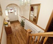
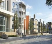
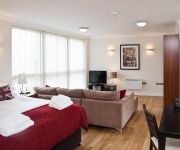
Citystay - The Belvedere
CB1 Apartments
Citystay - Warren Close
Hilton Cambridge City Centre
Gonville Hotel
Varsity Hotel & Spa
Rosa's Bed & Breakfast
Citystay - Glenalmond
Your Space Apartments - Byron House
Citystay - The Vie
Videos from this area
These are videos related to the place based on their proximity to this place.
Rose Farm Campsite, Belton, Norfolk
Time to go to sleep on my first camping trip near Great Yarmouth.
Cambridge Museum of Technology - Steam Engine Pump
August Bank Holiday... They fired up the old pump! http://www.museumoftechnology.com/
CRC Cycle Team 16 May 2012
The victorious return to CRC, accompanied by a police escort for the final leg of the journey.
Bubbles at Milton Village Fayre
At this year's fayre a new stall: big plastic bubbles (inflated via a modified leaf blower I think) inside which children could go and then float in a big paddling pool. Looked like a lot of...
Video Stagecoach East 19310 AE07KZM on Green P&R to Babraham Road 20140111
Stagecoach East Dennis Trident 2 Alexander Enviro 400 Dual Door 19310 AE07KZM on Milton - City Centre - Babraham Road Park & Ride on 11th January 2014.
Neck Pain, Headaches and the chiropractic treatment of them, by Milton Chiropracti Clinic
This video explains the chiropractic examination and treatment of neck pain and headaches. The video is made by the British Chiropractic Association. It is one of video's which is featured...
Churchill M2 bumped by Pembroke, Lent Bumps 2008
Churchill College M2 getting bumped by Pembroke College M2 on day 2 of Lent Bumps 2008.
How To Make A Watercolour Colour Chart
Get the full tip! Visit http://watercolourjourney.com for more inside information... . You can use these ideas to create your own watercolour colour chart and tonal chart, and it also helps...
A Little off the Top
Joe gets his hair cut in aid of The Little Princess Trust. 8 years of hair goes in little more than 8 minutes!
Ten Top Photo Tips from the Milton Photography Club
Member advice on simple ways to improve your photography of people, flowers and landscapes.
Videos provided by Youtube are under the copyright of their owners.
Attractions and noteworthy things
Distances are based on the centre of the city/town and sightseeing location. This list contains brief abstracts about monuments, holiday activities, national parcs, museums, organisations and more from the area as well as interesting facts about the region itself. Where available, you'll find the corresponding homepage. Otherwise the related wikipedia article.
Chesterton, Cambridge
Chesterton is a suburb in the northeast corner of Cambridge, England. It is also the name of two electoral wards (West Chesterton and East Chesterton) in the city. These are roughly the same as the area normally called Chesterton: specifically the land north of the River Cam, east of Castle Hill and south of the Arbury and King's Hedges estates. A large council estate makes up part of the East Chesterton area.
Cambridge Science Park
The Cambridge Science Park, founded by Trinity College in 1970, is the oldest science park in the United Kingdom. It is a concentration of science and technology related businesses, and has strong links with the nearby University of Cambridge. The science park is situated about 3 km to the north of Cambridge city centre, by junction 33 of the A14, in the parish of Milton, contiguous with Cambridge itself.
Cambridge Business Park
Cambridge Business Park is a large business complex in Cambridge, England. It is home to many companies, mostly IT-related, such as CSR, Autonomy, MathWorks and Red Gate Software, but also intellectual property firms such as Mewburn Ellis, Venner Shipley and Mathys and Squire. \t\t \t\t\tCambridge Business Park entrance. jpg \t\t\t Cambridge Business Park entrance. \t\t\t \t\t \t\t \t\t\tCambridge Business Park BBC. jpg \t\t\t BBC Cambridgeshire building at Cambridge Business Park.
A1309 road
The A1309 is a short road (1.9 miles) which links the two ends of the A10 to north and south of Cambridge city centre in Cambridgeshire, England. It was numbered as part of the A10 prior to the construction of the Cambridge Western Bypass (now M11) and the Northern Bypass. Its northern end is at the Milton Interchange with the A14 and A10.
Chesterton Rural District
Chesterton was a rural district in Cambridgeshire, England from 1894 to 1974. It was formed in 1894 as a successor to the Chesterton rural sanitary district. In 1934, under a County Review Order, its boundaries were altered, taking in the disbanded Swavesey Rural District and part of the disbanded Caxton and Arrington Rural District. It also ceded an area to the borough of Cambridge. In 1965 it became part of the new administrative county of Cambridgeshire and the Isle of Ely.
Cambridge Regional College
Cambridge Regional College is a college of further education located in Cambridge, Cambridgeshire, England.
St John's Innovation Centre
St John's Innovation Centre (SJIC) is a business incubator in Cambridge, England. It houses a concentration of science and technology related businesses.
Cambridge Science Park railway station
Cambridge Science Park railway station (or Chesterton railway station) is a proposed railway station that would be located in the Cambridge suburb of Chesterton, close to Cambridge Science Park. The official proposal from Cambridgeshire County Council, which has the backing of the rail industry, is to locate the station at Chesterton Sidings on the Fen Line, which runs from Cambridge to King's Lynn.
Chesterton Hall
Chesterton Hall is a house in Chesterton, Cambridge. It lies in the city of Cambridge in the county of Cambridgeshire approximately 50 miles (80 km) north-northeast of London. Most of the grounds have long since been sold off and the house is now located on one of the major roundabouts of the city. The house dates from the early 17th century. The house was built by the Hobsons: the younger, Thomas Hobson lived at Chesterton Hall in 1627, four years prior to his death in 1631.
Beth Shalom Cambridge
Beth Shalom Reform Synagogue is a synagogue in the City of Cambridge. It was founded in 1981. The community is currently raising funds to build the first Reform synagogue in the history of Cambridge. A site on Auckland Road in the centre of Cambridge has been identified with approval from Cambridge City Council and the planned building will accommodate a prayer hall for at least 200 people and will meet other social and educational needs.


