Safety Score: 3,0 of 5.0 based on data from 9 authorites. Meaning we advice caution when travelling to United Kingdom.
Travel warnings are updated daily. Source: Travel Warning United Kingdom. Last Update: 2024-08-13 08:21:03
Explore Horseway
The district Horseway of in Cambridgeshire (England) is located in United Kingdom about 67 mi north of London, the country's capital.
If you need a place to sleep, we compiled a list of available hotels close to the map centre further down the page.
Depending on your travel schedule, you might want to pay a visit to some of the following locations: Thorney, Cambridge, Grantchester, Barton and Fulbourn. To further explore this place, just scroll down and browse the available info.
Local weather forecast
Todays Local Weather Conditions & Forecast: 9°C / 48 °F
| Morning Temperature | 5°C / 42 °F |
| Evening Temperature | 7°C / 45 °F |
| Night Temperature | 5°C / 42 °F |
| Chance of rainfall | 0% |
| Air Humidity | 77% |
| Air Pressure | 1027 hPa |
| Wind Speed | Gentle Breeze with 6 km/h (4 mph) from North-East |
| Cloud Conditions | Overcast clouds, covering 89% of sky |
| General Conditions | Overcast clouds |
Saturday, 16th of November 2024
8°C (47 °F)
7°C (45 °F)
Light rain, gentle breeze, overcast clouds.
Sunday, 17th of November 2024
8°C (46 °F)
4°C (39 °F)
Light rain, moderate breeze, overcast clouds.
Monday, 18th of November 2024
6°C (42 °F)
0°C (32 °F)
Snow, moderate breeze, broken clouds.
Hotels and Places to Stay
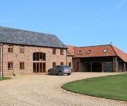
Kings Barn Farmhouse Bed & Breakfast
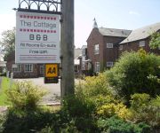
The Cottage
Anchor Inn
VS King William
Oliver Cromwell
Videos from this area
These are videos related to the place based on their proximity to this place.
F-15mx Tracks - Stop Mepal Motocross Track Closure Petition Please Sign
F-15mx Tracks - Mepal Track Petition. Please sign! http://www.change.org/petitions/fenland-district-council-cambs-county-council-support-mepal-motocross-track-planning-application They are...
Motion MX 2014
Motion Motocross. The Ultra Slow Motion Edition- EASSC RND1 2014. Film and Edit By Jason Kirby. Facts about Motocross From Wikipedia: Did you know that Motocross first evolved in the United...
A Microlight Flight
A four minute video taken when Josh went for a microlight flight at Sutton, Cambridgeshire.
Challenge Frank 3 - ukcruisers visit to RSPCA Block Fen Animal Centre 17th July 2011
Franks Challenge this year was to become "Frank the Wonder Dog" for the day and help raise funds for the RSPCA Block Fen Animal Centre in the process. This is the annual visit by UKCruisers,...
UKCruisers visit RSPCA Block Fen Open Day 17th July 2011
UKCruisers, Chrysler PT Cruiser Owners Club visit to RSPCA Open Day at Block Fen. This is a yearly event we attend to help raise funds for this great cause. This charity runs on donations...
EASSC 2015 Mepal Alfie Osborn Team Thurrock Motocross Mx Judd Racing
Mx Rider Alfie Osborn Judd Racing EHR Team Thurrock Motocross @ EASSC, Mepal For The 2015, 2nd Round Of The Pro Green Mx Winter Series. Auto Class.
Mx 2014 1st Round EASSC Motocross @ F-15mx Tracks Mepal 23/02/14
Quick Edit from today. The 1st Round EASSC Motocross @ F-15mx Tracks Mepal 23/02/14. Film and Edit by Jason Kirby.
Apprentices at Mepal Outdoor Centre 2011
Team building week administered by the attentive and highly motivated staff at Mepal Outdoor Centre. Engineering Apprentices had a brilliant time and the lessons learned from their experiences...
East Kent Summer Mx Championship @ Mepal 2013 EKSSC
East Kent @ F-15Mx Mepal. Summer Championship, 2013 EKSSC.
Videos provided by Youtube are under the copyright of their owners.
Attractions and noteworthy things
Distances are based on the centre of the city/town and sightseeing location. This list contains brief abstracts about monuments, holiday activities, national parcs, museums, organisations and more from the area as well as interesting facts about the region itself. Where available, you'll find the corresponding homepage. Otherwise the related wikipedia article.
Old Bedford River
The Old Bedford River is an artificial, partial diversion of the waters of the River Great Ouse in the Fens of Cambridgeshire, England. It was named after the fourth Earl of Bedford who contracted with the local Commission of Sewers to drain the Great Level of the Fens beginning in 1630. The idea of an artificial river running, as the Old Bedford River does, from Earith to Denver was not a new idea; it had been proposed as early as 1604 by the engineer John Hunt.
Fen Causeway
Fen Causeway or the Fen Road is the modern name for a Roman road of England that runs between Denver, Norfolk in the east and Peterborough in the west. Its path covers 24 miles, passing March and Eldernell before joining the major Roman north-south route Ermine Street west of modern-day Peterborough. It provided a link from the north and west of England to East Anglia.
HM Prison Whitemoor
HM Prison Whitemoor is a Category A men's prison, located near the town of March in Cambridgeshire, England. The prison is operated by Her Majesty's Prison Service.
North West Cambridgeshire (UK Parliament constituency)
North West Cambridgeshire is a county constituency represented in the House of Commons of the Parliament of the United Kingdom. It elects one Member of Parliament (MP) by the first past the post system of election.
Ely Rural District
Ely was a rural district in England from 1894 to 1974. It was named after Ely, and surrounded it to the west and north. The district was created in 1894 under the Local Government Act 1894 from the Ely rural sanitary district. It formed part of the administrative county of the Isle of Ely from 1894 to 1965, when this was merged into Cambridgeshire and Isle of Ely. In 1974 it was abolished, and its area made part of the new East Cambridgeshire district of Cambridgeshire.
March Town United F.C
March Town United F.C. are an English football club based in March, Cambridgeshire. The club are currently members of Eastern Counties League Division One and play at the GER Sports Ground.
Manea railway station
Manea railway station, on the line between Peterborough and Ely, serves the village of Manea in Cambridgeshire, England. It was proposed for closure under the Beeching report of 1963 but was reprieved due to "the acute social hardship this would cause".
Stonea Camp
Stonea Camp is an Iron Age hill fort located near March in the Cambridgeshire Fens. Situated on a gravel bank just 2 metres above sea-level, it is the lowest hill fort in Britain. Around 500 BC, when fortification is thought to have begun at this site, this "hill" would have provided a significant area of habitable land amidst the flooded marshes of the fens.
Forty Foot Drain
In the drainage schemes of The Fens of Eastern England, some of the principal drainage channels are each known as The Forty Foot or Forty Foot Drain, the name being qualified when there is a need to distinguish between them. They are Vermuden's Drain, South Forty Foot and North Forty Foot.
Chatteris Abbey
Chatteris Abbey in Chatteris, Cambridgeshire was founded as a monastery for Benedictine nuns in 1016 by Ednoth, Bishop of Dorchester. Before 1310 much of the monastery was destroyed by fire. By the middle of the 14th century, some of the local families appear to have been using the nave of the monastic church as their parochial church.
March TMD
March TMD was a railway Traction Maintenance Depot situated near March, England. March was a steam locomotive shed under British Railways with the depot code 31B; the depot code of the diesel depot under BR was MR. The nearest railway station is March, and the depot was located close to the Whitemoor Marshalling Yard. Despite its rural location, in the 1970s it accommodated a similar number of locomotives to the comparatively larger Toton TMD and served as the main diesel depot for East Anglia.
Chatteris Town F.C
Chatteris Town F.C. is an English football club based in Chatteris, Cambridgeshire. The club are currently members of the Cambridgeshire League Premier Division, and play at West Street.
Somersham railway station
Somersham railway station was a station in Somersham, Cambridgeshire on the Great Eastern Railway between March and St Ives. There was also a branch line that ran north-west from the station to Ramsey. Preceding station Disused railways Following station St Ives Great Eastern RailwayMarch Line Chatteris St Ives Great Eastern RailwayRamsey Line Warboys
Chatteris railway station
Chatteris railway station was a station in Chatteris, Cambridgeshire on the line between St Ives and March. For much of its history it was run by the Great Eastern Railway. It closed to passengers on 6 March 1967 in the wake of the Beeching Report. The station was demolished in the early 1970s and the station site/ trackbed used for the new alignment of the A141 road Preceding station Disused railways Following station Somersham Great Eastern RailwayMarch Line Wimblington
Wimblington railway station
Wimblington railway station was a station in the village of Wimblington, Cambridgeshire. It was closed in 1967 as part of the Beeching Axe. The station was demolished in the early 1970s and the site used for the construction of the new alignment of the A141 road. Preceding station Disused railways Following station Chatteris GN and GE Joint Railway March
Norwood Road nature reserve
Norwood Road is a nature reserve managed by the Wildlife Trust for Bedfordshire, Cambridgeshire, Northamptonshire and Peterborough. It lies in the centre of the town of March in the county of Cambridgeshire.
Stonea railway station
Stonea railway station is a former railway station serving the small village of Stonea, Cambridgeshire. Although the station closed in 1966, the line is still in use. Preceding station Historical railways Following station March Great Eastern Railway Manea
Wentworth, Cambridgeshire
Wentworth is a small village near Ely in Cambridgeshire, England.
Dunhams Wood
Dunhams Wood is a privately owned broadleaved woodland that is occasionally open to the public. The area was planted over a period of 6 years starting in 1985. It is located approximately 2 miles outside of March, Cambridgeshire in Fenland. The area is owned by Margaret and Arthur Dunham, who open the woodlands to the public during the summer. Treasure hunts and other games take place within the wood. A major feature of the wood is the Dunhams Wood Railway.
Tracked Hovercraft
Tracked Hovercraft was an experimental high speed train developed in the United Kingdom during the 1960s. It combined two British inventions, the hovercraft and linear induction motor, in an effort to produce a train system that would provide 250 mph inter-city service with lowered capital costs compared to other high-speed solutions. Substantially similar to the French Aérotrain, Tracked Hovercraft suffered a similar fate when it was cancelled as a part of wide budget cuts in 1973.
The Avenue Sports Club Ground
The Avenue Sports Club Ground is a cricket ground in March, Cambridgeshire. The ground was established in 1939, when Cambridgeshire played Suffolk in the grounds first Minor Counties Championship match. From 1935 to the present day, it has hosted 69 Minor Counties matches. The first List-A match played on the ground came in the 1975 Gillette Cup between Cambridgeshire and Northamptonshire.
Welches Dam
Welches Dam is a parish in Cambridgeshire around 5 miles to the north west of Ely. It covers an area of 2,355 acres . The parish of Welches Dam is surrounded by those of Coveney, Manea, Mepal, and Witcham. The civil parish was divided between Chatteris and Manea in 1960.
Stonea
Stonea is a village in Cambridgeshire, England.
Westry
Westry is a village in Cambridgeshire, England. It lies to the northwest of March on the A141 to Wisbech. The Church of St Mary was erected in 1873 to a design by Thomas Henry Wyatt. It is a Grade II listed building. The church was gutted by fire on 15 March 2010 but restoration is nearly complete.
A1421 road
The A1421 is a short 'A' road in the English county of Suffolk It links Haddenham (and the A1123, which it meets there) with the A142 near Sutton, which leads to Ely, Cambridgeshire.


