Safety Score: 3,0 of 5.0 based on data from 9 authorites. Meaning we advice caution when travelling to United Kingdom.
Travel warnings are updated daily. Source: Travel Warning United Kingdom. Last Update: 2024-08-13 08:21:03
Delve into Luddenden Foot
Luddenden Foot in Calderdale (England) with it's 2,190 habitants is a city located in United Kingdom about 171 mi (or 275 km) north-west of London, the country's capital town.
Current time in Luddenden Foot is now 09:45 PM (Sunday). The local timezone is named Europe / London with an UTC offset of zero hours. We know of 8 airports closer to Luddenden Foot, of which 5 are larger airports. The closest airport in United Kingdom is Leeds Bradford Airport in a distance of 15 mi (or 25 km), North-East. Besides the airports, there are other travel options available (check left side).
There are several Unesco world heritage sites nearby. The closest heritage site in United Kingdom is Liverpool – Maritime Mercantile City in a distance of 44 mi (or 71 km), South-East. Also, if you like playing golf, there are some options within driving distance. In need of a room? We compiled a list of available hotels close to the map centre further down the page.
Since you are here already, you might want to pay a visit to some of the following locations: Oxenhope, Halifax, Clayton, Keighley and Meltham. To further explore this place, just scroll down and browse the available info.
Local weather forecast
Todays Local Weather Conditions & Forecast: 7°C / 44 °F
| Morning Temperature | 5°C / 40 °F |
| Evening Temperature | 5°C / 42 °F |
| Night Temperature | 4°C / 39 °F |
| Chance of rainfall | 3% |
| Air Humidity | 78% |
| Air Pressure | 1013 hPa |
| Wind Speed | Gentle Breeze with 9 km/h (5 mph) from East |
| Cloud Conditions | Scattered clouds, covering 32% of sky |
| General Conditions | Light rain |
Monday, 18th of November 2024
3°C (37 °F)
-1°C (31 °F)
Rain and snow, moderate breeze, overcast clouds.
Tuesday, 19th of November 2024
-2°C (29 °F)
-5°C (24 °F)
Snow, moderate breeze, broken clouds.
Wednesday, 20th of November 2024
0°C (32 °F)
-2°C (28 °F)
Snow, moderate breeze, few clouds.
Hotels and Places to Stay
The New Hobbit Hotel
White Lion Hotel
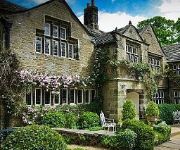
Holdsworth House
Thorpe House
Tower House Hotel
Hebden Bridge Guest House
The White Swan Halifax by Compass Hospitality
Best Western Pennine Manor Hotel
TRAVELODGE HALIFAX
Halifax Town Centre
Videos from this area
These are videos related to the place based on their proximity to this place.
Sowerby Bridge 12/03/08
Neil & H take a drive through Sowerby Bridge, Halifax, West Yorkshire, England. To see if anything has changed,since leaving the U.K. back in 1989.
400 Roses at the Sowerby Bridge Rushbearing Festival 2013
The 400 Roses (http://www.fourhundredroses.org.uk/) are a dance troupe that blend traditional folk dance with tribal belly-dance to provide a gloriously colourful and exotic performance.
400 Roses at the Sowerby Bridge Rushbearing Festival 2013
The 400 Roses (http://www.fourhundredroses.org.uk/) are a dance troupe that blend traditional folk dance with tribal belly-dance to provide a gloriously colourful and exotic performance.
Lower Bentley Royd Barn
Lower Bentley Royd Barn is a 4/5 Bedroom Barn Conversion conveniently situated on the outskirts of Sowerby Bridge. Sympathetically converted approximately 9 years ago from an original stone...
Type C waterproofing to BS8102.wmv
Here, Bryan shows you around a nearly complete basement waterproofing job in West Yorkshire. This shows a type C cavity drain membrane basement waterproofing system in place, ready for ...
SBHS Head National Campaign
Our 6th formers were given First Aid training and thereafter led life saving CPR training to lower school. Here is a short message from Project Ambassador and NHS Consultant, Dr Lockey.
Literacy advice for Parents
Whether you child is in Year 7 or Sixth Form, here are some tips on how to help your child improve their literacy.
Videos provided by Youtube are under the copyright of their owners.
Attractions and noteworthy things
Distances are based on the centre of the city/town and sightseeing location. This list contains brief abstracts about monuments, holiday activities, national parcs, museums, organisations and more from the area as well as interesting facts about the region itself. Where available, you'll find the corresponding homepage. Otherwise the related wikipedia article.
Calderdale
The Metropolitan Borough of Calderdale is a metropolitan borough of West Yorkshire, England, through which the upper part of the River Calder flows, and from which it takes its name. There are also some small river valleys that contain tributaries of the River Calder. Calderdale was formed by the merger of six former local government districts, spanning (from east to west), the towns of Brighouse, Elland, Halifax, Sowerby Bridge, Hebden Bridge and Todmorden.
Calder Valley (UK Parliament constituency)
Calder Valley is a constituency represented in the House of Commons of the UK Parliament since 2010 by Craig Whittaker of the Conservative Party.
Sowerby (UK Parliament constituency)
Sowerby was a county constituency centred on the village of Sowerby in Calderdale, West Yorkshire. It returned one Member of Parliament (MP) to the House of Commons of the Parliament of the United Kingdom.
List of United Kingdom locations: Tri-Tz
Boulderclough
Boulderclough is a small village between Sowerby and Mytholmroyd in Calderdale, West Yorkshire, England. It is a very picturesque village looking down on the Calderdale valley and beyond. The Chapel in the village is worth looking at as it is very impressive. The village pub closed some years ago although the village is within easy walking distance of the Travellers Rest. 32px This West Yorkshire location article is a stub. You can help Wikipedia by expanding it.
Wood Lane Hall
Wood Lane Hall is a Grade 1 listed building near Sowerby, West Yorkshire. It was rebuilt in the mid-1650s as a prodigy house.
Triangle, West Yorkshire
Triangle is a village in Calderdale on the main A58 road over the Pennines, near Halifax and between Sowerby Bridge and Ripponden in the Ryburn valley. It dates mainly from the 19th century period of industrialisation but was here for some time prior. The name of the village derives from the patch of ground formed when the old road parted with the newer (A58) toll road to Rochdale. Previous to this time the village was named Pond.
Friendly, West Yorkshire
Friendly is a settlement near Sowerby Bridge in Calderdale, West Yorkshire, England, lying on the A 646 road in the valley of the River Calder. It was described in Bartholomew's 1887 Gazetteer of the British Isles as a village 3 miles north west of Halifax. It is the home of The Friendly Band, a brass band founded in 1868, and has two pubs, the White Horse and The Friendly Inn.


