Safety Score: 3,0 of 5.0 based on data from 9 authorites. Meaning we advice caution when travelling to United Kingdom.
Travel warnings are updated daily. Source: Travel Warning United Kingdom. Last Update: 2024-08-13 08:21:03
Delve into Walton
Walton in Buckinghamshire (England) is a city located in United Kingdom about 36 mi (or 57 km) north-west of London, the country's capital town.
Current time in Walton is now 03:00 AM (Friday). The local timezone is named Europe / London with an UTC offset of zero hours. We know of 11 airports closer to Walton, of which 5 are larger airports. The closest airport in United Kingdom is RAF Benson in a distance of 19 mi (or 30 km), South-West. Besides the airports, there are other travel options available (check left side).
There are several Unesco world heritage sites nearby. The closest heritage site in United Kingdom is Blenheim Palace in a distance of 7 mi (or 11 km), East. Also, if you like playing golf, there are some options within driving distance. We saw 1 points of interest near this location. In need of a room? We compiled a list of available hotels close to the map centre further down the page.
Since you are here already, you might want to pay a visit to some of the following locations: Aylesbury, Shenley Church End, Loughton, Stanbridge and Bow Brickhill. To further explore this place, just scroll down and browse the available info.
Local weather forecast
Todays Local Weather Conditions & Forecast: 8°C / 47 °F
| Morning Temperature | 4°C / 40 °F |
| Evening Temperature | 6°C / 43 °F |
| Night Temperature | 4°C / 40 °F |
| Chance of rainfall | 0% |
| Air Humidity | 82% |
| Air Pressure | 1028 hPa |
| Wind Speed | Light breeze with 5 km/h (3 mph) from North-East |
| Cloud Conditions | Overcast clouds, covering 100% of sky |
| General Conditions | Overcast clouds |
Saturday, 16th of November 2024
7°C (45 °F)
7°C (45 °F)
Broken clouds, gentle breeze.
Sunday, 17th of November 2024
7°C (45 °F)
3°C (37 °F)
Light rain, moderate breeze, broken clouds.
Monday, 18th of November 2024
5°C (42 °F)
3°C (37 °F)
Moderate rain, moderate breeze, overcast clouds.
Hotels and Places to Stay
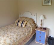
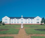
Arngrove B&B
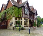
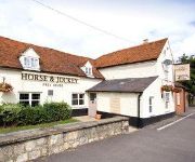
Five Arrows
Olympic Lodge Stoke Mandeville Stadium
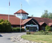
Holiday Inn AYLESBURY
Best Western Garden Court Aylesbury
Aylesbury
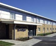
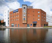
TRAVELODGE AYLESBURY
Videos from this area
These are videos related to the place based on their proximity to this place.
Vale of Oxbury by Carl Woodwards seen at Railex Aylesbury May 2014
Vale of Oxbury by Carl Woodwards seen at Railex Aylesbury May 2014. An N Gauge layout depicting a Western Region (Ex-GWR) junction in Oxfordshire in the 1960s. A video by Black and Decker ...
Keane Gurney Karting at Rogue Racing Aylesbury
Recorded at Rogue Racing Aylesbury, Buckinghamshire's premier indoor kart track Website: http://rogueracing.co.uk Facebook: http://facebook.com/rogueracinguk Phone: 01296 330 567 Viewpoint...
WADEBRIDGE by John Greenwood seen at Railex Aylesbury May 2014
WADEBRIDGE by John Greenwood seen at Railex Aylesbury May 2014. A 2mm Finescale Layout depicting Wadebridge and the Southern Railway in North Cornwall. A video by Black and Decker Boy.
Matt Dyer Karting at Rogue Racing Aylesbury
Check out Rogue Racing Aylesbury, Buckinghamshire's premier indoor karting track Website: http://rogueracing.co.uk Facebook: http://facebook.com/rogueracinguk Phone: 01296 330 567 Viewpoint...
Bath Green Park by Taunton MRG seen at Railex Aylesbury May 2014
Bath Green Park by Taunton MRG seen at Railex Aylesbury May 2014. A 00 gauge finescale model railway of the northern terminus of the Somerset & Dorset railway as it would have been in the 1950s.
Jack Howe Karting at Rogue Racing Aylesbury
Recorded at Rogue Racing Aylesbury, Buckinghamshire's premier indoor kart track Website: http://rogueracing.co.uk Facebook: http://facebook.com/rogueracinguk Phone: 01296 330 567 Viewpoint...
Michael Baker Karting at Rogue Racing Aylesbury
Check out Rogue Racing Aylesbury, Buckinghamshire's premier indoor kart track Website: http://rogueracing.co.uk Facebook: http://facebook.com/rogueracinguk Phone: 01296 330 567 Viewpoint...
Fence Houses 2mm finescale by Bob Jones at Railex Aylesbury 2013
Fence Houses, a 2mm finescale layout by Bob Jones as seen at Railex Aylesbury 2013. Fence Houses is set on a North Eastern Railway secondary line near Newcastle - U - Tyne and depicts the ...
USAR turnout (Aylesbury HQ/USAR Centre)
USAR turning out from the Buckinghamshire USAR centre based in Aylesbury.
Andy Leather karting at Rogue Racing Aylesbury
Recorded at Rogue Racing Aylesbury, Buckinghamshire's premier indoor kart track Website: http://rogueracing.co.uk Facebook: http://facebook.com/rogueracinguk Phone: 01296 330 567 Viewpoint...
Videos provided by Youtube are under the copyright of their owners.
Attractions and noteworthy things
Distances are based on the centre of the city/town and sightseeing location. This list contains brief abstracts about monuments, holiday activities, national parcs, museums, organisations and more from the area as well as interesting facts about the region itself. Where available, you'll find the corresponding homepage. Otherwise the related wikipedia article.
Broughton Crossing
Broughton Crossing is a small settlement located between the Buckinghamshire villages of Bierton and Broughton in England. It takes its name from a long-vanished level crossing where the road crossed the now-defunct Cheddington to Aylesbury Line a branch line connecting the West Coast Main Line at Cheddington and Aylesbury. It consists of a public house and a few private houses, the easterly part of the former railway has been made into a road.
Stoke Mandeville Hospital
Stoke Mandeville Hospital is a large National Health Service hospital within Aylesbury Urban Area to the south of the town of Aylesbury, near the village of Stoke Mandeville in Buckinghamshire. It is part of Buckinghamshire Healthcare NHS Trust. The hospital's National Spinal Injuries Centre is one of the largest specialist spinal units in the world, and the pioneering rehabilitation work carried out there by Sir Ludwig Guttmann led to the development of the Paralympic Games.
HM Prison Aylesbury
HM Prison Aylesbury (full title Her Majesty's Young Offender Institution Aylesbury) is a Young Offender Institution situated in Aylesbury, Buckinghamshire, England. The prison is located on the north side of the town centre, on Bierton Road. The prison is operated by Her Majesty's Prison Service.
Tindal Centre
The Tindal Centre (formerly Tindal Hospital) is a centre for the treatment of mental illnesses in Aylesbury, Buckinghamshire, England. It includes a residential hospital for people with profound mental health difficulties and also counselling/therapy outpatient services.
Aylesbury High Street railway station
Aylesbury High Street railway station was the London and North Western Railway station which served the town of Aylesbury in the English county of Buckinghamshire. It was the terminus of a branch from Cheddington on what is now known as the West Coast Main Line running to London Euston Station and to Birmingham New Street and further north. Two stations were built, the first being used as a goods terminus after its closure to passengers.
Centre for Buckinghamshire Studies
The Centre for Buckinghamshire Studies is the county record office for Buckinghamshire, England. It houses the former Buckinghamshire Record Office and the former Buckinghamshire Local Studies Library. It is located in Aylesbury, in the base of County Hall.
Aylesbury Hundred
Aylesbury Hundred was a hundred in the ceremonial county of Buckinghamshire, England. It was situated in the centre of the county and was bounded on the east by Hertfordshire and on the west by Oxfordshire.
Municipal Borough of Aylesbury
Aylesbury was, from 1894 to 1974, a local government district in Buckinghamshire, England. It was incorporated as a municipal borough in 1917. The urban district took over the responsibilities of the disbanded Aylesbury Local Board District. The district contained the whole of the town and civil parish of Aylesbury. In 1917 the town was granted municipal borough status under the Municipal Corporations Act 1882.
Aylesbury Waterside Theatre
Aylesbury Waterside Theatre is a £47 million theatre in Aylesbury, England, United Kingdom presenting a range of West End and touring musicals and plays, along with performances of opera and ballet and a Christmas pantomime.
Stoke Mandeville Stadium
Stoke Mandeville Stadium is the National Centre for Disability Sport in the United Kingdom. It is sited alongside Stoke Mandeville Hospital near Stoke Mandeville and Aylesbury in Buckinghamshire. The stadium was officially opened by Queen Elizabeth II in August 1969. The stadium developed out of the Stoke Mandeville Games — the forerunner of the Paralympic Games — founded in 1948 by Ludwig Guttmann.
International Spinal Cord Society
The International Spinal Cord Society (ISCoS) was founded in 1961 as the International Medical Society of Paraplegia. It is an INGO, whose purpose is to study all problems relating to lesions of the spinal cord.
International Society for Computer Aided Surgery
The International Society for Computer Aided Surgery (ISCAS) is an INGO, whose purpose to promote all scientific and clinical advance of computer-aided surgery and related medical procedures around the world.


