Safety Score: 3,0 of 5.0 based on data from 9 authorites. Meaning we advice caution when travelling to United Kingdom.
Travel warnings are updated daily. Source: Travel Warning United Kingdom. Last Update: 2024-08-13 08:21:03
Delve into Soulbury
Soulbury in Buckinghamshire (England) with it's 294 habitants is located in United Kingdom about 39 mi (or 63 km) north-west of London, the country's capital town.
Current time in Soulbury is now 12:15 AM (Friday). The local timezone is named Europe / London with an UTC offset of zero hours. We know of 11 airports close to Soulbury, of which 5 are larger airports. The closest airport in United Kingdom is London Luton Airport in a distance of 15 mi (or 25 km), East. Besides the airports, there are other travel options available (check left side).
There are several Unesco world heritage sites nearby. The closest heritage site in United Kingdom is Blenheim Palace in a distance of 7 mi (or 12 km), South-East. Also, if you like playing golf, there are some options within driving distance. We encountered 1 points of interest near this location. If you need a hotel, we compiled a list of available hotels close to the map centre further down the page.
While being here, you might want to pay a visit to some of the following locations: Bow Brickhill, Simpson, Wavendon, Potsgrove and Woburn Sands. To further explore this place, just scroll down and browse the available info.
Local weather forecast
Todays Local Weather Conditions & Forecast: 8°C / 46 °F
| Morning Temperature | 4°C / 40 °F |
| Evening Temperature | 6°C / 42 °F |
| Night Temperature | 4°C / 39 °F |
| Chance of rainfall | 0% |
| Air Humidity | 82% |
| Air Pressure | 1028 hPa |
| Wind Speed | Gentle Breeze with 6 km/h (3 mph) from North-East |
| Cloud Conditions | Overcast clouds, covering 100% of sky |
| General Conditions | Overcast clouds |
Saturday, 16th of November 2024
7°C (45 °F)
7°C (44 °F)
Light rain, gentle breeze, overcast clouds.
Sunday, 17th of November 2024
7°C (44 °F)
3°C (37 °F)
Light rain, gentle breeze, overcast clouds.
Monday, 18th of November 2024
5°C (41 °F)
1°C (34 °F)
Moderate rain, moderate breeze, broken clouds.
Hotels and Places to Stay
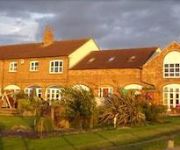
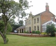
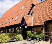
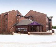
Furzton - Prestigious Houses
Doubletree by Hilton Milton Keynes
The Old Stables
Woodleys Farm House
Campanile - Milton Keynes - Fenny Stratford
Milton Keynes South
Milton Keynes Sw(Furzton Lake)
Videos from this area
These are videos related to the place based on their proximity to this place.
Leighton Buzzard Railway - 'GREAT SLATE QUARRY FEST' 15/09/2012
The Leighton Buzzard Railway's 'Great Slate Quarry Fest' Steam Gala on Saturday 15th September 2012. This was a tribute to some of the locomotives of Penryhn Quarry. Among the highlights were...
Journey Out the Window of Class 350 Bletchley to Leighton Buzzard on Local Line on 3/10/12
Journey Out the Window of Class 350 Bletchley to Leighton Buzzard.
Britannia at Leighton Buzzard - 14th April 2012
This an improved HD version of a clip published in 2012. A busy Saturday morning at Leighton Buzzard with Pendolinos and EMUs, culminating in the passage of two special trains. The first is...
Dirt Running Trail Races
The Dirt Half Challenge Trail Race Saturday 17th November 2012 @ 10am Leighton Buzzard, Bedfordshire, UK A very popular half marathon trail race.
North London & North of London Freight (15-07-2014)
We start on the North London Line at Canonbury, we then head west to Kensal Rise before heading north to Wembley Central, where we see 47501 leading 47828 and 90002 on route to Crewe.
Watching Trains - West Coast Main Line - Stoke Hammond
http://www.mikemccormac.com/ Watching West Coast Main Line trains at Stoke Hammond, Buckinghamshire. Action includes Class 221 'Super Voyager' units, Class 390 'Pendolino' units, Class 350...
The Three Locks on the Grand Union Canal
On my way to the Northampton meet today, I decided to stop at The Three Locks on the Grand Union Canal to have my lunch. It's a very pleasant spot and you get so see canal locks in action,...
Apr 2012 (HD): Scouts St George's Day Parade, Stewkley, Bucks
As the 1st Stewkley Scouts celebrate fifty years since the troop's formation, its members host the annual St George's Day Parade and church service. Stewkley Film Archive April 2012.
Videos provided by Youtube are under the copyright of their owners.
Attractions and noteworthy things
Distances are based on the centre of the city/town and sightseeing location. This list contains brief abstracts about monuments, holiday activities, national parcs, museums, organisations and more from the area as well as interesting facts about the region itself. Where available, you'll find the corresponding homepage. Otherwise the related wikipedia article.
Littleworth, Aylesbury Vale
Littleworth is a hamlet in the parish of Wing, in Buckinghamshire, England. It is situated between the main village and the hamlet of Burcott. The hamlet name is of Anglo Saxon origin, and means 'small enclosure'. Today the hamlet has all but disappeared with the growth of the village of Wing, and remains as a road name only. Littleworth Road is the road that leads from Wing through Burcott to Soulbury.
Ascott House
Ascott House, sometimes referred to as simply Ascott, is situated in the hamlet of Ascott near Wing in Buckinghamshire, England. It is set in a 3,200-acre estate. Ascott House was originally a farm house, built in the reign of James I and known as "Ascott Hall". In 1873 it was acquired by Baron Mayer de Rothschild. The Rothschild family had begun to acquire vast tracts of land in Buckinghamshire earlier in the century, on which they built a series of large mansions from 1852 onwards.
Wing Rural District
Wing Rural District was a rural district in the administrative county of Buckinghamshire, England from 1894 to 1974. It was created under the Local Government Act 1894 from the parts of both the Leighton Buzzard and the Berkhampstead Rural Sanitary Districts that were in Buckinghamshire. In 1897 Linslade was transferred to the newly created Linslade Urban District. It was merged into the Aylesbury Vale district in 1974 under the Local Government Act 1972.
Leighton Buzzard railway station
Leighton Buzzard railway station serves the Leighton Buzzard and Linslade area of Bedfordshire and nearby parts of Buckinghamshire. Actually situated in Linslade, the station isBad rounding here{{#invoke:Math|precision_format| 64*1,000/1,609.344 | 1-1 }} miles (64 km) north west of London Euston and is served by London Midland local services from Northampton to London on the West Coast Main Line.
St. Mary the Virgin, Great Brickhill
St. Mary the Virgin is the Anglican parish church in Great Brickhill, Buckinghamshire, England. It is noteworthy as a Grade II* listed building dating back to the 13th century. It stands about 500 metres north of the village centre at grid reference SP901307. The south aisle and chapel were erected in 1460 and the north aisle and chapel were added circa 1500. In 1865 the church was heavily restored, the exterior being faced with the local green sand rubble with limestone dressings.
A4146 road
The A4146 is an A-class road running through south-central England from M1 Junction 14 at Milton Keynes, around Linslade and Leighton Buzzard (as a new dual carriageway bypass), and via Dagnall to Hemel Hempstead, where it terminates at a roundabout with the A4251.
Linslade Urban District
Linslade was an urban district in the administrative county of Buckinghamshire, England from 1897 to 1965. It comprised the single civil parish of Linslade which prior to 1897 was part of Wing Rural District and had been part of the Leighton Buzzard Rural Sanitary District until 1894. As part of a county boundary change in 1965 Linslade UD was abolished along with Leighton Buzzard Urban District in Bedfordshire and the new Bedfordshire urban district of Leighton-Linslade was created.
Church of St Mary, Linslade
Church of St Mary is a Grade I listed church in Linslade, Bedfordshire, England. It became a listed building on 20 February 1954.


