Safety Score: 3,0 of 5.0 based on data from 9 authorites. Meaning we advice caution when travelling to United Kingdom.
Travel warnings are updated daily. Source: Travel Warning United Kingdom. Last Update: 2024-08-13 08:21:03
Delve into Frieth
Frieth in Buckinghamshire (England) with it's 571 habitants is located in United Kingdom about 32 mi (or 51 km) west of London, the country's capital town.
Current time in Frieth is now 06:01 AM (Friday). The local timezone is named Europe / London with an UTC offset of zero hours. We know of 11 airports close to Frieth, of which 5 are larger airports. The closest airport in United Kingdom is RAF Benson in a distance of 10 mi (or 17 km), West. Besides the airports, there are other travel options available (check left side).
There are several Unesco world heritage sites nearby. The closest heritage site in United Kingdom is Blenheim Palace in a distance of 19 mi (or 30 km), North-East. Also, if you like playing golf, there are some options within driving distance. We encountered 2 points of interest near this location. If you need a hotel, we compiled a list of available hotels close to the map centre further down the page.
While being here, you might want to pay a visit to some of the following locations: Remenham, Hurley, Bisham, Wargrave and Twyford. To further explore this place, just scroll down and browse the available info.
Local weather forecast
Todays Local Weather Conditions & Forecast: 8°C / 46 °F
| Morning Temperature | 4°C / 40 °F |
| Evening Temperature | 6°C / 43 °F |
| Night Temperature | 5°C / 40 °F |
| Chance of rainfall | 0% |
| Air Humidity | 82% |
| Air Pressure | 1028 hPa |
| Wind Speed | Light breeze with 4 km/h (2 mph) from North-East |
| Cloud Conditions | Overcast clouds, covering 100% of sky |
| General Conditions | Overcast clouds |
Saturday, 16th of November 2024
8°C (46 °F)
7°C (45 °F)
Scattered clouds, gentle breeze.
Sunday, 17th of November 2024
8°C (46 °F)
3°C (38 °F)
Light rain, moderate breeze, broken clouds.
Monday, 18th of November 2024
6°C (42 °F)
8°C (47 °F)
Light rain, gentle breeze, overcast clouds.
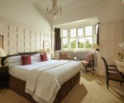
Hotels and Places to Stay
Hurley House Hotel
Macdonald Compleat Angler
Olde Bell Inn
Danesfield House Hotel & Spa
Malvern House
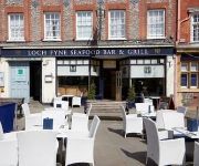
Loch Fyne Restaurant and Hotel Henley-on-Thames
HOTEL DU VIN HENLEY ON THAMES
Pinkneys Court Mews
Phyllis Court Club
JCT. 4 Holiday Inn HIGH WYCOMBE M40
Videos from this area
These are videos related to the place based on their proximity to this place.
Kings Hotel Stockenchurch | Hotel, Restaurant, Wedding and Conference Venue in Buckinghamshire
http://www.kingshoteluk.com | Hotel,Restaurant,Wedding & Conference Venue Buckinghamshire |http://youtu.be/rwIhXEwiNAs Kings Hotel Oxford Road Stokenchurch High Wycombe Buckinghamshire ...
Top Photoshop Tips
We all need a little help improving our photographs from time to time, and if you are one of those people looking at their photo's from the Christmas period and thinking that there is something...
A bit of a spin in an Ariel Atom
A bit of a spin, courtesy of Martyn Bell. The Ariel Atom has a 0-60mph in just under 2.9s if your quick enough on the gear change. Exhillarating experience, well recommended. See Jeremy Clarkson...
Eden Shopping Centre High Wycombe
Rio Carnival-style Exotic Dancers and Drummers at the Eden Launch Party.
Rescuing the Control Tower from RAF Booker (now Wycombe Air Park) 1997
Built around 1950 the Control Tower at RAF Booker was finally replaced by a new and more modern building in 1997. It was decided to rescue it and transport it back to Brooklands. The Brooklands...
Buckinghamshire Squash Championships 2015 Final
Final of the Buckinghamshire Squash Championships 2015 featuring Tom Power against Alex Preston played on Sunday 25th January 2015 at Wycombe Squash and Racketball Club.
Hambleden BE100 XC 2014
Deborah Boulton & Argento Dancer competing at Hambleden International - BE100 18.04.2014.
Purple Patch WoL Half Marathon #6
Purple Patch Water of Life Half Marathon #6 Sunday 20/03/2011. This video shot at Water Point 2 and shows the last runner (Susie Symes) returning to the water point having completed the 3...
Miss Marple and Midsomer Film Location December 6th 2014 HAMBLEDON
Hambledon, location for Miss Marple and many Midsomer episodes.
Videos provided by Youtube are under the copyright of their owners.
Attractions and noteworthy things
Distances are based on the centre of the city/town and sightseeing location. This list contains brief abstracts about monuments, holiday activities, national parcs, museums, organisations and more from the area as well as interesting facts about the region itself. Where available, you'll find the corresponding homepage. Otherwise the related wikipedia article.
Wheeler End
Wheeler End is a hamlet in the parish of Piddington and Wheeler End, in Buckinghamshire, England. The hamlet is located close to the main A40 between West Wycombe and Stokenchurch. The hamlet name refers to the Wheeler family, who lived here. They were once the main brewers of High Wycombe. The hamlet itself however, is much older, dating back to the Anglo-Saxon period. Wheeler End is a collection of terraced houses and free standing properties surrounding the village common.
Piddington, Buckinghamshire
Piddington is a hamlet in the parish of Piddington and Wheeler End in Buckinghamshire, England. It is located on the main A40 between Stokenchurch and West Wycombe. Piddington only dates back to the mid 19th century when it was a hamlet based around a pub called The Dashwood Arms. At the turn of the century, a furniture factory was established and the hamlet grew around it. The factory is no more, but a small light industrial area now stands on its site.
Hambleden Rural District
Hambleden was a rural district in Buckinghamshire, England from 1894 to 1934. It was formed under the Local Government Act 1894 from the Buckinghamshire part of the Henley Rural Sanitary District, the Oxfordshire part forming the Henley Rural District. It comprised the three civil parishes of: Fawley, Hambleden Medmenham It was abolished by a County Review Order in 1934, the parishes being added to the Wycombe Rural District.
Parmoor
Parmoor is a hamlet to the south of Frieth in the parish of Hambleden, in Buckinghamshire, England.
Greenlands
Greenlands is a country house situated by the River Thames in Buckinghamshire, just outside Henley-on-Thames. Built in the nineteenth century, it now forms the core of Greenlands Campus of the University of Reading, and is used by their Henley Business School as the base for its MBA and corporate learning offerings.
Cobstone Windmill
Cobstone Mill was built around 1816 and is located in the civil parish of Ibstone in Buckinghamshire, England, and overlooks the village of Turville. It is sometimes referred to as Turville Windmill. It is a smock mill that replaced the original mill that had stood there since the 16th century. The machinery was previously used in another mill in the village of Lacey Green. It was a working mill grinding cereal until 1873.
Bolter End
Bolter End is a hamlet 5 mi to the west of High Wycombe in Buckinghamshire, England. Bolter End lies on the B482 road that connects Stokenchurch and Marlow between Cadmore End and Lane End and where it is crossed by the Piddington to Fingest road. Bolter End is part of Lane End civil parish and is within Wycombe district. Bolter End Sand pit is a Site of Special Scientific Interest.
Ackhampstead
Ackhampstead (literally 'oak homestead' in Old English) or 'The Moor' was an ancient township in the Chiltern Hills, south of Lane End. Until 1844 it was a detached part of Oxfordshire in the parish of Lewknor, part of a division of the parish known as Lewknor Uphill consisting of three detached parts. It was transferred to Buckinghamshire by the Counties (Detached Parts) Act 1844. By the mid-nineteenth century the population of the community was negligible.


