Safety Score: 3,0 of 5.0 based on data from 9 authorites. Meaning we advice caution when travelling to United Kingdom.
Travel warnings are updated daily. Source: Travel Warning United Kingdom. Last Update: 2024-08-13 08:21:03
Delve into Dinton
Dinton in Buckinghamshire (England) with it's 253 habitants is located in United Kingdom about 38 mi (or 62 km) north-west of London, the country's capital town.
Current time in Dinton is now 03:18 AM (Friday). The local timezone is named Europe / London with an UTC offset of zero hours. We know of 11 airports close to Dinton, of which 5 are larger airports. The closest airport in United Kingdom is RAF Benson in a distance of 15 mi (or 24 km), South-West. Besides the airports, there are other travel options available (check left side).
There are several Unesco world heritage sites nearby. The closest heritage site in United Kingdom is Blenheim Palace in a distance of 11 mi (or 18 km), East. Also, if you like playing golf, there are some options within driving distance. We encountered 2 points of interest near this location. If you need a hotel, we compiled a list of available hotels close to the map centre further down the page.
While being here, you might want to pay a visit to some of the following locations: Aylesbury, Remenham, Calverton, Bisham and Shenley Church End. To further explore this place, just scroll down and browse the available info.
Local weather forecast
Todays Local Weather Conditions & Forecast: 8°C / 46 °F
| Morning Temperature | 4°C / 40 °F |
| Evening Temperature | 6°C / 43 °F |
| Night Temperature | 4°C / 40 °F |
| Chance of rainfall | 0% |
| Air Humidity | 82% |
| Air Pressure | 1028 hPa |
| Wind Speed | Light breeze with 5 km/h (3 mph) from North-East |
| Cloud Conditions | Overcast clouds, covering 100% of sky |
| General Conditions | Overcast clouds |
Saturday, 16th of November 2024
7°C (45 °F)
7°C (45 °F)
Broken clouds, gentle breeze.
Sunday, 17th of November 2024
8°C (46 °F)
3°C (37 °F)
Light rain, moderate breeze, broken clouds.
Monday, 18th of November 2024
5°C (42 °F)
3°C (38 °F)
Moderate rain, moderate breeze, overcast clouds.
Hotels and Places to Stay
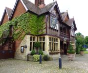
Five Arrows
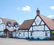
Peacock
Best Western Garden Court Aylesbury
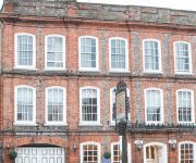
The Spread Eagle
Aylesbury
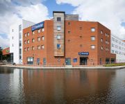
TRAVELODGE AYLESBURY
Videos from this area
These are videos related to the place based on their proximity to this place.
Chiltern Champion - D1015 Western Champion - 47773 - Aylesbury Vale Parkway to Claydon LNE Junction
Scenes from aboard the Chiltern Champion special from just north of Aylesbury Vale Parkway to Claydon L&NE Junction, a chord installed to connect the Great Central Main Line to the Varsity...
BBC Three Counties Radio visit Aylesbury parkrun 11-10-2014
BBC Three Counties Jonathan Vernon-Smith came to Aylesbury parkrun on 11th October 2014 as part of "Treasure Quest"
aylesbury parkway main rail infrastructure work
thsi is the main rail infrastructure work i got pictures of.
Chiltern Railways, Haddenham & Thame Parkway
Chiltern Railways class 168 and class 165 #165021 in Network Southeast livery seen at Haddenham & Thame Parkway station on 10 july 2003.
Fire at The Thame Show car park.
What happens when you park on a stubble field! The fire started under one car and then spread quickly under at least 20 before heading across the fields.
Towersey Plus
A Cotswold morris workshop with Towersey Morris at the Towersey Village Folk Festival culminating in a lunchtime performance at The Three Horseshoes.
Balloon Flight - 20th April 2013 - GoPro HD
Flight from Towersey, over Thame, to Worminghall. Great visibility during this flight meant we could see around 50 miles to London. Filmed using GoPro HD www.balloonatic84.co.uk.
Aero Balloon Flight - 16th Sept 2011 AM - GoPro HD
Flight from Thame Showground to Bainton in G-OAER. A quick flight covering 14nm is 45 minutes. Joined by Stu and Kerr in the basket. Filmed using GoPro HD www.balloonatic84.co.uk.
Waddesdon Sponsored Ride - Helmet Cam
A little video of the some of the helmet cam best bits from the 2012 Waddesdon Sponsored Ride in aid of the charities Special Effect and Riding for the Disabled amoung others (20.05.12). I...
The beast of Waddesdon
www.myblog.uk.com ... Time-lapse macro photography and animation of the life and death of an insect (1.3 millimetre) at magnification ratio of up to 3:1. The lens, a 120 mm Rodenstock 120mm...
Videos provided by Youtube are under the copyright of their owners.
Attractions and noteworthy things
Distances are based on the centre of the city/town and sightseeing location. This list contains brief abstracts about monuments, holiday activities, national parcs, museums, organisations and more from the area as well as interesting facts about the region itself. Where available, you'll find the corresponding homepage. Otherwise the related wikipedia article.
Eythrope
Eythrope (previously Ethorp) is a hamlet and country house in the parish of Waddesdon, in Buckinghamshire, England. It is located to the south east of the main village of Waddesdon. It was bought in the 1870s by a branch of the Rothschild family, and belongs to them to this day.
Ford, Buckinghamshire
Ford is a hamlet in the parish of Dinton-with-Ford and Upton, in Buckinghamshire, England. It is located in the south eastern corner of the main parish. The place name is Anglo Saxon in origin and refers simply to the place where a stream crosses the main road via a ford. The 16th Century pub in Ford is named after The Dinton Hermit. As well as being an old coaching inn on the main route between Aylesbury and Thame, it is also a building of historical significance.
Gibraltar, Buckinghamshire
Gibraltar is a hamlet in the parish of Dinton-with-Ford and Upton in Buckinghamshire, England. It is located on the modern main road that links Aylesbury with Thame. The hamlet is named after the British dependency of Gibraltar. In 2003, the public house in Gibraltar, called the Bottle and Glass, was gutted when the thatch of the pub roof caught fire following an electrical fault in the upper storey of the building. Following extensive rebuilding the Bottle and Glass reopened on 27 April 2007.
Westlington
Westlington is a hamlet near the village of Dinton in the civil parish of Dinton-with-Ford and Upton, Buckinghamshire, England.
Upton, Buckinghamshire
Upton is a hamlet in the parish of Dinton-with-Ford and Upton, in Buckinghamshire, England. It is located to the north of the main village of Dinton, on the junction between the new road from Aylesbury to Thame, and the old road before it was rerouted. The hamlet name is a common one in England, and means 'higher farm', referring in this case to the hamlet's location at the top of an adjacent hill to Dinton.
Dinton Castle
50x40pxThis article does not cite any references or sources. Please help improve this article by adding citations to reliable sources. Unsourced material may be challenged and removed. Dinton Castle (also known as Dinton Folly) is located just north of the village of Dinton, in Buckinghamshire and was built as an eyecatcher from Dinton Hall by Sir John Vanhatten in 1769. He used the castle to store his collection of fossils in the limestone walls. According to Rev.
Swan's Way (footpath)
Swan's Way is a long distance bridle route and footpath in Northamptonshire, Buckinghamshire and Oxfordshire, England. It runs 65 miles from Salcey Forest, Northamptonshire to Goring-On-Thames, Oxfordshire. Although designed primarily for horseriders, it is also a multi-use trail. For walkers the path links with the Ridgeway National Trail, the western end of the Icknield Way Path, the Ouse Valley Way and the Three Shires Way.
Dinton Cricket Club Ground
Dinton Cricket Club Ground is a cricket ground in Dinton, Buckinghamshire. The first recorded match on the ground was in 2001, when Buckinghamshire played the Worcestershire Cricket Board in a List-A match in the 1st round of the 2002 Cheltenham & Gloucester Trophy which was held in 2001. The following year the ground held its second List-A match when Buckinghamshire played Suffolk in the 1st round of the 2003 Cheltenham & Gloucester Trophy which was played in 2002.


