Safety Score: 3,0 of 5.0 based on data from 9 authorites. Meaning we advice caution when travelling to United Kingdom.
Travel warnings are updated daily. Source: Travel Warning United Kingdom. Last Update: 2024-08-13 08:21:03
Explore Shirehampton
Shirehampton in Bristol (England) is located in United Kingdom about 110 mi (or 176 km) west of London, the country's capital.
Local time in Shirehampton is now 06:40 AM (Friday). The local timezone is named Europe / London with an UTC offset of zero hours. We know of 10 airports in the wider vicinity of Shirehampton, of which 5 are larger airports. The closest airport in United Kingdom is Bristol Filton Airport in a distance of 4 mi (or 7 km), North-East. Besides the airports, there are other travel options available (check left side).
There are several Unesco world heritage sites nearby. The closest heritage site in United Kingdom is Blaenavon Industrial Landscape in a distance of 22 mi (or 36 km), North-West. Also, if you like golfing, there are multiple options in driving distance. We found 2 points of interest in the vicinity of this place. If you need a place to sleep, we compiled a list of available hotels close to the map centre further down the page.
Depending on your travel schedule, you might want to pay a visit to some of the following locations: Bristol, Dundry, Winford, Almondsbury and Brockley. To further explore this place, just scroll down and browse the available info.
Local weather forecast
Todays Local Weather Conditions & Forecast: 8°C / 47 °F
| Morning Temperature | 4°C / 40 °F |
| Evening Temperature | 7°C / 44 °F |
| Night Temperature | 6°C / 42 °F |
| Chance of rainfall | 0% |
| Air Humidity | 74% |
| Air Pressure | 1028 hPa |
| Wind Speed | Light breeze with 4 km/h (3 mph) from North-East |
| Cloud Conditions | Scattered clouds, covering 29% of sky |
| General Conditions | Scattered clouds |
Saturday, 16th of November 2024
9°C (49 °F)
8°C (46 °F)
Scattered clouds, gentle breeze.
Sunday, 17th of November 2024
9°C (48 °F)
6°C (43 °F)
Light rain, moderate breeze, overcast clouds.
Monday, 18th of November 2024
6°C (43 °F)
12°C (53 °F)
Moderate rain, fresh breeze, overcast clouds.
Hotels and Places to Stay
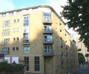
Hamilton Apartments
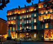
Radisson Blu Bristol
Hotel du Vin & Bistro Bristol
Bristol Marriott Royal Hotel
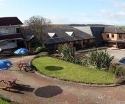
Green Island Resort
Marsh Apartments
Cotham Lawn apartments
Hamilton Apartments
ibis Bristol Centre
The Town and Country Lodge
Videos from this area
These are videos related to the place based on their proximity to this place.
CN11 GZA Potentially illegal motorcycles
Contour GPS 2013-05-05 Two motorcycles on the M5 just south of the Avonmouth Bridge, one of them without a license plate. They might not even be motorway leg...
Feral youth - blame the parents - Pill shops, near Bristol, Somerset
A feral child (also, colloquially, wild child) is a human child who has lived isolated from human contact from a very young age, and has no (or little) experience of human care, loving or social...
Cabinet 3rd October 2013
Bristol City Council cabinet meeting at Avonmouth Community Centre. 3rd October 2013, 6.00PM.
Dji Phantom Quadcopter, Test flight with GoPro 2
Test flight of the Dji Phantom Quadcopter, on Ham Green Hill, Pill, North Somerset. Weather was snowy with gusty wind at time. Dji Phantom Quadcopter, Footage captured on a GoPro 2.
The Long Ashton Cycle, 'More of The River Avon Trail', PART THIRTEEN, Aug 2012
This is just one Part(13) of 16 in total as I continue to explore 'My Beautiful Somerset'.The River Avon Trail is a journey into the past--it is steeped in history and many features confirm...
Avonmouth Truck Wash 2013 - black box data dash cam camera 1080p
Real 1080P full HD Resolution Digital Video with Seamless Loop Recording. LPW (Truckwash) Avonmouth - Third Way,. Avonmouth Docks,. Bristol. Postcode, BS11 9YP. Country, United Kingdom.
Kayak, On the Bristol River Avon
Kayak on the Bristol River Avon. Shirehampton to Clifton Suspension Bridge. Pictures, with The Alan Parsons Project. Shadow of a Lonely Man and Time.
Broke the speed limit
Always thought cyclists were unable to set off these signs due to their size, it seems not.
Simon Bunce Project
A belated birthday message to Simon Bunce for his 50th. Memories of UKC, especially Darwin College.
PureClean PowerBox - Torrent 400 Alternative!
The Ultimate High Pressure Parts Washer. Larger, more powerful alternative to Torrent 400 parts washer. A truly incredible parts washer.
Videos provided by Youtube are under the copyright of their owners.
Attractions and noteworthy things
Distances are based on the centre of the city/town and sightseeing location. This list contains brief abstracts about monuments, holiday activities, national parcs, museums, organisations and more from the area as well as interesting facts about the region itself. Where available, you'll find the corresponding homepage. Otherwise the related wikipedia article.
Avonmouth Bridge
The Avonmouth Bridge is a road bridge that carries the M5 motorway over the River Avon into Somerset near Bristol, England. The main span is 538 ft long, and the bridge is 4,554 ft long, with an air draught above mean high water level of 98.4 ft . It also has a separate footpath and cycleway.
Bristol Manor Farm F.C
Bristol Manor Farm F.C. is an English football team based in Bristol. They play in the Western Football League Premier Division. They play their home games at The Creek. The club is affiliated to the Gloucestershire County FA.
Bristol Port Railway and Pier
The Bristol Port Railway and Pier (occasionally referred to as the Bristol Port and Pier Railway) was a railway in Bristol, England.
Horseshoe Bend, Shirehampton
Horseshoe Bend, Shirehampton is a 4.45 hectare biological Site of Special Scientific Interest in Bristol, England, on the north bank of a lower, tidal stretch of the River Avon, 3 kilometres downstream from the Avon Gorge, and just east of the village of Shirehampton. It was notified as an SSSI in 1999.
Bewys Cross
The monument currently known as Bewys Cross is the steps, plinth and truncated shaft said to be of an ancient cross of uncertain age (?? early 15th century; the steps may well be later) which used to stand on the bank of the River Severn near what is now Avonmouth, Bristol, UK. It is marked as "Bevis Stone" on a map of 1772, close to where the River Avon used to flow into the Severn; the Avon has since the 1870s flowed into the Severn some way further south.
Kingsweston (ward)
Kingsweston is a ward of the city of Bristol. The three districts in the ward are Coombe Dingle, Lawrence Weston and Sea Mills. The ward takes its name from the old district of Kings Weston (usually spelt in two words), now generally considered part of Lawrence Weston.
Leigh Court
Leigh Court is a country house which is a Grade II* listed building in Abbots Leigh, Somerset, England. The manor of Leigh at the time of the Norman Conquest belonged to the lordship of Bedminster but William the Conqueror awarded it to the Bishop of Coutances. The manor house was given in 1118 by Robert Fitzharding to become a house of rest for the abbot and monks of St Augustine's Monastery in Bristol and as "Abbot's Leigh" it was destinguished from other places named "Leigh".
Lamplighters Marsh
Lamplighters Marsh is a public open space near Shirehampton in the city of Bristol, England. It is a narrow strip of land between the railway line which connects Bristol to Avonmouth, and the River Avon. The site contains two main types of vegtation: an area of marsh, which contains a varied plant community, including Water Parsnip and Wild Celery, and an area of wasteland which is also botanically notable, with species including Narrow-leaved Everlasting-pea.


