Safety Score: 3,0 of 5.0 based on data from 9 authorites. Meaning we advice caution when travelling to United Kingdom.
Travel warnings are updated daily. Source: Travel Warning United Kingdom. Last Update: 2024-08-13 08:21:03
Explore Brighton Marina Village
The district Brighton Marina Village of in Brighton and Hove (England) is located in United Kingdom about 48 mi south of London, the country's capital.
If you need a place to sleep, we compiled a list of available hotels close to the map centre further down the page.
Depending on your travel schedule, you might want to pay a visit to some of the following locations: Rottingdean, Brighton, Lewes, Fulking and Henfield. To further explore this place, just scroll down and browse the available info.
Local weather forecast
Todays Local Weather Conditions & Forecast: 10°C / 49 °F
| Morning Temperature | 9°C / 47 °F |
| Evening Temperature | 11°C / 52 °F |
| Night Temperature | 11°C / 52 °F |
| Chance of rainfall | 0% |
| Air Humidity | 78% |
| Air Pressure | 1020 hPa |
| Wind Speed | Moderate breeze with 11 km/h (7 mph) from East |
| Cloud Conditions | Broken clouds, covering 78% of sky |
| General Conditions | Light rain |
Sunday, 17th of November 2024
9°C (47 °F)
7°C (44 °F)
Light rain, moderate breeze, overcast clouds.
Monday, 18th of November 2024
12°C (54 °F)
13°C (55 °F)
Moderate rain, high wind, near gale, overcast clouds.
Tuesday, 19th of November 2024
5°C (41 °F)
3°C (38 °F)
Rain and snow, strong breeze, overcast clouds.
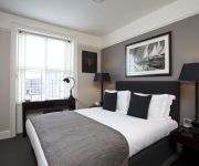
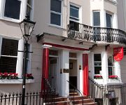
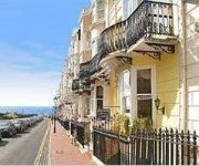
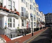
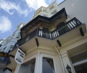
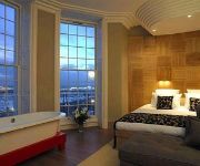
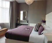
Hotels and Places to Stay
The Charm - Brighton Boutique Hotel
Kemp Townhouse
Birch at Brighton Marina
New Steine
Gullivers
Five Brighton
Marine View
Drakes of Brighton
A Room With A View
Brighton Inn Boutique Guest Accommodation
Videos from this area
These are videos related to the place based on their proximity to this place.
Brighton Kite Jumping EXTREME
Check out these lunatics usings kites to do things like backflips and massive jumps!!
Brighton Calling — by EF International Language Centers
Learn more about EF Brighton at http://www.ef.com/ef-brighton Brighton is calling - study English at EF Brighton! EF International Language Centre Brighton 1-2 Sussex Square Brighton BN2...
Fantastic sight and sound of Gigantic climbing Wilson Avenue, Brighton.
Taken February 20th after a damp and rainy day outside the Brighton Centre after the 2015 Brighton Model World.
Brighton Marina. E.Sussex. UK.
Brighton marina has become one of Brighton's main attractions. A place where you can enjoy good food, entertainment, and view yachts which you could only afford in your dreams. The waterfront...
Sheetbend Knots- Sailing Knots from Neilson Active Holidays
This knot is great for tying two separate ropes together. To really practice this one, it might be worth grabbing another rope. If youre a little rusty with your sailing knots or just want...
Figure of 8 Knots- Sailing Knots from Neilson Active Holidays
This is a good stopper knot that saves the rope from escaping. If youre a little rusty with your sailing knots or just want learn the basics before your sailing holiday, or even watch one...
Sea Fishing Brighton Marina with Chater Boat Seabreeze3
Deep sea fishing from Brighton Marina with the charter boat SeaBeeze3. In this boat trip we are fishing for Bass off the south coast, where you can also book hire for Cod, Conger, Ling, Black...
Whitehawk F.C. Champions 2012-13 pictures by JJ Waller
A photo essay by JJ Waller showing Whitehawk F.C being presented the Ryman championship cup. Next season the club will be renamed Brighton City and play in the Conference League. Thanks...
Videos provided by Youtube are under the copyright of their owners.
Attractions and noteworthy things
Distances are based on the centre of the city/town and sightseeing location. This list contains brief abstracts about monuments, holiday activities, national parcs, museums, organisations and more from the area as well as interesting facts about the region itself. Where available, you'll find the corresponding homepage. Otherwise the related wikipedia article.
Kemp Town
Kemp Town is a 19th Century residential estate in the east of Brighton in East Sussex, England, UK. Conceived and financed by Thomas Read Kemp it has given its name to the larger Kemptown region of Brighton. The estate was designed by Charles Busby and Amon Henry Wilds and constructed by Thomas Cubitt. Building work started in 1823 on Arundel Terrace, Chichester Terrace, Lewes Crescent and Sussex Square. Chichester Terrace incorporated the earlier Chichester House.
Kemptown, Brighton
Kemptown is a small community running along the King's Cliff to Black Rock in the east of Brighton, East Sussex, England.
Volk's Electric Railway
Volk's Electric Railway (VER) is the oldest operating electric railway in the world. It is a narrow gauge railway that runs along a length of the seafront of the English seaside resort of Brighton. It was built by Magnus Volk, the first section being completed in August 1883.
Whitehawk
Whitehawk is a suburb in the east of Brighton, part of the English city of Brighton and Hove. The area is a large, modern housing estate built in a downland dry valley historically known as Whitehawk Bottom. The estate was originally developed by the local authority between 1933 and 1937 and included nearly 1,200 residences.
Royal Sussex County Hospital
The Royal Sussex County Hospital is an acute teaching hospital in Brighton, England. Together with the Princess Royal Hospital (Haywards Heath), it is administered by the Brighton and Sussex University Hospitals NHS Trust. The services provided at the hospital include an Emergency Department, cancer services at the Sussex Cancer Centre, cardiac surgery, maternity services, and both adult and neonatal intensive care units.
Kemp Town railway station
Kemp Town railway station, sometimes referred to as Kemptown railway station, was a terminus station in Kemptown, Brighton (now part of the city of Brighton and Hove), East Sussex, England, on a (now closed) branch line which terminated at Kemp Town station. This line branched off the East Coastway Line a short distance from the Ditchling Road tunnel, between London Road and Moulsecoomb stations. The branch line and all its stations are no longer extant.
Whitehawk F.C
Whitehawk F.C. is a football club based in Whitehawk, in Brighton, England. They play in the Isthmian League Premier Division.
Woodingdean
Woodingdean is an eastern suburb of the city of Brighton and Hove, East Sussex, separated from the main part of the city by downland and the Brighton Racecourse.
Ovingdean
Ovingdean is a small formerly agricultural village in Brighton and Hove, East Sussex, England.
Queen's Park, Brighton
Queen's Park is an administrative ward and a public park in Brighton, England. The area lies to the east of the centre of Brighton, north of Kemptown and south-east of Hanover. It is largely made up of Victorian terraced houses, with a smaller number of detached and semi-detached houses. There are also a number of low-rise blocks of modern flats.
Roedean, East Sussex
Roedean is immediately to the east of the seaside resort of Brighton, England. It is administratively part of the city of Brighton and Hove.
Brighton Racecourse
Brighton Racecourse is an English horse racing course located a mile to the northeast of the centre of Brighton, Sussex owned by Northern Racing. It is situated on Whitehawk Hill, on the edge of the South Downs about four hundred feet above sea level and a mile from the coast. The track takes the form of a horseshoe one and a half miles in length. The finishing straight is about four furlongs in length, with a steep descent followed by a slightly less steep climb to the winning post.
St George's Church, Brighton
St George's Church is an Anglican church in the Kemptown area of Brighton, in the English city of Brighton and Hove. It was built at the request of Thomas Read Kemp, who had created and financed the Kemp Town estate on the cliffs east of Brighton in the early 19th century, and is now regarded as the parish church of the wider Kemptown area. It is a Grade II listed building.
St John the Baptist's Church, Brighton
St John the Baptist's Church is a Roman Catholic church in the Kemptown area of the English city of Brighton and Hove. It was the first Roman Catholic church built in Brighton after the process of Catholic Emancipation in the early 19th century removed restrictions on Catholic worship. Located on Bristol Road, a main road east of the city centre, it is one of 11 Catholic churches in Brighton and Hove.
St Wulfran's Church, Ovingdean
St Wulfran's Church, dedicated to Wulfram of Sens, a 7th-century French archbishop, is an Anglican church in Ovingdean, a rural village now within the English city of Brighton and Hove. Parts of the structure date from the early 12th century, and the church is listed at Grade I, a designation used for buildings "of outstanding architectural or historic interest".
Black Rock (Brighton and Hove)
Black Rock is an area of undeveloped land located near Brighton Marina in the city of Brighton and Hove. It was previously the site of a swimming pool that was demolished in the 1970s.
St Luke's Church, Queen's Park, Brighton
St Luke's Church is an Anglican church in the Queen's Park area of Brighton, part of the English city of Brighton and Hove. Occupying a large corner site on Queen's Park Road, it was designed in the 1880s by Sir Arthur Blomfield in the Early English style, and has been given listed building status because of its architectural importance.
Fife House
Fife House is a Grade I listed building in Kemp Town, Brighton, United Kingdom, which was previously owned by the Duke of Devonshire and the Duke of Fife; it is not to be confused with the former Fife House, Whitehall, in London.
Pepper Pot, Brighton
The Pepper Pot, also known as the Pepperpot, the Pepper Box or simply The Tower, is a listed building in the Queen's Park area of the English city of Brighton and Hove. Designed and built in 1830 by architect Charles Barry in the grounds of a villa built for the owner of Queen's Park, it survived the villa's demolition and is now one of its only surviving remnants.
St Mary the Virgin, Brighton
St Mary the Virgin Church is an Anglican church in the Kemptown area of Brighton, in the English city of Brighton and Hove. The present building dates from the late 1870s and replaced a church of the same name which suddenly collapsed while being renovated. The Gothic-style red-brick building, whose style resembles Early English revival and French Gothic revival, is now a Grade II* listed building, and remains in use despite threats of closure.
Radio Reverb
RadioReverb 97.2FM is a Brighton based non-profit community radio station. The station is based on the Old Steine and is supported by Earshot.
Brighton Speed Trials
The Brighton Speed Trials, in full The Brighton National Speed Trials, is commonly held to be the oldest running motor race. The first race was held July 19–22, 1905 after Sir Harry Preston persuaded Brighton town council to tarmac the surface of the road adjacent to the beach between the Brighton Pier|Palace Pier]] and Black Rock in order to hold motor racing events.
St Wilfrid's Church, Brighton
St Wilfrid's Church is a former Anglican church in Brighton, part of the English city of Brighton and Hove. Designed and built in the 1930s to replace a temporary building in the densely populated Elm Grove area, its unusual design—not conforming with architectural norms of the era—was widely praised. It was declared redundant after less than 50 years as a place of worship, and was converted into sheltered housing with minimal alteration to the exterior.
St Mark's Church, Brighton
St Mark's Church is a former Anglican church in the Kemptown area of Brighton, part of the English city of Brighton and Hove. Originally intended as the private chapel of the adjacent St Mary's Hall school, it was partly built in 1838 at the request of Frederick Hervey, 1st Marquess of Bristol; but arguments over whether or not it should also be open to the public delayed its completion for more than 10 years.
Sassoon Mausoleum
The Sassoon Mausoleum is the former grave of Sir Albert Sassoon and other members of his family, including Sir Edward Sassoon, 2nd Baronet, of Kensington Gore. It stands at 83 St. George's Road in Brighton, England.


