Safety Score: 3,0 of 5.0 based on data from 9 authorites. Meaning we advice caution when travelling to United Kingdom.
Travel warnings are updated daily. Source: Travel Warning United Kingdom. Last Update: 2024-08-13 08:21:03
Explore Bierley
Bierley in Bradford (England) is located in United Kingdom about 170 mi (or 273 km) north-west of London, the country's capital.
Local time in Bierley is now 09:40 PM (Sunday). The local timezone is named Europe / London with an UTC offset of zero hours. We know of 9 airports in the wider vicinity of Bierley, of which 5 are larger airports. The closest airport in United Kingdom is Leeds Bradford Airport in a distance of 7 mi (or 12 km), North-East. Besides the airports, there are other travel options available (check left side).
There are several Unesco world heritage sites nearby. The closest heritage site in United Kingdom is Liverpool – Maritime Mercantile City in a distance of 39 mi (or 63 km), South-East. Also, if you like golfing, there are multiple options in driving distance. If you need a place to sleep, we compiled a list of available hotels close to the map centre further down the page.
Depending on your travel schedule, you might want to pay a visit to some of the following locations: Bradford, Drighlington, Clayton, Baildon and Mirfield. To further explore this place, just scroll down and browse the available info.
Local weather forecast
Todays Local Weather Conditions & Forecast: 7°C / 44 °F
| Morning Temperature | 5°C / 42 °F |
| Evening Temperature | 6°C / 43 °F |
| Night Temperature | 5°C / 40 °F |
| Chance of rainfall | 2% |
| Air Humidity | 76% |
| Air Pressure | 1013 hPa |
| Wind Speed | Gentle Breeze with 8 km/h (5 mph) from East |
| Cloud Conditions | Few clouds, covering 24% of sky |
| General Conditions | Light rain |
Monday, 18th of November 2024
4°C (39 °F)
0°C (32 °F)
Snow, gentle breeze, overcast clouds.
Tuesday, 19th of November 2024
-0°C (31 °F)
-3°C (26 °F)
Snow, moderate breeze, broken clouds.
Wednesday, 20th of November 2024
1°C (33 °F)
-2°C (29 °F)
Snow, gentle breeze, few clouds.
Hotels and Places to Stay
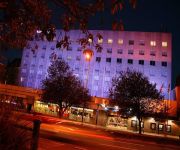
The Bradford
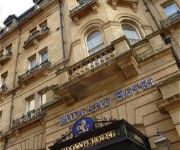
MIDLAND HOTEL
Clarion Collection Cedar Court Hotel Bradford
Campanile Bradford
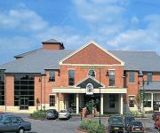
Gomersal Park Hotel and Leisure Club
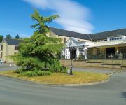
Holiday Inn LEEDS - BRIGHOUSE
Healds Hall West Yorkshire
Great Victoria Hotel
Best Western Guide Post
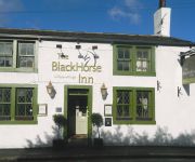
Black Horse Inn
Videos from this area
These are videos related to the place based on their proximity to this place.
Electric Tram Rides from Forster Square, Bradford (1902) | BFI
Electric Tram Rides from Forster Square, Bradford (1902) | BFI. Subscribe: http://bit.ly/subscribetotheBFI The BFI DVD 'Electric Edwardians: The Films of Mitchell and Kenyon' is available...
Bradford Coronation Procession (1902)
The BFI DVD 'Electric Edwardians: The Films of Mitchell and Kenyon' is available to buy at http://filmstore.bfi.org.uk/acatalog/info_107.html This film is part of the Mitchell and Kenyon...
Bradford Storm vs Huddersfield - Varsity 2012 Rugby League
Bradford University vs Huddersfield University Rugby League Varsity - 21st March 2012.
Tanks in Action 4 - Yorkshire Wartime Experience 2013
Filmed on the Sunday 7th July 2013 at the Yorkshire Wartime Experience, Hunsworth, near Cleckheaton. You might notice that the video is baised towards me and my Daimler Ferret, and my friends...
Tanks in Action 5 - Yorkshire Wartime Experience 2013
Filmed on the Sunday 7th July 2013 at the Yorkshire Wartime Experience, Hunsworth, near Cleckheaton. You might notice that the video is baised towards me and my Daimler Ferret, and my friends...
Tanks in Action 8 - Yorkshire Wartime Experience 2013
Filmed on the Sunday 7th July 2013 at the Yorkshire Wartime Experience, Hunsworth, near Cleckheaton. You might notice that the video is baised towards me and my Daimler Ferret, and my friends...
Tanks in Action 7 - Yorkshire Wartime Experience 2013
Filmed on the Sunday 7th July 2013 at the Yorkshire Wartime Experience, Hunsworth, near Cleckheaton. You might notice that the video is baised towards me and my Daimler Ferret, and my friends...
Tanks in Action 1 - Yorkshire Wartime Experience 2013
Filmed on the Sunday 7th July 2013 at the Yorkshire Wartime Experience, Hunsworth, near Cleckheaton. You might notice that the video is baised towards me and my Daimler Ferret, and my friends...
Tanks in Action 3 - Yorkshire Wartime Experience 2013
Filmed on the Sunday 7th July 2013 at the Yorkshire Wartime Experience, Hunsworth, near Cleckheaton. You might notice that the video is baised towards me and my Daimler Ferret, and my friends...
Videos provided by Youtube are under the copyright of their owners.
Attractions and noteworthy things
Distances are based on the centre of the city/town and sightseeing location. This list contains brief abstracts about monuments, holiday activities, national parcs, museums, organisations and more from the area as well as interesting facts about the region itself. Where available, you'll find the corresponding homepage. Otherwise the related wikipedia article.
East Bowling
East Bowling is an area of Bradford, West Yorkshire, England, located approximately one mile south of Bradford city centre. It is roughly bordered by Wakefield Road, Rooley Lane and Bowling Hall Road/ Hall Lane.
Odsal Stadium
Odsal Stadium, also known as Provident Stadium through sponsorship rights, is a large outdoor sports stadium situated in Odsal near Wibsey, Bradford, West Yorkshire. The venue has been home to the Rugby League side Bradford Bulls (formerly Bradford Northern) since 1934. It is the largest stadium in the European Super League The stadium is currently owned by the Rugby Football League who purchased it in 2012 and rent it to Bradford Bulls.
Bolling Hall, Bradford
Bolling Hall is one of the oldest buildings in Bradford, West Yorkshire, England. It is currently used as a museum and education centre. The building is about a mile from the centre of Bradford. Its surroundings are suburban in character. Before the Industrial Revolution, Bradford was a small town and difficult to defend as it lay in a basin. However, Bolling Hall occupies a commanding position on a hillside.
Cutler Heights
Cutler Heights is a district of Bradford, West Yorkshire, England. It is known for its many industrial estates.
Dudley Hill railway station
Dudley Hill railway station was a railway station that served Dudley Hill, West Yorkshire, England.
Transperience
Transperience was a short-lived museum of passenger transport located at Low Moor, in the south of Bradford, England. It opened in July 1995, but closed only 2 years later in October 1997, with debts of over £1 million.
Staithgate
Staithgate is a Community in the City of Bradford, West Yorkshire, England. The postcode serving Staithgate: BD6. The community is near the M606 motorway.
Bowling Park, Bradford
Bowling Park is a public urban park near Bolling Hall in Bradford, West Yorkshire, UK about 1.5 km south south east from the city centre. The park is irregularly shaped with an area of 20 hectares and is bounded by Bowling Hall Road, Burras Road, Bowling Memorial Cemetery, Parkside Road, Avenue Road, Bowling Park Allotments and Bowling Park Drive (formerly New Hey Road).


