Safety Score: 3,0 of 5.0 based on data from 9 authorites. Meaning we advice caution when travelling to United Kingdom.
Travel warnings are updated daily. Source: Travel Warning United Kingdom. Last Update: 2024-08-13 08:21:03
Explore Orsett
Orsett in Borough of Thurrock (England) with it's 1,267 inhabitants is located in United Kingdom about 21 mi (or 34 km) east of London, the country's capital.
Local time in Orsett is now 05:44 PM (Friday). The local timezone is named Europe / London with an UTC offset of zero hours. We know of 8 airports in the wider vicinity of Orsett, of which 5 are larger airports. The closest airport in United Kingdom is London City Airport in a distance of 13 mi (or 22 km), West. Besides the airports, there are other travel options available (check left side).
There are several Unesco world heritage sites nearby. The closest heritage site in United Kingdom is Royal Botanic Gardens, Kew in a distance of 4 mi (or 6 km), South-West. Also, if you like golfing, there are multiple options in driving distance. We found 1 points of interest in the vicinity of this place. If you need a place to sleep, we compiled a list of available hotels close to the map centre further down the page.
Depending on your travel schedule, you might want to pay a visit to some of the following locations: Grays, Cuxton, Cooling, Halling and Rochester. To further explore this place, just scroll down and browse the available info.
Local weather forecast
Todays Local Weather Conditions & Forecast: 10°C / 49 °F
| Morning Temperature | 7°C / 45 °F |
| Evening Temperature | 9°C / 47 °F |
| Night Temperature | 7°C / 44 °F |
| Chance of rainfall | 0% |
| Air Humidity | 73% |
| Air Pressure | 1028 hPa |
| Wind Speed | Light breeze with 4 km/h (2 mph) from North-East |
| Cloud Conditions | Broken clouds, covering 77% of sky |
| General Conditions | Broken clouds |
Saturday, 16th of November 2024
9°C (48 °F)
9°C (49 °F)
Light rain, gentle breeze, overcast clouds.
Sunday, 17th of November 2024
9°C (48 °F)
5°C (41 °F)
Broken clouds, moderate breeze.
Monday, 18th of November 2024
10°C (50 °F)
11°C (53 °F)
Moderate rain, moderate breeze, overcast clouds.
Hotels and Places to Stay
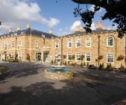
Orsett Hall
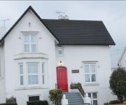
Jessamine House
Derougemont Manor Hotel & Suites
The Clarendon Royal Hotel
TRAVELODGE BRENTWOOD EAST HORNDON
Basildon South
Campanile Basildon
Gravesend Central
Videos from this area
These are videos related to the place based on their proximity to this place.
New Year 2014 - Grays, Essex, England
It was dark, (naturally), cold, (of course), and it was noisey - with horns from the river, (Thames), and a bazillion rockets & fireworks going off everywhere! :)
UFO A13 Grays Essex UK. 27/10/11
UFO in Essex above A13 near Grays.UK 27/10/11. Spotted by Keiron Gall. Feel free to comment even if you are from the government and say "its fake and gay". Like you always do.(be original)
CAR FIRE - BRADLEIGH AVENUE GRAYS ESSEX 25.06.12
A car exploded on Bradleigh Avenue, Grays Essex at 6.15pm on Monday 25th June 2012. It happened right outside our flat! No-one was hurt and the road wasn't closed off - but boy what a fire...
Montgomery Close, North Grays, Essex
Montgomery Close, North Grays. A modern two bedroom semi detached bungalow. Presented by Porter Glenny Estate Agents. Call 01375 374444 to view. Filmed & Edited by Leigh Dawney.
OLYMPIC TORCH - GRAYS, ESSEX - LAUREN BEARD TO KIRK CROSS
OLYMPIC TORCH - GRAYS, ESSEX - LAUREN BEARD TO KIRK CROSS - this was the huge event in Grays today. The Olympic torch came to town! Here was the changeover at the bottom our our road ...
2009 04 04 York City
Grays Athletic 1 (Pugh 38) - York City 0 Blue Square Premier Saturday 4th April 2009 Grays Team: Arnold, Long, Stuart, Elliott, Taylor(Slabber 79), Pugh, Welsh, Wilnis, Cogan, Beavan, Thurgood...
Olympic Torch Relay 6th July 2012 - Grays, Essex
Footage of the London 2012 Olympic Torch Relay. Taken in Grays, Essex at the junction of Lodge Lane and Southend Road. Includes all the build-up from the sponsors and various Olympic Vehicles....
Meadow View North Grays, Essex
Newly built four bedroom house. Presented by Porter Glenny Estate Agents. Call 01375 374444 to view. Filmed & Edited by Leigh Dawney. www.leighdawneyphotography.com.
Videos provided by Youtube are under the copyright of their owners.
Attractions and noteworthy things
Distances are based on the centre of the city/town and sightseeing location. This list contains brief abstracts about monuments, holiday activities, national parcs, museums, organisations and more from the area as well as interesting facts about the region itself. Where available, you'll find the corresponding homepage. Otherwise the related wikipedia article.
A13 road (England)
The A13 is a major road in England linking Central London with east London and south Essex. Its route is similar to the route of the London, Tilbury and Southend Railway, and runs the entire length of the northern Thames Gateway area, terminating on the Thames Estuary at Shoeburyness. It is a Trunk Road as far as the Tilbury turn-off, a primary route between there and Sadlers Hall Farm near South Benfleet, and a non-primary route between there and Shoeburyness.
Basildon (UK Parliament constituency)
Basildon was a parliamentary constituency represented in the House of Commons of the Parliament of the United Kingdom. It elected one Member of Parliament (MP) by the first past the post system of election. It was created in 1974, mostly from the seat of Billericay. It was one of the best known bellwether constituencies in the Britain, having voted for the winning party in each election since its creation.
Thurrock Urban District
Thurrock was a local government district and civil parish in south Essex, England from 1936 to 1974.
Orsett Rural District
Orsett Rural District was a local government district in south Essex, England from 1894 to 1936. It was formed as a rural district in 1894. From 1835, the constituent parishes had made up the Orsett Poor Law Union and from 1875 they also formed the Orsett RSD.
Orsett Hall
Orsett Hall was a 17th century grade 2 listed building in Orsett, Essex (de-listed on 10 March 2008). It was set in 12 acres of parkland and was the centre of the Orsett Hall agricultural estate. The house was destroyed by fire on 11 May 2007 and rebuilt in the same style and on the same footprint as the original building in 2009.
Baker Street Mill, Orsett
Baker Street Mill is a grade II listed Smock mill at Baker Street, Orsett, Essex, England which has been part adapted to residential use on its lower 2 floors only.
The Dell (Thurrock)
The Dell is a house in Grays built in concrete - one of the earliest houses in Britain to be built in this material. It was built on the instructions of Alfred Russel Wallace who lived in Grays from 1872 until 1876.
Orsett Heath
Orsett Heath is a location and recently built hamlet in the unitary authority of Thurrock, in the ceremonial county of Essex. It is located about twenty miles away from London. Nearby settlements include the towns of Tilbury and Grays Thurrock and the villages of Orsett and Chadwell St Mary. For transport there is the A13 road (England), the A1089 road and the A1013 road nearby. The nearest railway station is Tilbury Town railway station.


