Safety Score: 3,0 of 5.0 based on data from 9 authorites. Meaning we advice caution when travelling to United Kingdom.
Travel warnings are updated daily. Source: Travel Warning United Kingdom. Last Update: 2024-08-13 08:21:03
Explore Horndon on the Hill
Horndon on the Hill in Borough of Thurrock (England) with it's 1,596 inhabitants is located in United Kingdom about 23 mi (or 37 km) east of London, the country's capital.
Local time in Horndon on the Hill is now 05:37 PM (Friday). The local timezone is named Europe / London with an UTC offset of zero hours. We know of 8 airports in the wider vicinity of Horndon on the Hill, of which 5 are larger airports. The closest airport in United Kingdom is Southend Airport in a distance of 13 mi (or 21 km), East. Besides the airports, there are other travel options available (check left side).
There are several Unesco world heritage sites nearby. The closest heritage site in United Kingdom is Royal Botanic Gardens, Kew in a distance of 6 mi (or 9 km), South-West. Also, if you like golfing, there are multiple options in driving distance. We found 1 points of interest in the vicinity of this place. If you need a place to sleep, we compiled a list of available hotels close to the map centre further down the page.
Depending on your travel schedule, you might want to pay a visit to some of the following locations: Grays, Cooling, Cuxton, High Halstow and Rochester. To further explore this place, just scroll down and browse the available info.
Local weather forecast
Todays Local Weather Conditions & Forecast: 10°C / 50 °F
| Morning Temperature | 7°C / 45 °F |
| Evening Temperature | 9°C / 48 °F |
| Night Temperature | 6°C / 43 °F |
| Chance of rainfall | 0% |
| Air Humidity | 70% |
| Air Pressure | 1027 hPa |
| Wind Speed | Light breeze with 5 km/h (3 mph) from North-East |
| Cloud Conditions | Broken clouds, covering 78% of sky |
| General Conditions | Broken clouds |
Saturday, 16th of November 2024
9°C (48 °F)
9°C (47 °F)
Light rain, gentle breeze, overcast clouds.
Sunday, 17th of November 2024
8°C (47 °F)
4°C (40 °F)
Light rain, moderate breeze, broken clouds.
Monday, 18th of November 2024
10°C (49 °F)
12°C (53 °F)
Moderate rain, fresh breeze, overcast clouds.
Hotels and Places to Stay
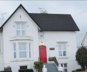
Jessamine House
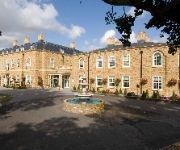
Orsett Hall
Holiday Inn BASILDON
The Clarendon Royal Hotel
Basildon South
Campanile Basildon
TRAVELODGE BRENTWOOD EAST HORNDON
TRAVELODGE BASILDON
Basildon (Festival Park)
Videos from this area
These are videos related to the place based on their proximity to this place.
UFO A13 Grays Essex UK. 27/10/11
UFO in Essex above A13 near Grays.UK 27/10/11. Spotted by Keiron Gall. Feel free to comment even if you are from the government and say "its fake and gay". Like you always do.(be original)
Window Cleaner in Basildon
http://www.tnt-cleaning.co.uk Looking for a window cleaner in Basildon, Essex? TnT Window Cleaning are a small, family business located in Langdon Hills, Basildon. We provide residential...
Basildon JOTA 2014
Basildon JOTA 2014 - "Jamboree On The Air" for cubs and scouts from the 1st Laindon, 9th Basildon and 1st Pitsea & Vange troops. Amateur radio guest messages, high altitude balloons and more....
St Margaret's Church Point Cloud Tour
3D Laser Scan point cloud tour of St Margaret's Church Stanford Le Hope. The Church was scanned utilizing a Faro Focus 3D laser scanner. Approximately 90 scans were completed with over half...
High/Low - Forty (Danfest, 02/08/2014)
Forty High/Low Danfest 2014, Crooked Billet, Stanford Le Hope (2nd Aug 2014)
Herida - Bleed (Danfest, 02/08/2014)
Bleed Herida Danfest 2014, Crooked Billet, Stanford Le Hope (2nd Aug 2014) http://www.herida.co.uk http://www.facebook.com/heridaband http://www.twitter.com/Herida_uk ...
Pure DC - Live Wire (Danfest, 02/08/2014)
Live Wire Pure DC Danfest 2014, Crooked Billet, Stanford Le Hope (2nd Aug 2014) http://www.facebook.com/Pure.DC.band.
Rat Face Lewey - Eagle Eyes/Killing Strangers (Danfest, 02/08/2014)
Track 1 Rat Face Lewey Danfest 2014, Crooked Billet, Stanford Le Hope (2nd Aug 2014) http://www.ratfacelewey.co.uk http://www.facebook.com/Ratfacelewey.
Pure DC - The Jack (Danfest, 02/08/2014)
The Jack Pure DC Danfest, Crooked Billet, Stanford Le Hope (2nd Aug 2014) http://www.facebook.com/Pure.DC.band.
Herida - Elias (Danfest, 02/08/2014)
Elias Herida Danfest 2014, Crooked Billet, Stanford Le Hope (2nd Aug 2014) http://www.herida.co.uk http://www.facebook.com/heridaband http://www.twitter.com/Herida_uk ...
Videos provided by Youtube are under the copyright of their owners.
Attractions and noteworthy things
Distances are based on the centre of the city/town and sightseeing location. This list contains brief abstracts about monuments, holiday activities, national parcs, museums, organisations and more from the area as well as interesting facts about the region itself. Where available, you'll find the corresponding homepage. Otherwise the related wikipedia article.
Thurrock
Thurrock is a unitary authority with borough status in the English ceremonial county of Essex. It is part of the London commuter belt and an area of regeneration within the Thames Gateway redevelopment zone. The local authority is Thurrock Council.
A13 road (England)
The A13 is a major road in England linking Central London with east London and south Essex. Its route is similar to the route of the London, Tilbury and Southend Railway, and runs the entire length of the northern Thames Gateway area, terminating on the Thames Estuary at Shoeburyness. It is a Trunk Road as far as the Tilbury turn-off, a primary route between there and Sadlers Hall Farm near South Benfleet, and a non-primary route between there and Shoeburyness.
Basildon (UK Parliament constituency)
Basildon was a parliamentary constituency represented in the House of Commons of the Parliament of the United Kingdom. It elected one Member of Parliament (MP) by the first past the post system of election. It was created in 1974, mostly from the seat of Billericay. It was one of the best known bellwether constituencies in the Britain, having voted for the winning party in each election since its creation.
Stanford-le-Hope railway station
Stanford-le-Hope railway station is a railway station located in the town of Stanford-le-Hope in the borough and unitary authority of Thurrock in the East of England. It was opened in September 1854, and was initially called Horndon, as part of the London, Tilbury and Southend Railway when the railway was extended from Tilbury to Low Street (closed), terminating at Stanford-le-Hope until the next section of railway was opened a year later. Passenger train services are provided by c2c.
East Tilbury railway station
East Tilbury railway station is a railway station located in the village of East Tilbury in the borough and unitary authority of Thurrock in the East of England. It was opened on 7 September 1936 as a halt on the London, Tilbury and Southend Railway. It was intended to serve workers at the Bata Shoe company and the company paid for the construction of the platforms. Initially, trains only stopped in the rush hour. The halt was given station status in January 1949.
Barstable Hundred
Barstable was a Hundred in the English County of Essex. Both the hundred and the manor with the same name are mentioned in the Domesday Book. A number of parishes in the western part of the Barstable hundred are now in Thurrock.
Mucking
Mucking is a hamlet and former Church of England parish adjoining the Thames estuary in southern Essex, England. It is located approximately 2 miles south of the town of Stanford le Hope in what is now Thurrock unitary authority.
Dunton Plotlands
The Dunton Plotlands was an area of small rural plots of land in southern Essex inhabited from the 1930s to the 1980s. The 'plotlands' consisted of small plots of land sold in the first half of the 20th century to people who built weekend cottages, holiday bungalows or smallholdings there. Many of the people building weekend cottages here would have come out from London.


