Safety Score: 3,0 of 5.0 based on data from 9 authorites. Meaning we advice caution when travelling to United Kingdom.
Travel warnings are updated daily. Source: Travel Warning United Kingdom. Last Update: 2024-08-13 08:21:03
Delve into Chafford Hundred
The district Chafford Hundred of in Borough of Thurrock (England) with it's 13,466 habitants Chafford Hundred is a district located in United Kingdom about 18 mi east of London, the country's capital town.
In need of a room? We compiled a list of available hotels close to the map centre further down the page.
Since you are here already, you might want to pay a visit to some of the following locations: Grays, Romford, Dagenham, Bexleyheath and Cuxton. To further explore this place, just scroll down and browse the available info.
Local weather forecast
Todays Local Weather Conditions & Forecast: 10°C / 50 °F
| Morning Temperature | 7°C / 45 °F |
| Evening Temperature | 9°C / 49 °F |
| Night Temperature | 7°C / 44 °F |
| Chance of rainfall | 0% |
| Air Humidity | 69% |
| Air Pressure | 1027 hPa |
| Wind Speed | Light breeze with 4 km/h (2 mph) from North-East |
| Cloud Conditions | Broken clouds, covering 83% of sky |
| General Conditions | Broken clouds |
Saturday, 16th of November 2024
9°C (48 °F)
9°C (48 °F)
Light rain, gentle breeze, overcast clouds.
Sunday, 17th of November 2024
9°C (48 °F)
5°C (42 °F)
Broken clouds, gentle breeze.
Monday, 18th of November 2024
10°C (50 °F)
11°C (53 °F)
Moderate rain, moderate breeze, overcast clouds.
Hotels and Places to Stay
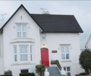
Jessamine House
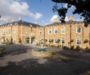
Orsett Hall
DoubleTree by Hilton Dartford Bridge
Best Western Manor
The Clarendon Royal Hotel
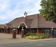
Thurrock Hotel
Holiday Inn Express LONDON - DARTFORD
London Rainham
Thurrock East
TRAVELODGE THURROCK M25
Videos from this area
These are videos related to the place based on their proximity to this place.
Kata training at Grays dojo
Kata training at Grays dojo on Saturday morning (15th February 2014) Belmont Village Hall Parker Road Grays, Essex, RM17 5YN Saturdays 10.30am-12pm Seitou Ryu Karate: Traditional values,...
Sedation Dentist Grays Essex - Call 01375 48 1000 Sedation Dentist in Grays
http://www.Basrai.co.uk Sedation Dentist Grays Essex - Call 01375 48 1000 Sedation Dentist in Grays https://plus.google.com/101291110873784024948/about Cosme...
Invisalign Dentist Grays Essex - Call 01375 48 1000 Invisalign Dentist in Grays
http://www.Basrai.co.uk Invisalign Dentist Grays Essex - Call 01375 48 1000 Invisalign Dentist in Grays https://plus.google.com/101291110873784024948/about Cosmetic Dentist in Grays offering...
Paper City (uk)
Craig Graham and Michele Reynolds playing at the Warren Primary School Chafford Hundred Essex 30-6-2012.
Mawashi geri block and counter (pad work drill)
On Saturday 19th April at our Grays dojo we were working on a few basic drills for blocking and countering using gyakutsuki (reverse punch) and mawashi geri (round kick). In this drill, the...
Inman Aligner Essex
Visit http://www.basrai.co.uk and Call 01375481000 To Schedule A Free Consultation Now! Inman Aligner in Grays Essex Can Straighten Your Teeth In As Little As 12 Weeks. Get Your Beautiful New...
Policing Lakeside
Shoppers, security staff, shop workers and the police all make up the community at Lakeside. Sgt Anna Brennan and Pc Adam Thompson talk about what they enjoy about policing the shopping centre.
Videos provided by Youtube are under the copyright of their owners.
Attractions and noteworthy things
Distances are based on the centre of the city/town and sightseeing location. This list contains brief abstracts about monuments, holiday activities, national parcs, museums, organisations and more from the area as well as interesting facts about the region itself. Where available, you'll find the corresponding homepage. Otherwise the related wikipedia article.
Dartford Crossing
The Dartford - Thurrock River Crossing, Dartford River Crossing (DRC) (or simply the Dartford Crossing) is a major road crossing of the River Thames in England, connecting Dartford in the south to Thurrock in the north, via two road tunnels and the Queen Elizabeth II Bridge. It opened in stages, the west tunnel in 1963, the east tunnel in 1980, and the bridge in 1991. Until the opening of the bridge, built to the east of the two tunnels, the crossing was known as the Dartford Tunnel.
Thames Gateway
The Thames Gateway is an area of land stretching 70 kilometres east from inner east London on both sides of the River Thames and the Thames Estuary. The area, which includes much brownfield land, has been designated a national priority for urban regeneration, taking advantage of the development opportunities realised by the completion of the High Speed 1 (officially known as the Channel Tunnel Rail Link) rail line.
Queen Elizabeth II Bridge
The Queen Elizabeth II Bridge is a 137 m high and 812 m long cable-stayed road bridge across the River Thames in south east England. It was opened in 1991 by Queen Elizabeth II. The bridge is the southbound element of the A282 Dartford Crossing, joining the two ends of the M25 clockwise carriageway, a strategic congestion charged road crossing the half mile wide river east of London.
Greenhithe railway station
Greenhithe railway station (also known as Greenhithe for Bluewater) serves the village of Greenhithe in north Kent and Bluewater Shopping Centre. Train services are operated by Southeastern.
Swanscombe railway station
Swanscombe railway station serves the village of Swanscombe in North Kent, England. The first station a small wooden halt was opened in 1908. In 1930 the present station was opened 840 yards east of the first station. Train services are operated by Southeastern. The station is awkwardly located in a very deep chalk cutting, with a long staircase from the booking office leading to the up platform. The down platform is reached across a road overbridge and down another long flight of stairs.
Thurrock (UK Parliament constituency)
Thurrock is a constituency represented in the House of Commons of the UK Parliament since 2010 by Jackie Doyle-Price, a Conservative.
Thurrock F.C
Thurrock Football Club is an English football club based in Aveley, Thurrock, Essex. Known as Purfleet until 2003, the club are currently members of the Isthmian League Premier Division and play at Ship Lane.
Aveley F.C
Aveley Football Club are an English football club based in Aveley, Essex. The club are currently members of the Isthmian League Division One North and play at the Mill Field.
Romford F.C
Romford F.C. is an English football club based in Romford, Greater London. The club are currently members of Division One North of the Isthmian League, and play at Ship Lane in Aveley.
Swanscombe and Greenhithe
Swanscombe and Greenhithe is a civil parish in the Borough of Dartford in Kent, England. The two villages which give the parish its name are both located on the south bank of the River Thames, approximately midway between Dartford town and Gravesend. Swanscombe village is an ancient one. The area today is undergoing a good deal of regeneration, from industry (cement works at one time dominated it) to housing and lighter industrial use.
Thurrock services
Thurrock services is a motorway service station on the M25 motorway in Thurrock, Essex. It is owned by Moto. The services were opened sometime between 1990 and 1992 (sources vary; see references). Parts of the service station overlook a lake.
400kV Thames Crossing
The 400 kV Thames Crossing is an overhead power line crossing of the River Thames, at Greenhithe Marshes in Swanscombe, Kent, England. Its towers are the tallest electricity pylons in the UK. The present crossing was built in 1965, and comprises two 190-metre (623 feet) tall lattice towers either side of the Thames. Some suggest that the choice of this height was deliberate, being just taller than the BT Tower in London.
Lower Thames Crossing
The Lower Thames Crossing (or Third Thames Crossing) is a proposed new crossing of the Thames estuary linking the county of Kent with the county of Essex at or east of the existing Dartford crossing.
New Recreation Ground
The New Recreation Ground was a football stadium on Bridge Road, Grays, Essex, England, and was the home ground of Grays Athletic. Prior to it being closed, the capacity stood at 4,100, of which 1,000 was seated. Grays Athletic moved to the ground, originally known as the Recreation Ground in 1906. Previously the ground had been home to Southern League club Grays United, but they had merged into Athletic. The record attendance of 9,500 was set in 1959 during an FA Cup tie with Chelmsford City.
Grays School Media Arts College
The Grays School Media Arts College is a comprehensive secondary school in Grays, Essex.
Pura Foods
Pura Foods Ltd is a manufacturer and supplier of edible oils and fats. The company now has two sites by the Thames, with manufacturing plant at Purfleet and R&D facilities at the former British Oil & Cake Mills (BOCM) in Erith. It is now part of ADM. The plant at Blackwall, east London, closed in 2006.
Arena Essex Raceway
Arena Essex Raceway is a stock car and speedway racing track located near Purfleet, Essex. The Lakeside Shopping Centre was built alongside the venue.
South Ockendon Windmill
South Ockendon Windmill was a Smock mill at South Ockendon, Essex, England which collapsed on 2 November 1977.
The Dell (Thurrock)
The Dell is a house in Grays built in concrete - one of the earliest houses in Britain to be built in this material. It was built on the instructions of Alfred Russel Wallace who lived in Grays from 1872 until 1876.
Beacon Hill Academy
Beacon Hill Academy (formerly Beacon Hill School) is a coeducational special school with academy status located in South Ockendon, Essex, England. The school is for students with profound and severe learning difficulties.
Treacle Mine Roundabout
Treacle Mine Roundabout is a suburban roundabout between Grays and Stifford Clays, Essex, England. It is named, as is the adjacent public house for the local legend of Treacle mines in the valley of the river Mardyke. The roundabout was built to link the new A13 to its former route (the A1306) and Long Lane at the top of Hogg Lane: a spot that London Country bus timetables used to call Grays Corner.
South Ockendon Psychiatric Hospital
South Ockendon Psychiatric Hospital (known locally as The Colony) was a hospital for patients with severe learning difficulties and for patients with major and rare mental health illnesses. The hospital opened in 1932. The hospital was built in several small, ground level clinics, which covered a quarter mile site.
St Thomas of Canterbury Catholic Primary School
St Thomas of Canterbury Catholic Primary School in Grays, Essex is a voluntary aided primary school linked to the local Catholic Church of St Thomas of Canterbury, Grays.
High House, Purfleet
High House is the collective name for a group of historic buildings in Purfleet, Thurrock, Essex, which was used as a farm for hundreds of years, with a Grade II listed house and barn, but with the addition of one of the best dovecotes (dove houses) in Southern England, which is a Scheduled Ancient Monument. This property includes the house, coachman's cottage, chaise house, stable, granary, barn, workshop, cart sheds, dovecote, and inner and outer walled gardens.
Belmont Castle
Belmont Castle was a neo-Gothic mansion near Grays in the English county of Essex. Built circa 1795 to designs by the little-known Thomas Jeffery, and surrounded by extensive pleasure grounds, it was the most prominent building in the parish, but was demolished in 1943 to make way for a chalk quarry. The castle and its occupants had played a significant role in the town's life for over a hundred years.


