Safety Score: 3,0 of 5.0 based on data from 9 authorites. Meaning we advice caution when travelling to United Kingdom.
Travel warnings are updated daily. Source: Travel Warning United Kingdom. Last Update: 2024-08-13 08:21:03
Discover Limefield
The district Limefield of Bury in Borough of Bury (England) is a district in United Kingdom about 171 mi north-west of London, the country's capital city.
Looking for a place to stay? we compiled a list of available hotels close to the map centre further down the page.
When in this area, you might want to pay a visit to some of the following locations: Salford, Rochdale, Manchester, Bolton and Stretford. To further explore this place, just scroll down and browse the available info.
Local weather forecast
Todays Local Weather Conditions & Forecast: 7°C / 45 °F
| Morning Temperature | 7°C / 44 °F |
| Evening Temperature | 7°C / 44 °F |
| Night Temperature | 6°C / 43 °F |
| Chance of rainfall | 3% |
| Air Humidity | 83% |
| Air Pressure | 1013 hPa |
| Wind Speed | Moderate breeze with 9 km/h (6 mph) from East |
| Cloud Conditions | Broken clouds, covering 58% of sky |
| General Conditions | Light rain |
Monday, 18th of November 2024
5°C (41 °F)
0°C (32 °F)
Rain and snow, moderate breeze, overcast clouds.
Tuesday, 19th of November 2024
0°C (32 °F)
-3°C (27 °F)
Snow, moderate breeze, broken clouds.
Wednesday, 20th of November 2024
2°C (36 °F)
1°C (34 °F)
Snow, gentle breeze, scattered clouds.
Hotels and Places to Stay
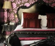
Manchester Sanctuary
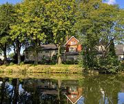
Red Hall
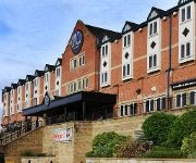
Village Hotel Manchester Bury
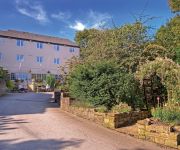
Best Western Bolholt Country Park
Best Western Old Mill and Leisure Club
Birch Hotel
TRAVELODGE BURY
Charnley Mews Boutique Guest House
TRAVELODGE MANCHESTER BIRCH M62 EASTBOUN
TRAVELODGE MANCHESTER BIRCH M62 WESTBOUN
Videos from this area
These are videos related to the place based on their proximity to this place.
Youth Highlights: Bury u18s v Oldham Athletic
Watch extended highlights of Bury Youth Team's 5-1 win over Oldham Athletic in the North West Youth Alliance league on 11th April 2015.
Bury FC: Carrington Press Conference
Chairman Stewart Day and Manager David Flitcroft face the press at Carrington.
Bury FC: Behind the Scenes - Southend (Abandoned)
The latest behind the scenes video from Alexandros Cuschieri...
Bury FC: Behind the Scenes - Training at Carrington
Watch a special addition of 'Behind the Scenes' filmed by Alexandros Cuschieri at our Carrington Training Facilities.
Videos provided by Youtube are under the copyright of their owners.
Attractions and noteworthy things
Distances are based on the centre of the city/town and sightseeing location. This list contains brief abstracts about monuments, holiday activities, national parcs, museums, organisations and more from the area as well as interesting facts about the region itself. Where available, you'll find the corresponding homepage. Otherwise the related wikipedia article.
East Lancashire Railway
This article is about the heritage East Lancashire Railway. For the 19th-century company see East Lancashire Railway 1844–1859 50x40pxThis article needs additional citations for verification. Please help improve this article by adding citations to reliable sources. Unsourced material may be challenged and removed. 40x40pxThis article may contain unsourced predictions, speculative material or accounts of events that might not occur.
Metropolitan Borough of Bury
The Metropolitan Borough of Bury is a metropolitan borough of Greater Manchester, in North West England. Lying to the north of the City of Manchester, the borough is composed of six towns: Bury, Ramsbottom, Tottington, Radcliffe, Whitefield and Prestwich, and has a population of 181,900. On the north side Bury bounds the Lancashire districts of Rossendale and Blackburn with Darwen.
M66 motorway
The M66 is a motorway in Lancashire and Greater Manchester, England. It is 8 miles long and provides part of the route between the M62 and M60 motorways and the M65, with the rest being provided by the A56.
The Met (arts centre)
The Met is a performing arts venue in Bury, Greater Manchester. It has two theatre spaces and a café bar. The centre is operated by Bury Metropolitan Arts Association, a registered charity, and it popularly known as Bury Met.
Derby Hall, Greater Manchester
The Derby Hall is a large Victorian neo-classical building situated on Market Street in the centre of Bury, Greater Manchester, England.
Bury North (UK Parliament constituency)
Bury North is a borough constituency in Greater Manchester, represented in the House of Commons of the Parliament of the United Kingdom. It elects one Member of Parliament (MP) by the first past the post system of election. It was first contested in 1983.
Bury South (UK Parliament constituency)
Bury South is a borough constituency represented in the House of Commons of the Parliament of the United Kingdom. It elects one Member of Parliament (MP) by the first past the post system of election. Since 1997 the MP has been Ivan Lewis of the Labour Party.
F.C. United of Manchester
F.C. United of Manchester is an English semi-professional football club based in Bury, Greater Manchester that plays in the Northern Premier League Premier Division. It was formed in 2005 by Manchester United supporters opposed to American businessman Malcolm Glazer's controversial takeover of the club. The supporters own the club and vote on how the club is run. The club entered the North West Counties Football League Division Two in 2005, winning the league in their inaugural season.
Gigg Lane
Gigg Lane is an all-seater football stadium in Bury, Greater Manchester, England. Historically within Lancashire, it was built for Bury F.C. in 1885, and has been their home ever since.
Holy Cross College (UK)
Holy Cross College is a Catholic Sixth Form College on Manchester Road in Bury, England, UK
Bury Rural District
Bury was a rural district in Lancashire, England from its establishment in 1894 under the Local Government Act 1894, until its abolition in 1933. The district consisted of a number of rural civil parishes near Bury, but did not include Bury itself. It was a successor to the Bury Rural Sanitary District. It originally included Tottington, which was made an urban district of its own in 1899 http://www. visionofbritain. org. uk/relationships.
Bury Market
Bury Market is an open-air retail market located in the town of Bury, in Greater Manchester, England. It started in 1444. It consists of a large market hall, with extensive stalls outside, selling fruit, flowers, clothing, hardware and groceries. There is a new fish and meat market hall, constructed in the 1990s, on the site of a former National Westminster Bank. The market is operative on Wednesdays, Fridays and Saturdays and attracts visitors from miles around.
Bury Bolton Street railway station
Bury Bolton Street railway station is in Bury, Greater Manchester, England.
Summerseat railway station
Summerseat railway station is a preserved railway station that serves the village of Summerseat in Greater Manchester, England. It is part of the Heritage East Lancashire Railway (which runs for 12 miles from Heywood-Rawtenstall).
Daisyfield Viaduct
Daisyfield Viaduct is a stone structure crossing the Manchester, Bolton and Bury Canal and River Irwell in Bury, Greater Manchester, England. It no longer carries trains, and is now used as a recreational feature for the general public.
Burrs Country Park
Burrs Country Park covers a 36 hectare site located on the banks of the River Irwell, 1.5km (1 ml) north west of Bury, Greater Manchester. It was acquired by Bury Metroplolitan Borough Council in 1986 and transformed from a derelict industrial site into a modern country park. Access to the park which is open all year round is via Woodhill Road.
Castlesteads, Greater Manchester
Castlesteads is an Iron Age promontory fort, situated on the east bank of the River Irwell on a natural promontory in Bury, Greater Manchester. It is listed as a Scheduled Ancient Monument. Excavated pottery indicates the site was occupied between 200BC and 250AD.
Church of St Mary the Virgin, Bury
The Parish Church of St Mary the Virgin is located in the town centre of Bury, Greater Manchester, England. It has been designated by English Heritage as a Grade II listed building.
County Borough of Bury
Bury was a local government district centred on Bury in the northwest of England from 1846 to 1974. Under the Bury Improvement Act 1846 a board of twenty-seven improvement commissioners was formed for Bury. The Improvement Commissioners District was enlarged in 1872. A charter of incorporation dated 9 September 1876 created the town a municipal borough and it was further extended in 1885. Under the Local Government Act 1888 Bury was constituted a county borough.
Ramsbottom Urban District
Ramsbottom Urban District was, from 1894 to 1974, a local government district of the administrative county of Lancashire, England. Its area was coterminate with Ramsbottom, spanning an area of the Rossendale Valley north of the County Borough of Bury.
Pilot Mill, Bury
Pilot Mill, Bury is a four-storey cotton spinning mill in Radcliffe, Bury, Greater Manchester. It was built in 1905. It was taken over by the Lancashire Cotton Corporation in the 1930s and passed to Courtaulds in 1964. Production finished, it survived and as of 2010 is in use by Antler Luggage.
Elton, Greater Manchester
Elton is a suburb of Bury, on the A58 road, in the Bury District, in the English county of Greater Manchester. Elton has a superstore. There is a brook called Elton Brook.
Holy Trinity Church, Bury
Holy Trinity Church, Bury, is located in Spring Street, Bury, Greater Manchester, England. It is a redundant Anglican parish church in the diocese of Manchester. The church has been designated by English Heritage as a Grade II listed building.
Peel Memorial, Bury
The Peel Memorial is a public statue by Edward Hodges Baily, a nineteenth century British artist best known for his sculpture of Nelson on Nelson's Column. It is located in the centre of Bury, Greater Manchester. The statue commemorates the life of Sir Robert Peel, twice UK Prime Minister and founder of the British Conservative Party, who was born in Bury. The statue is of bronze, and stands 3.5m high.
St Paul's Church, Bury
St Paul's Church, Bury, is located in Church Street, Bury, Greater Manchester, England. A former Anglican parish church, it is now redundant and, following fire damage, has been converted into residential use. The former church is designated by English Heritage as a Grade II listed building.


