Safety Score: 3,0 of 5.0 based on data from 9 authorites. Meaning we advice caution when travelling to United Kingdom.
Travel warnings are updated daily. Source: Travel Warning United Kingdom. Last Update: 2024-08-13 08:21:03
Delve into Edgworth
Edgworth in Blackburn with Darwen (England) with it's 2,321 habitants is a city located in United Kingdom about 176 mi (or 283 km) north-west of London, the country's capital town.
Current time in Edgworth is now 08:23 AM (Tuesday). The local timezone is named Europe / London with an UTC offset of zero hours. We know of 10 airports closer to Edgworth, of which 5 are larger airports. The closest airport in United Kingdom is Manchester Airport in a distance of 21 mi (or 33 km), South. Besides the airports, there are other travel options available (check left side).
There are several Unesco world heritage sites nearby. The closest heritage site in United Kingdom is Pontcysyllte Aqueduct and Canal in a distance of 51 mi (or 83 km), South-West. Also, if you like playing golf, there are some options within driving distance. In need of a room? We compiled a list of available hotels close to the map centre further down the page.
Since you are here already, you might want to pay a visit to some of the following locations: Bolton, Bury, Blackburn, Salford and Haigh. To further explore this place, just scroll down and browse the available info.
Local weather forecast
Todays Local Weather Conditions & Forecast: 11°C / 52 °F
| Morning Temperature | 7°C / 45 °F |
| Evening Temperature | 11°C / 51 °F |
| Night Temperature | 9°C / 49 °F |
| Chance of rainfall | 0% |
| Air Humidity | 73% |
| Air Pressure | 1022 hPa |
| Wind Speed | Light breeze with 3 km/h (2 mph) from North |
| Cloud Conditions | Overcast clouds, covering 99% of sky |
| General Conditions | Overcast clouds |
Wednesday, 6th of November 2024
14°C (56 °F)
11°C (52 °F)
Broken clouds, calm.
Thursday, 7th of November 2024
14°C (57 °F)
11°C (51 °F)
Few clouds, light breeze.
Friday, 8th of November 2024
12°C (54 °F)
8°C (47 °F)
Overcast clouds, light breeze.
Hotels and Places to Stay
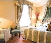
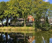
EGERTON HOUSE HOTEL
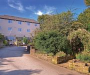
Best Western Old Mill and Leisure Club
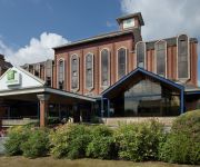
Holiday Inn BOLTON CENTRE
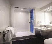
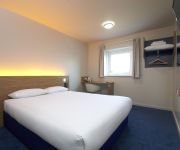
TRAVELODGE BOLTON CENTRAL RIVER STREET
Best Western Bolholt Country Park
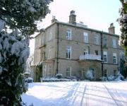
Astley Bank Hotel
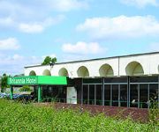
Britannia Bolton
TRAVELODGE BLACKBURN M65
J4) Blackburn South (M65
Videos from this area
These are videos related to the place based on their proximity to this place.
Euro Truck Simulator 2 - Trip of a Lifetime Slideshow
So the year 2014 is nearly over so I thought I would gather all of the best screenshots that I have taken in Euro Truck over the past 2 years. Hope you have a Merry Christmas and a Happy 2015!!
Last Drop Village Bolton Wedding Photography - Cheshire Wedding Photographer
A short slideshow of image from Heather & Phil's Wedding at Last Drop Village Bolton by Cheshire Wedding Photographer, SimonH http://www.simonh.co.uk/
Ariel of Golf Club, Bolton, Lancs. AutoPilot FPV EPP Plane
UAV (Unmanned Ariel Vehicle from Hobby King ) With GoPro HD camera taking FPV ariel shots over Golf Course. i.e. Flying from the ground with a ground monitor and video goggles with the new...
Halo 3 Mountain Race Map
Race on Halo 3 Gametype: Race Map: Mountain Race video by Al zero 1 and Boffy09D.
Videos provided by Youtube are under the copyright of their owners.
Attractions and noteworthy things
Distances are based on the centre of the city/town and sightseeing location. This list contains brief abstracts about monuments, holiday activities, national parcs, museums, organisations and more from the area as well as interesting facts about the region itself. Where available, you'll find the corresponding homepage. Otherwise the related wikipedia article.
Entwistle railway station
The rural Entwistle railway station is served by Northern Rail services on the Manchester Victoria/Bolton 'Ribble Valley' Line towards Blackburn and Clitheroe in England. The station is 5+⁄4 miles north of Bolton. It is the closest station to Edgworth, but lack of parking and a difficult approach along minor roads make it unpopular with commuters.
Turton Urban District
Turton was a township and later civil parish and local government district in Lancashire, England. Its former area is now divided between two local authorities. North Turton is part of the Borough of Blackburn with Darwen, and South Turton is part of the Metropolitan Borough of Bolton. Although no longer used as an administrative area, Turton is still used as an historical area.
Turton F.C
Turton F.C. are an association football club based in Edgworth, in the North Turton district of Blackburn with Darwen, Lancashire, England. They are members of the Lancashire Football Association, and in the 2012–13 season their senior team is playing in the West Lancashire League Division One, which is at the 12th level of the English football league system. Prior to playing in the West Lancashire League they were members of the Bolton Combination.
Turton and Edgworth railway station
Turton and Edgworth railway station was on what is now the Northern Rail Ribble Valley Line. In spite of its name, it was actually in the village of Chapeltown, Lancashire. In light of this, the station underwent a number of name changes, including Edgworth and Chapeltown (the latter of which was too easily confused with Chapeltown, South Yorkshire). Its neighbouring stations are still operational. There have been calls to reopen the station by the Ribble Valley Rail user group.
Jumbles Reservoir
The Jumbles Reservoir is a heavily modified, high alkalinity, shallow reservoir in North West England. It lies in Jumbles Country Park, in the valley of Bradshaw Brook, partly in the Metropolitan Borough of Bolton, Greater Manchester, and partly in Blackburn with Darwen, Lancashire. It was opened on 11 March 1971 by HRH Queen Elizabeth II for the then Bolton Corporation Waterworks (since privatisation the reservoir is now owned by United Utilities).
Wayoh Reservoir
Wayoh Reservoir is a water reservoir in the town of Edgworth, Lancashire, England. It was completed on 28 April 1876 to supply water to Bolton. Wayoh, together with the Turton and Entwistle Reservoir, make up 50% of Bolton's drinking water. In 1962 in response to an increasing demand for drinking water in Bolton, a treatment plant was built and the reservoir enlarged to its present capacity of 501 million imperial gallons.
Turton and Entwistle Reservoir
Turton and Entwistle Reservoir is a water reservoir in the town of Edgworth, Lancashire. The reservoir's existence is due to the Entwistle Dam. When constructed in 1832 the Entwistle Dam was the highest in Britain; it rises 108 feet from the base. The reservoir contains almost 750 thousand imperial gallons (roughly 3,400,000 litres) and, with the Wayoh Reservoir just below, satisfies around 50% of Bolton's need for drinking water.
Greater Manchester Army Cadet Force
The Greater Manchester Army Cadet Force (GMACF) is the county cadet force for Greater Manchester which forms part of the wider Army Cadet Force, a youth organisation in the United Kingdom that offers learning and experiences around a military training theme. It is home to between 1400-1750 cadets and 200-230 adult volunteers in 45-47 detachments. GMACF headquarters is at Hawkshaw in Bury, and piping and parade nights are held at Hulme in Manchester.


