Safety Score: 3,0 of 5.0 based on data from 9 authorites. Meaning we advice caution when travelling to United Kingdom.
Travel warnings are updated daily. Source: Travel Warning United Kingdom. Last Update: 2024-08-13 08:21:03
Discover Farrington Gurney
Farrington Gurney in Bath and North East Somerset (England) with it's 901 citizens is a place in United Kingdom about 105 mi (or 168 km) west of London, the country's capital city.
Current time in Farrington Gurney is now 06:58 AM (Friday). The local timezone is named Europe / London with an UTC offset of zero hours. We know of 9 airports near Farrington Gurney, of which 5 are larger airports. The closest airport in United Kingdom is Bristol International Airport in a distance of 10 mi (or 16 km), North-West. Besides the airports, there are other travel options available (check left side).
There are several Unesco world heritage sites nearby. The closest heritage site in United Kingdom is Blaenavon Industrial Landscape in a distance of 37 mi (or 59 km), North-West. Also, if you like playing golf, there are a few options in driving distance. We encountered 1 points of interest in the vicinity of this place. If you need a hotel, we compiled a list of available hotels close to the map centre further down the page.
While being here, you might want to pay a visit to some of the following locations: Paulton, Clutton, Timsbury, Camerton and Publow. To further explore this place, just scroll down and browse the available info.
Local weather forecast
Todays Local Weather Conditions & Forecast: 7°C / 44 °F
| Morning Temperature | 2°C / 36 °F |
| Evening Temperature | 4°C / 40 °F |
| Night Temperature | 3°C / 38 °F |
| Chance of rainfall | 0% |
| Air Humidity | 79% |
| Air Pressure | 1028 hPa |
| Wind Speed | Light breeze with 3 km/h (2 mph) from North-East |
| Cloud Conditions | Few clouds, covering 11% of sky |
| General Conditions | Few clouds |
Saturday, 16th of November 2024
8°C (46 °F)
7°C (45 °F)
Light rain, gentle breeze, few clouds.
Sunday, 17th of November 2024
8°C (46 °F)
3°C (38 °F)
Light rain, moderate breeze, broken clouds.
Monday, 18th of November 2024
5°C (41 °F)
10°C (50 °F)
Light rain, fresh breeze, overcast clouds.
Hotels and Places to Stay
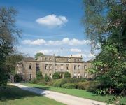
Ston Easton Park
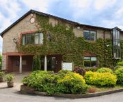
Best Western Plus Centurion Midsomer Norton
Cameley Lodge
The Old Malt House Hotel
Leeford Place Hotel
HUNSTRETE HOUSE
The Oakhill Inn
Videos from this area
These are videos related to the place based on their proximity to this place.
Get out of the rain and drive from the city
We are a Local Driving school passionate about everything to do with driving lessons. We cater for the Learner driver, Car and Trailer towing lessons and als...
Quick Bits week 10
Negotiating Bath City High Street. How to deal with pedestrians, cyclists etc in a busy town / city situation.
8/7/07 - 37th Kingswood at Somer-sounds 2007
The 37th Kingswood Drum and Bugle Corps cadets triumph at the 2007 Somer-sounds event at Paulton, England in July 2007 Post your comment - tell me what you think !
IBJJF Euros Black Rooster Finals - Caio Terra - Submission #1335
IBJJF European Championship, Lisbon, Portugal, Jan 2015.
Passed my driving test today!!
We are a Local Driving school passionate about everything to do with driving lessons. We cater for the Learner driver, Car and Trailer towing lessons and als...
A day with Jamie's BB Gun
We all go up Jamie's (sorry for interupting Jamie and Charlotte) and experiment by shooting each other.
Artificial Grass Bath, UK. Installation by Luxolawn™
An artificial grass installation by leading South West artificial grass specialist Luxolawn™. Luxolawn™ is part of the Turf King company - a family business with a passion for artificial...
Driving test passes in Bristol, Bath and Frome from Belt Up School of Motoring in 2013
We are a Local Driving school passionate about everything to do with driving lessons. We cater for the Learner driver, Car and Trailer towing lessons and also Company driver risk assessments...
Videos provided by Youtube are under the copyright of their owners.
Attractions and noteworthy things
Distances are based on the centre of the city/town and sightseeing location. This list contains brief abstracts about monuments, holiday activities, national parcs, museums, organisations and more from the area as well as interesting facts about the region itself. Where available, you'll find the corresponding homepage. Otherwise the related wikipedia article.
Wansdyke (UK Parliament constituency)
Wansdyke was a county constituency represented in the House of Commons of the Parliament of the United Kingdom. It elected one Member of Parliament (MP) by the first past the post system of election. The constituency was created for the 1983 general election, and abolished at the 2010 general election.
North East Somerset (UK Parliament constituency)
North East Somerset is a constituency represented in the House of Commons of the UK Parliament since its 2010 creation by Jacob Rees-Mogg, a Conservative.
Paulton Rovers F.C
Paulton Rovers Football Club are an English football club based at the Athletic Field on Winterfield Road in the village of Paulton near Bristol. They were established in 1891 and currently play in the Southern League Division One South and West. The club is affiliated to the Somerset County FA.
Ston Easton Park
Ston Easton Park in Somerset was built in the 18th century for John Hippisley Coxe. The Hippisley family had been Lords of the Manor of Ston Easton since 1544, and in the 17th century had moved from the old manor house by the parish church to a new Jacobean house. This Jacobean house was converted into a Palladian mansion by John Hippisley Coxe.
Paulton Memorial Hospital
Paulton Memorial Hospital is a small community hospital located in the village of Paulton, Somerset, approximately 12 miles from the City of Bath. There are 28 beds for inpatients in the hospital ward including 5 single rooms and the largest bay having 7 beds. An outpatient service operates 5 days a week Monday to Friday. NHS Bath and North East Somerset contract in Consultants time from 2 local acute trusts to provide specialist local outpatient service.
Chilcompton railway station
Chilcompton railway station was a station on the Somerset and Dorset Joint Railway at Chilcompton in the county of Somerset in England. Opened on 20 July 1874, the station consisted of two platforms, the building on the down platform having a canopy. There was a goods yard and sidings, controlled from a 13 lever signal box, which replaced the original ground frame. The station closed to goods in 1964: passenger services were withdrawn when the SDJR closed on 7 March 1966.
Cloud Quarry
Cloud Quarry was a quarry near Temple Cloud, in the limestone of the Mendip Hills, in Somerset, England. During World War II a factory was built in the disused quarry to make tyres for Avro Lancaster Bomber. The roof was painted blue in an attempt to fool German bombers. The factory is now used for light industry and workshops.
Clutton Rural District
Clutton was a rural district in Somerset, England, from 1894 to 1974. It was created in 1894 under the Local Government Act 1894 as a successor to the rural sanitary district. In 1974 it was abolished under the Local Government Act 1972. The parishes in the district became part of the Non-metropolitan district of Wansdyke in the newly formed County of Avon.


