Safety Score: 3,0 of 5.0 based on data from 9 authorites. Meaning we advice caution when travelling to United Kingdom.
Travel warnings are updated daily. Source: Travel Warning United Kingdom. Last Update: 2024-08-13 08:21:03
Explore Wombwell
Wombwell in Barnsley (England) with it's 15,518 inhabitants is a city in United Kingdom about 149 mi (or 240 km) north of London, the country's capital.
Local time in Wombwell is now 05:59 PM (Thursday). The local timezone is named Europe / London with an UTC offset of zero hours. We know of 9 airports in the vicinity of Wombwell, of which 5 are larger airports. The closest airport in United Kingdom is Robin Hood Doncaster Sheffield Airport in a distance of 16 mi (or 26 km), East. Besides the airports, there are other travel options available (check left side).
There are several Unesco world heritage sites nearby. The closest heritage site in United Kingdom is Liverpool – Maritime Mercantile City in a distance of 18 mi (or 29 km), South-East. Also, if you like golfing, there are multiple options in driving distance. If you need a place to sleep, we compiled a list of available hotels close to the map centre further down the page.
Depending on your travel schedule, you might want to pay a visit to some of the following locations: Little Houghton, Wentworth, Great Houghton, Shafton and Barnsley. To further explore this place, just scroll down and browse the available info.
Local weather forecast
Todays Local Weather Conditions & Forecast: 2°C / 36 °F
| Morning Temperature | 0°C / 33 °F |
| Evening Temperature | 2°C / 36 °F |
| Night Temperature | 3°C / 38 °F |
| Chance of rainfall | 0% |
| Air Humidity | 73% |
| Air Pressure | 999 hPa |
| Wind Speed | Moderate breeze with 10 km/h (6 mph) from East |
| Cloud Conditions | Scattered clouds, covering 40% of sky |
| General Conditions | Scattered clouds |
Friday, 22nd of November 2024
4°C (40 °F)
2°C (36 °F)
Light rain, fresh breeze, clear sky.
Saturday, 23rd of November 2024
4°C (39 °F)
13°C (55 °F)
Rain and snow, fresh breeze, overcast clouds.
Sunday, 24th of November 2024
14°C (58 °F)
10°C (50 °F)
Moderate rain, fresh breeze, overcast clouds.
Hotels and Places to Stay
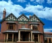
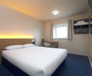
Holiday Inn Express ROTHERHAM - NORTH
Staindrop Lodge
Barnsley (Dearne Valley)
TRAVELODGE BARNSLEY
Videos from this area
These are videos related to the place based on their proximity to this place.
how to make a cheap airsoft trip wire mine in 6 steps ( non explosive )
how to make a cheap airsoft trip wire / mine in 6 steps ( non explosive ) load with 8 - 15 bb's for best results, try a small amount of flour as well. you will need; tube, dowel, a screw,...
Giving Nation TV Challenge 3 minute promo
A short promotional excerpt from a full length 90 minute documentary about the Giving Nation Challenge following students at 3 UK schools as they compete to come up with businesses that benefit...
Just Cause 2 extremely fast hidden car found!!
This is my first ever video! I found this car when i was on the demo. Ive noticed that on the demo if you are bein chased by enemys when this car spawns it will have a machine gun on it! Subscribe...
Guitar licks
3 of my most used licks that i could think of today. anyho if u fancy learning them have fun. questions, message me as usual. positive feedback is lovely :P laters.
Hair loss in women hints and tips
I made this Vid to help women in a situation like mine, Im still none the wiser why my hair has fallen out but since then my friend Logan has shaved it all off for me and given me a Chelsea...
PJ RS5 Wombwell Round 2.mp4
My car is the white one with RS5 on it. This is my final for the day i had a few problems with steering / servos and i finished 8th Never mind i will try harder next time....
Review: Ardsley House Hotel, Ardsley, Barnsley, South Yorkshire, England - June 2014
This film is a short review of Ardsley House Hotel, which is situated in the village of Ardsley, approximately 3 miles East of Barnsley town centre. It features external views of the hotel,...
Chris Myers (SY) & Charles Hall (69) Karting in 1996
100cc Britain karting at Wombwell Barnsley in 1996.
Videos provided by Youtube are under the copyright of their owners.
Attractions and noteworthy things
Distances are based on the centre of the city/town and sightseeing location. This list contains brief abstracts about monuments, holiday activities, national parcs, museums, organisations and more from the area as well as interesting facts about the region itself. Where available, you'll find the corresponding homepage. Otherwise the related wikipedia article.
Trans Pennine Trail
The Trans Pennine Trail is a long-distance path running from coast to coast across northern England entirely on surfaced paths and using only gentle gradients (it runs largely along disused railway lines and canal towpaths). It forms part of European walking route E8 and is part of the National Cycle Network. The surface and gradients make it a relatively easy trail, suitable for cyclists, pushchairs and wheelchair users. Some parts are also open to horse riding.
Dearne FM
Dearne FM is an Independent Local Radio station which broadcasts to the Barnsley area. The station is owned and operated by the Lincs FM Group, whose stations take more of an interest in their local areas than other larger radio companies, and offer a wider type of music.
Old Moor Wetland Centre RSPB reserve
RSPB Old Moor is a 250-acre wetlands nature reserve in Barnsley, England run by the Royal Society for the Protection of Birds (RSPB). It lies on the junction of the north/south and east/west routes of the Trans Pennine Trail. The centre was opened by Barnsley Metropolitan Borough Council in 1998 as part of the regeneration of the Dearne Valley and then developed further with the help of a lottery grant in 2002.
Wentworth and Dearne (UK Parliament constituency)
Wentworth and Dearne is a borough constituency represented in the House of Commons of the Parliament of the United Kingdom. It was created for the 2010 general election, and elects one Member of Parliament (MP) by the first past the post system of election.
Cortonwood
Cortonwood Colliery was sunk in 1873, a year after the formation of the Brampton Colliery Company, which took its name from the local parish of Brampton Bierlow, near Rotherham, South Yorkshire, England. In March 1984, the National Coal Board announced that the mine was due to close, this becoming the "final straw" which brought about the long-running UK miners' strike (1984–1985). The site has now been converted into a shopping and leisure area.
Cat Hill Tunnel
Cat Hill Tunnel was the name of a railway tunnel that ran through Darfield, South Yorkshire, England, leading to Darfield railway station (now closed). The tunnel was built by George Stephenson for the North Midland Railway opened in 1840. It was 154 yards long (one of the longest in the region) and ran under fields into Darfield station from the Cathill Road end of Darfield. The railway bridge was removed in the 1990s.
Elsecar Collieries
The Elsecar Collieries were a series of coal mines sunk in and around Elsecar, a small village to the south of Barnsley in what is now South Yorkshire, but was traditionally in the West Riding of Yorkshire. The last operating mine, Elsecar Main, closed in 1984 and with its closure ended 230 years of mining in the village
Elsecar goods station
Elsecar goods station was a goods facility constructed near the village of Elsecar, near Barnsley, South Yorshire, at the terminus of the South Yorkshire Railways branch line from Elsecar Junction on its Mexborough to Barnsley line. The total length of the line was 2 miles 1204 yards. The line from Elsecar Junction followed closely that of the Elsecar Branch of the Dearne and Dove Canal to its terminus at Elsecar where the sidings of Earl Fitzwillian's Elsecar Colliery are alongside.


