Safety Score: 3,0 of 5.0 based on data from 9 authorites. Meaning we advice caution when travelling to United Kingdom.
Travel warnings are updated daily. Source: Travel Warning United Kingdom. Last Update: 2024-08-13 08:21:03
Delve into Ingbirchworth
Ingbirchworth in Barnsley (England) is a city located in United Kingdom about 155 mi (or 249 km) north-west of London, the country's capital town.
Current time in Ingbirchworth is now 12:17 AM (Wednesday). The local timezone is named Europe / London with an UTC offset of zero hours. We know of 9 airports closer to Ingbirchworth, of which 5 are larger airports. The closest airport in United Kingdom is Leeds Bradford Airport in a distance of 22 mi (or 35 km), North. Besides the airports, there are other travel options available (check left side).
There are several Unesco world heritage sites nearby. The closest heritage site in United Kingdom is Liverpool – Maritime Mercantile City in a distance of 29 mi (or 46 km), East. Also, if you like playing golf, there are some options within driving distance. In need of a room? We compiled a list of available hotels close to the map centre further down the page.
Since you are here already, you might want to pay a visit to some of the following locations: Penistone, Cawthorne, Mirfield, Wortley and Stainborough. To further explore this place, just scroll down and browse the available info.
Local weather forecast
Todays Local Weather Conditions & Forecast: 14°C / 58 °F
| Morning Temperature | 10°C / 50 °F |
| Evening Temperature | 12°C / 54 °F |
| Night Temperature | 11°C / 52 °F |
| Chance of rainfall | 0% |
| Air Humidity | 77% |
| Air Pressure | 1030 hPa |
| Wind Speed | Calm with 2 km/h (1 mph) from North-East |
| Cloud Conditions | Scattered clouds, covering 44% of sky |
| General Conditions | Scattered clouds |
Thursday, 7th of November 2024
14°C (57 °F)
10°C (50 °F)
Sky is clear, light breeze, clear sky.
Friday, 8th of November 2024
11°C (52 °F)
9°C (48 °F)
Sky is clear, light breeze, clear sky.
Saturday, 9th of November 2024
14°C (56 °F)
11°C (51 °F)
Broken clouds, calm.
Hotels and Places to Stay
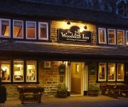
The Woodman Inn
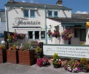
The Fountain Inn
The Grove
Bagden Hall Hotel
Videos from this area
These are videos related to the place based on their proximity to this place.
Peak District Mountain Biking - April 2012
Shot for http://www.actioncamtalk.com First proper ride of the season turned out slightly eventful on the first attempt! Great ride though even if it was a little muddy in places and some great...
LMS 44871 & 45407 on The Tin Bath on Sun 17th March 2013 makes its way across Penistone viaduct
the tin bath hauled by 44871 & 45407 begins to exhilarate out of Pennistone station and across the viaduct. Part 1: http://www.youtube.com/watch?v=0geK-dNdBf0 Part 3: ...
Kittens available for adoption as at 30th July 2010 (Vid 2)
Maureen's Penistone Cat Rescue, kittens available for adoption 30/07/2010.
Kittens available for adoption as at 30th July 2010
Maureen's Penistone Cat Rescue, kittens available for adoption 30/07/10.
Pen Steam
This video clip came to me from Braham Hughes, who had shot it in high-definition and I rendered it to low-definition. It shows a double-header steam train passing over Penistone viaduct...
4th Jan 2014 Pennine Trail Dog Walk
Paula, Len & Louise with Cezar, Susie, Dallas and Bruno go for a 9km odd walk along the Pennine Trail form Penistone.
Don-Bur Teardrop Trailer (2013 Commercial) HD
Since the launch of the aerodynamic, streamlined Teardrop trailers in 2006, they have become a common site on the UK road infrastructure; many of which in blue-chip customer livery, such as...
Videos provided by Youtube are under the copyright of their owners.
Attractions and noteworthy things
Distances are based on the centre of the city/town and sightseeing location. This list contains brief abstracts about monuments, holiday activities, national parcs, museums, organisations and more from the area as well as interesting facts about the region itself. Where available, you'll find the corresponding homepage. Otherwise the related wikipedia article.
Ingbirchworth
Ingbirchworth is a village in the Metropolitan Borough of Barnsley in South Yorkshire, England. Ingbirchworth has its own reservoir, the eldest of the three situated in the area, and currently has one local pub or inn - The Fountain Inn, a 4 star hotel as well as a restaurant and bar with an area for a family atmosphere. The village is in the civil parish of Gunthwaite and Ingbirchworth. At the 2001 census, the civil parish had a population of 400.
Penistone rail accidents
|} Over the latter years of the 19th and early years of the 20th centuries Penistone in Yorkshire gained a name as an accident black-spot on Britain's railway network, indeed it could be said to hold the title of the worst accident black-spot in the country. The main line through the town was the Woodhead route of the Manchester, Sheffield and Lincolnshire Railway between Sheffield Victoria and Manchester, London Road.
Penistone Rural District
Penistone Rural District was a rural district in the West Riding of Yorkshire. It was named after but did not contain Penistone. The town itself was contained within the Penistone Urban District. The district was abolished in 1974 by the Local Government Act 1972 and went on to be part of the newly formed Metropolitan Borough of Barnsley in the, also newly formed, metropolitan county of South Yorkshire.
Hartcliff Folly
The Hartcliff Folly (or Tower) near Penistone, South Yorkshire, England was built in 1856 by a linen merchant called Henry Richardson. At this time the Linen works were Barnsley’s largest industry. Richardson also built Hartcliffe Lodge before becoming the first Mayor of the borough of Barnsley. The tower looks as though it’s a Folly but it has stairs running through the middle of it and some believe that it was used as a viewing platform for game shooting.
Saint John the Baptist Church, Penistone
Saint John the Baptist Church, Penistone Parish Church, or Penistone Church is a Church of England church in the Parish of Penistone, near Barnsley, in the United Kingdom. The church is a Grade 1 listed building and is located in the centre of the town of Penistone.
Lower Cumberworth
Lower Cumberworth is a village in the Borough of Kirklees in West Yorkshire, England, to the south east of Huddersfield. The civil parish of Denby Dale covers the village. The parish council gave the population of the villages of Upper and Lower Cumberworth as 1,222 in the 2001 Census. http://www. kirklees. gov. uk/community/statistics/census-by-settlement/KS02settle2003. xls The village consists of around 200 homes.
Thurgoland Tunnel
Thurgoland Tunnel is a double bore abandoned railway tunnel between Penistone and Wortley. Its total length is 924 feet . It was opened in 1845 on the Sheffield, Ashton-Under-Lyne and Manchester Railway between Manchester Store Street and Sheffield. It is characterised by a curve of sixty chains radius on a falling gradient of 1 in 131. Because of the difficulties in laying it out, it consists of a series of straight sections in a series of erratic curves varying from 100 to 20 chains.
Millhouse Green
Millhouse Green is a village on the north banks of the River Don on the A628 road west of Penistone in the English county of South Yorkshire. Administratively, Millhouse Green forms part of the Metropolitan Borough of Barnsley and Penistone civil parish.


