Address & Contact
Contact Information:
Airport homepage
Wikipedia page
GPS Coordinates:
Longitude: -1,993°
Latitude: 51,505°
Summary
RAF Lyneham is a large airport in United Kingdom, serving the region of Lyneham. The longest runway is 7.828 feet or 2.386 meters long.
Facts:
Airport size: medium airport Serving area: Lyneham Longest runway: 7828 (ft)
Codes:
IATA: LYE,
ICAO: EGDL
Flight information:
Departure times (FlightStats)
Flight times (FlightRadar24)
Location on map
Show bigger map on Openstreetmap
About the airport
RAF Lyneham, with the IATA code LYE and the ICAO code EGDL, is a former Royal Air Force base located in Wiltshire, United Kingdom. Although it primarily served as a military airfield, it also accommodated civilian flights. However, as of 2012, it ceased its civilian operations.
Situated approximately 10 miles northwest of Swindon, RAF Lyneham offered convenient access to the picturesque countryside of Wiltshire. The airport boasted a single runway and various facilities, including a passenger terminal, parking areas, and a range of amenities.
While RAF Lyneham is no longer operational for civilian flights, it remains an important historical site and is occasionally used for military purposes. Travelers planning their trips to the United Kingdom should be aware that the airport is no longer available for commercial use and should consider alternative airports in the region, such as Bristol Airport or London Heathrow Airport, for their travel needs.
Hotels and places to stay
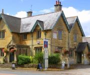
The Foxham Inn
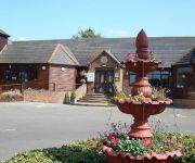
Bowood Hotel
Bowood Spa & Golf Resort
The Duke Hotel
THE WILTSHIRE HOTEL
Videos from the area of the airport
Videos provided by Youtube are under the copyright of their owners.


